

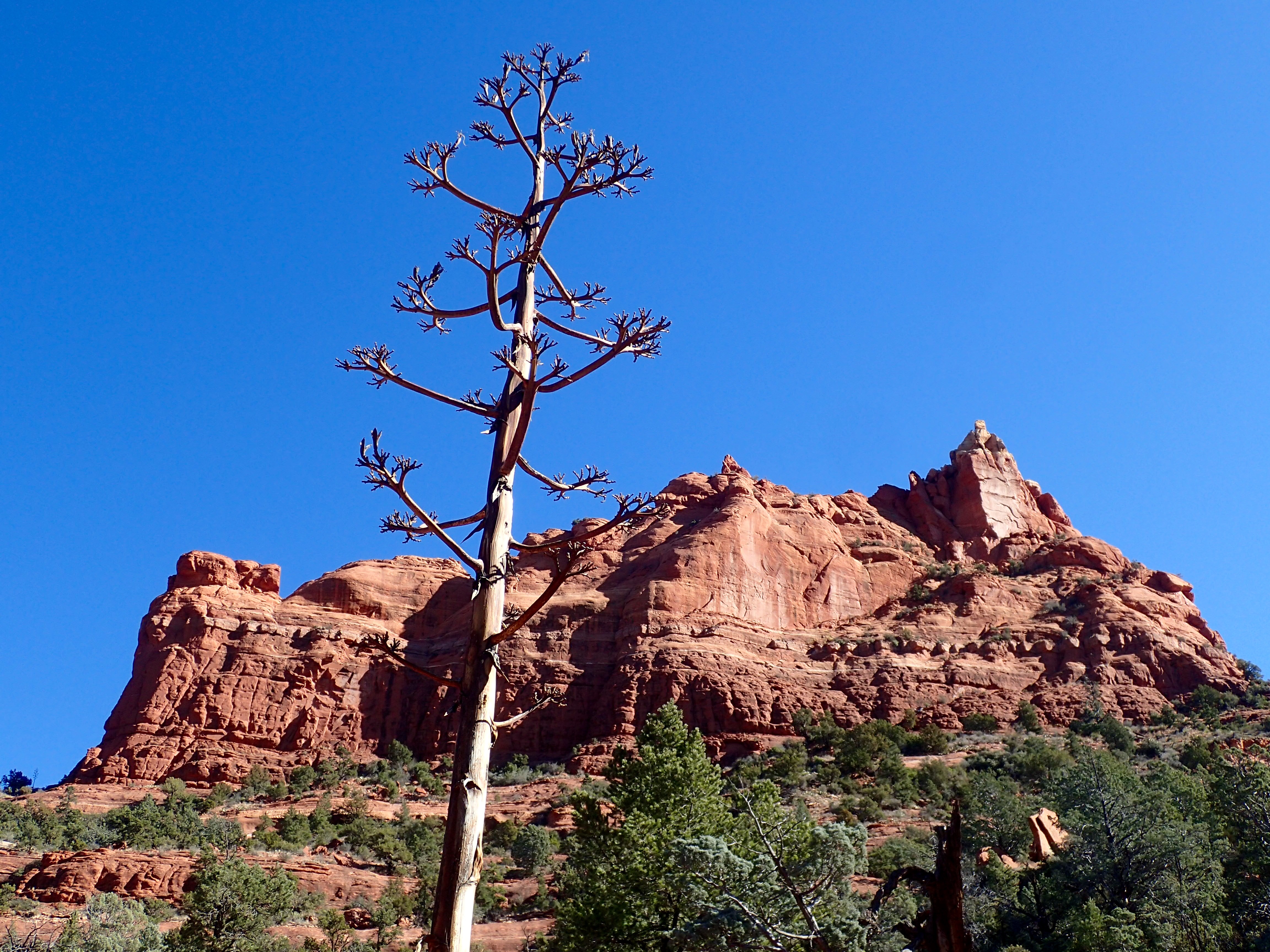
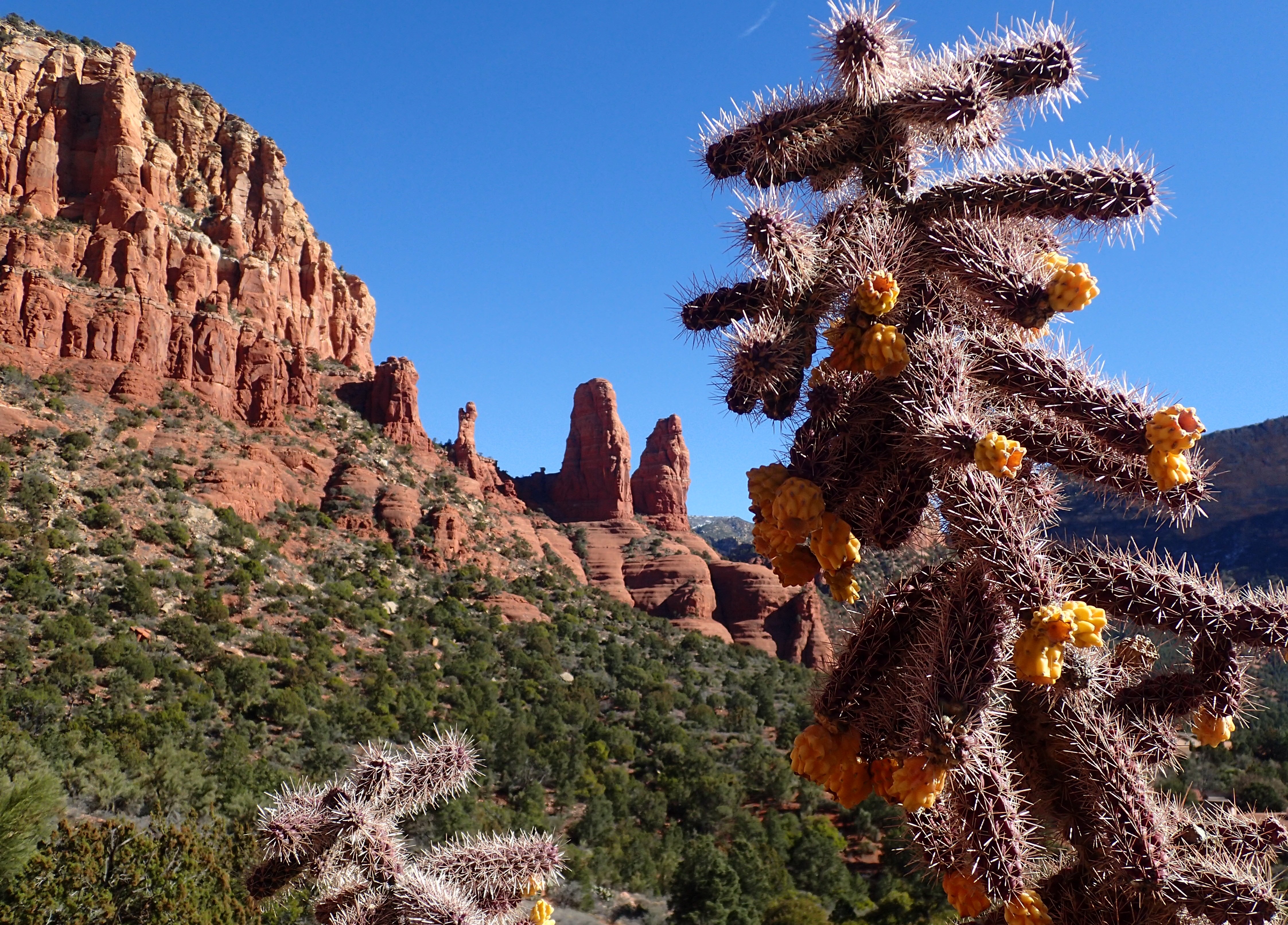
Sedona’s red-rock monoliths punctuate the blue horizon in fanciful, rounded shapes, imitating the forms for which they are named: Mother and Child Rock, Twin Nuns, Three Golden Chiefs, Eagle Head Rock, Rabbit Ears, Coffee Pot Rock, Cathedral Rock, Steamboat Rock, Mittens, and Cow Pies.
They glow orange in the rising and setting sun, radiating warmth and peace. They pull at your attention. And maybe at your soul.
Crystals
Sedona’s rock formations have attracted native peoples from all over the Americas for thousands of years.
According to historians, tribal shamans often traveled to the area to seek guidance from the Great Spirit.
At Honanki Heritage Site, I saw cat-claw scratches on rocks, supposedly made by ancient spiritual leaders to express their trance-induced visions. Native Americans still consider the Sedona area sacred ground.
Present-day shamans, that is new-age healers, psychics, clairvoyants, and spiritual guides, also call Sedona home.

They offer various alternative approaches to improved health, including meditation, massage, aura photography, hypnotherapy, tarot-card reading, aromatherapy, and channeling, some of which may involve crystals.
Vortex tours and vortex maps are available throughout Sedona. In the past, the positive energy people felt at these sites was thought to be magnetic or electric in nature. Scientists disagree. Vortex marketers claim the sites enhance meditation and healing.
However, believers and non-believers alike agree Sedona’s otherworldly red-rock landscape naturally encourages reflection.
Rust
Heading north out of Phoenix, the terrain changes with the altitude. The high desert is forested by saguaro cacti, bent like pipe cleaners into human forms. Dusty yellows, browns, and greens. Scrubland follows with piñon pines and junipers.
The snowcapped twelve-thousand-feet San Francisco Peaks emerge just above the horizon. Gradually, the earth turns red and cliffs erupt from the valley floors. You’re in red-rock country and it’s wreck-your-car beautiful.
The nearly two million acres of the Coconino National Forest contain deserts, ponderosa-pine forests, mesas, tundra, and volcanic peaks. The forest surrounds the towns of Sedona and Flagstaff, as well as the Red Rock Ranger District and the majestic Oak Creek Canyon.
Water and wind created the steep terrain, dissolving the soft sandstone and carving deep canyons. Where hard, water-resistant basalt and limestone cap the cliff tops, buttes and pinnacles were left behind. The vibrant red color of the fantastic rock formations is due to iron oxide in the sandstone. The rocks are literally rusting.
Schnebly, Arizona?
The town of Sedona sits two hours north of Phoenix, perched between the cliffs of Oak Creek Canyon and the wide open Verde Valley. Its population is around twelve thousand.

Sedona is not a Native American or Spanish name. It is the name of a woman, Sedona Miller Schnebly (1877–1950), and was concocted by her mother. Sedona and her husband, T.C. Schnebly, started the first general store, hotel, and post office in the area.
When opening the post office, T.C. suggested two names to the US Postmaster General—Oak Creek and Schnebly. Both were rejected. His next suggestion, his wife’s first name, was approved and the town got its name.
The owner of my B&B in Sedona recommended several hiking trails, most helpful as over three hundred are available. The first was in the Red Rock-Secret Mountain Wilderness, forty-seven thousand acres of rock pinnacles, arches, and slot canyons.
After a breakfast of egg-and-cheese quesadillas, I drove to the Jordan Road trailhead and pieced together a loop from segments of the Brins Mesa, Soldiers Pass, Jordan, and Cibola trails. The top of the mesa was cold and windy, yet the sun felt warm on the back of my neck. The views were spectacular in every direction, red rocks mottled with green cypress, juniper and prickly pear, all set against the azure sky.

“I was here”
Next day, I toured Montezuma Castle, which is not a castle and was never visited by Montezuma. When European Americans first “discovered” the ancient cliff dwellings in the 1860s, they assumed they were Aztec in origin, hence the misnomer.
The “castle,” a five-story, twenty-room cliff dwelling, was built sometime between 1100 and 1300 by the Sinagua people. It looks like an apartment building, set within an alcove of a limestone cliff face one-hundred feet above Beaver Creek. Centuries before Columbus arrived in America, up to fifty people inhabited the high-rise complex. Montezuma is one of the best-preserved cliff dwellings in North America.
Just down the creek are the badly deteriorated remains of a larger structure that once numbered about forty-five rooms.
The name Sinagua was coined in 1939 by archaeologist Harold Colton, founder of the Museum of Northern Arizona, from the Spanish words sin meaning without and agua meaning water. The name reflects the lack of hydration in the area.
Between 1350 and 1400, the Sinagua left the valley, leaving behind their homes and their rock art. Why? Drought? Disease? Conflict?
In 1583 Antonio de Espejo was the first European to see Montezuma Castle. Imagine riding into the valley and finding these high-rise dwellings, standing silent and empty.
A ranger described her experiences inside the ruins, which are now off-limits to tourists. The soot from the ancient cookfires is still on the ceilings, she said. Handprints of the Sinagua have been left behind on the mud walls, presumably intentionally.
She speculated, “They were saying, ‘I was here. Don’t forget about me.’ And we haven’t.”
Walls and bridges
At breakfast I asked the B&B owner about coyotes. She told me of two instances when small dogs on leashes were attacked and killed right in front of their owners while out for a stroll.

I drove to the Dry Creek Vista parking lot and headed toward Devil’s Bridge, the largest natural arch in the Sedona area. (Devil’s Bridge. Devil’s Tower. Why does the devil get credit for so many of nature’s wonders?)
The hike to the arch was steep. In places I scrambled by hand over uneven rocks. Two trails provided views of the arch, one from beneath and one above. A third led across the arch itself, dangerous given the height and the ice on the surface. I watched some teens take the risk and pose for selfies in the middle.
On the way back to the car, as I was hiking along the ATV access road, a coyote bounded across the trail in front of me.
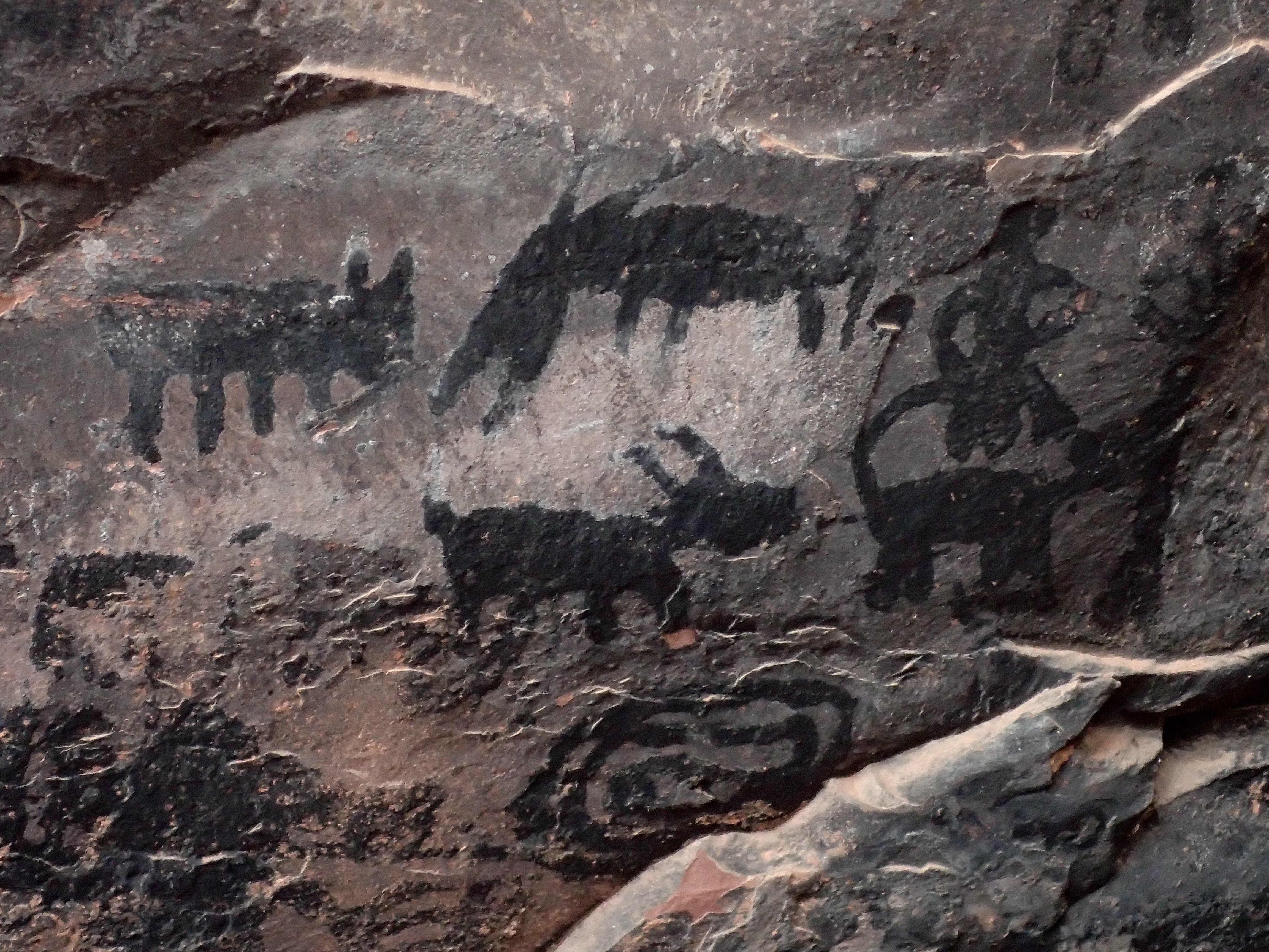
The V-Bar-V Heritage Site is the largest and best preserved petroglyph site in the Verde Valley. It consists of 1,032 petroglyphs on a huge rock wall.

The petroglyphs were chiseled onto the stone by Sinagua farmers between 1150 and 1400. The site became part of the V-Bar-V ranch around 1907, where ranchers protected it from vandalism. The petroglyphs are now managed by the United States Forest Service. Remnants of the ranch house are still visible in the park.
I walked the trail to the glyphs, where the docent identified the more prominent designs–snakes, turtles, coyotes, herons, lizards, and antelope. Many were clan signs. The next most common are human figures and geometrics, such as spirals and grids. The V-Bar-V petroglyphs are unusual in that all are of the same style and neatly spaced.
Most interesting, however, was the prehistoric calendar. The docent pointed out the jagged rocks that, during solstices, cast sun and shadow shafts across the wall, pointing to certain symbols that mark time. Incredibly a planting calendar, an ancient farmers’ almanac, is carved into the rock surface.
“Too strong to die”
Another day I drove up steep Cleopatra Hill to the former ghost town of Jerome. One-mile high and a one-hundred-mile view.
Jerome was a copper-mine boomtown with a peak population of more than fifteen thousand, once making it the fourth largest city in Arizona.

The town owes its existence to two huge copper ore deposits, the richest ever found anywhere. The first mining claims were filed in 1876. Within twenty years Jerome was a billion-dollar mining center and one of the wildest towns in the west.
During its heyday, the mining companies created diversions for their employees, building theaters, casinos, and saloons. And brothels. Their locations are now commemorated with brass plaques. Residents engaged in drinking, gambling, fighting, and whoring around the clock in over two dozen establishments. On February 5, 1903, The New York Sun labeled Jerome “the wickedest town in the West.”
In 1938 an underground blast rocked the town and slid its business district down the side of the hill. When the mines shut down in 1952, Jerome’s population fell to around fifty. Efforts to save it finally succeeded when artists discovered the scenic view, laid-back atmosphere, and cheap real estate.
Today, Jerome is a thriving art colony, a remote, whimsically shabby place, with a population close to five hundred. The town called “too strong to die” became a National Historic Landmark in 1967.

City of ruins
In every direction, prehistoric stone dwellings are tucked into canyons, hugging alcove walls and straddling outcroppings, often barely visible. I visited several during my stay, often putting the rental car at risk on rocky, dust-choked roads.
At the Honanki Heritage Site, stone walls divide the base of the cliff and the alcove into seventy-two rooms, once housing up to two hundred people.
At nearby Palatki, a rock wall beneath an overhang displays both pictographs (painted) and petroglyphs (carved). Anthropologists say the red, yellow, black, and white images were created by multiple cultures from, incredibly, twelve thousand years ago through the 1800s.

Another site, Montezuma Well, is an oasis in the desert, a limestone sinkhole sacred to all local clans. From an underground spring, 1.5 million gallons of water emerge each day. Between 1125 and 1400, up to 150 people lived around the well in cliff dwellings and pueblos.
Nearby, Tuzigoot National Monument preserves a three-story pueblo ruin on the summit of a ridge above the Verde River floodplain. The pueblo once had 110 rooms, housing over two hundred people.
The combined populations of all of these scattered stone dwellings amount to a modern city’s-worth of fifty thousand Sinagua in the Verde Valley around 1300.
Lost on the mesa
Overnight it snowed but the morning sky was clear. After pumpkin pancakes and sausage, I headed to the snow-covered trails to hike to Brins Mesa again.

My tire tracks were the only ones on the access road; my car the only one at the trailhead. The trail was icy, especially on the red-rock ledges. I moved slowly, glad I borrowed a walking stick from the B&B. On the mesa, I broke trail in deeper snow and became concerned I would lose my way. I found animal tracks, which appeared to be deer and coyote.
I paused on top for a while and listened to the stillness. No wind. Nothing but rocks, snow, scrub, and sky. Interesting to see snow on yucca and prickly pear. I noticed the burnt stumps, remnants of the 2007 forest fire.
Once I turned onto Soldiers Pass, I lost the trail. Every avenue was a deadend.
I backtracked until I realized the problem. A tree had fallen across the trail, probably in the high wind two nights ago. It was covered with snow, which made it look like a permanent feature. I walked around it and found the main trail again on the other side.
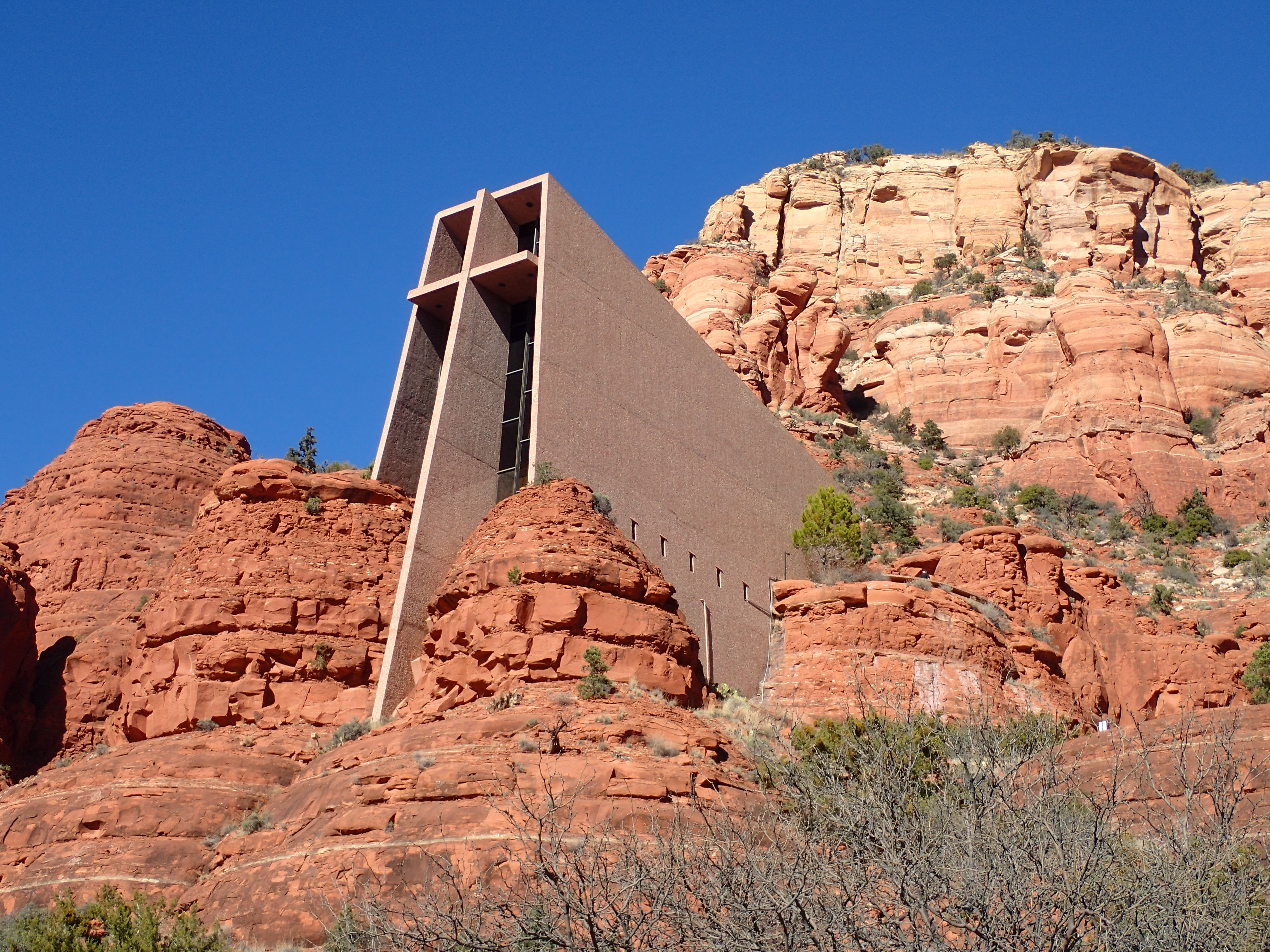
Back in Sedona, I visited the stunningly situated Chapel of the Holy Cross.
The chapel was built by local rancher Marguerite Brunswig Staude, who was inspired in 1932 by the newly constructed Empire State Building.
The original design was by Lloyd Wright, son of Frank Lloyd Wright. After World War II interfered with an attempt to build the chapel in Budapest, she chose to build it in Sedona. Completed in 1956, the chapel appears to emerge from the face of the cliff.
Ball courts and ballrooms
The further north I drove, the more snow I encountered. Plus, rocks in the road, usually near Watch for Falling Rocks signs. Finally I arrived at the beautifully desolate Sunset Crater Volcano National Monument.

Sometime between 1040 and 1100, a series of eruptions created more than six hundred mountains in the area north of what is now Flagstaff.
Molten rock spouted into the air, solidified, and fell to earth. Lava flowed, smoked billowed, and cinders piled into heaps.
Eight hundred square miles of northern Arizona were blackened. Today the national monument protects over three thousand acres.
At Wupatki National Monument, no one was home except the ranger. The pueblo ruins once comprised over one hundred rooms, plus a community space and a ball court. Archaeologists have found evidence of gambling on a game similar to hurling played at the court.
Wupatki was first inhabited around 500 CE. By 1182, over a hundred people lived there. Forty-some years later, the village was abandoned.
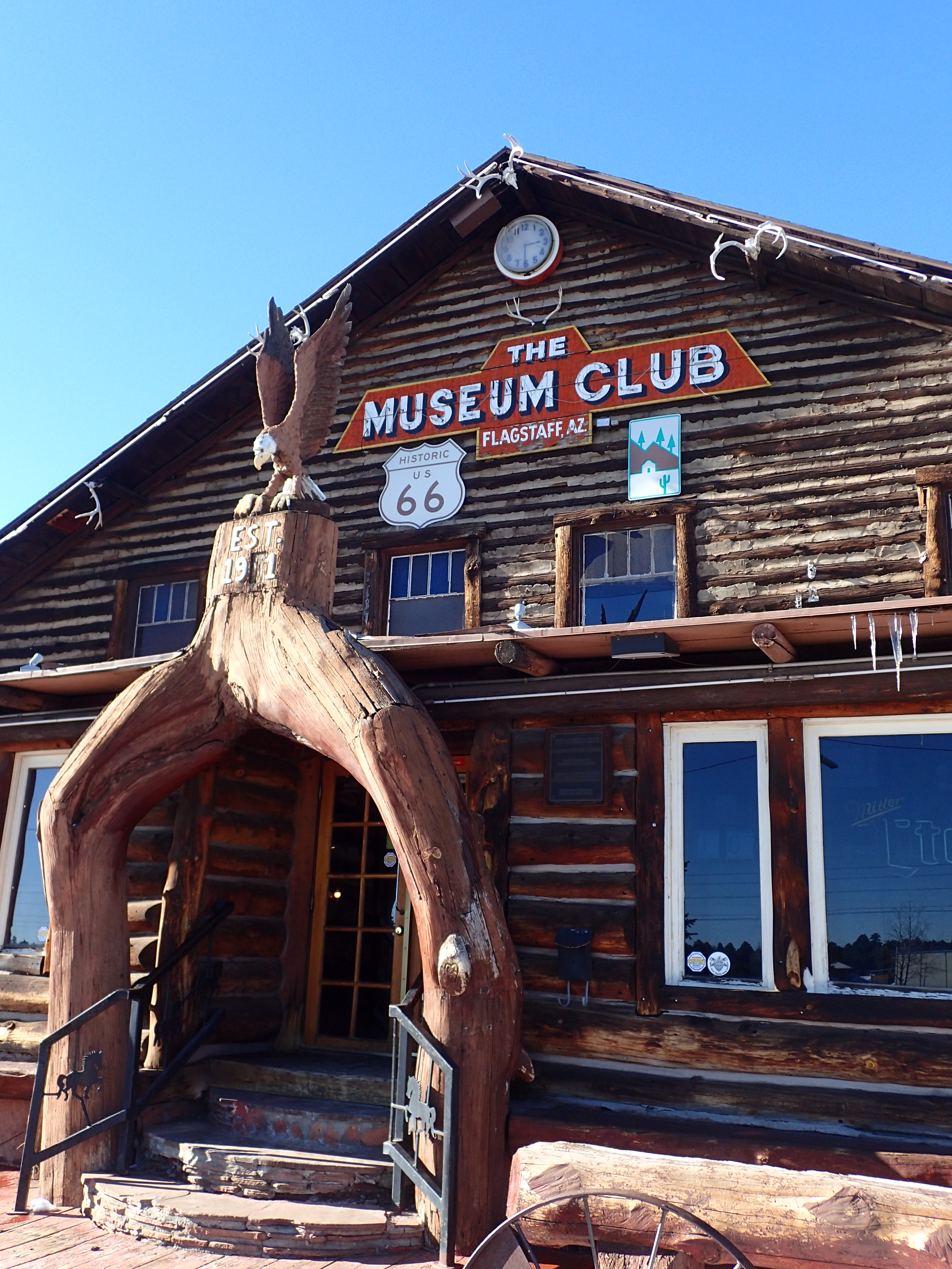
On the way back through Flagstaff, I stopped at the Museum Club, a Route 66 icon.
The club, once touted as “the biggest log cabin in the world,” was built by taxidermist Dean Eldredge in 1931. Inside, he displayed his collection of stuffed animals, two-headed calves, six-legged sheep, Winchester rifles, and Native American artifacts.
In 1963, Don Scott, a musician, bought the club and converted it to a country dance hall. He booked his friends, including Waylon Jennings, Willie Nelson, Wanda Jackson, and Barbara Mandrell.

Stars in the canyon
Almost one hundred movies, mostly westerns, were filmed using Sedona’s scenery as a backdrop. The first, made in 1923, was Zane Grey’s The Call of the Canyon. In 1945 John Wayne produced Angel and the Badman. A western-street set was built.
During Sedona’s heyday as a location, almost every major star visited, including Jimmy Stewart, Henry Fonda, Joan Crawford, Glenn Ford, Robert DeNiro, Robert Young, Hopalong Cassidy, Tyrone Power, Rock Hudson, and Donna Reed. Elvis Presley’s Sedona movie, Stay Away, Joe, is considered his worst.

The West Fork Trail in Oak Creek Canyon was thick with ice from earlier footprints. The path follows a stream, crisscrossing it several times. I was able to pick my way across snow-covered stepping stones, but when I reached an ice-coated log bridge across the creek I knew it was time to turn back.
Bear Howard built a cabin along Oak Creek in the 1870s. He earned his nickname by hunting and killing every grizzly in the canyon. He was inspired by the loss of a friend who died as a result of a bear attack.
The cabin was remodeled by other homesteaders, eventually as a hunting and fishing lodge in the early 1900s. Carl Mayhew bought and enlarged it in 1925. The Mayhew family ran the lodge until 1968 and hosted many famous guests, including President Herbert Hoover, Jimmy Stewart, Walt Disney, and Clark Gable.
Getting metaphysical
The other pueblo available to tour in Sunset Crater Volcano National Monument is Wukoki. I passed through the charred lunar landscape, my car the only one on the road. Eventually a yellow prairie emerged, dotted with dusty scrub. I looked north toward the Painted Desert, glowing pink on the horizon.

Searching for the pueblo, I turned onto a side road for a few miles. And then, there it was, rising from the desert floor like a spaceship. Stones stacked against the wind upon a red-rock outcropping, a cloudless blue sky above.
I pulled into the empty parking lot. I could see for miles across the desert. No other cars were visible.
I was alone with the ancient ruin. I had it to myself.
Somewhat in awe, I approached it slowly. Nine hundred years ago, an untold number of families lived in these ten rooms in the middle of this wasteland. They were born here, raised families, grew crops, and died.

To my surprise, visitors were allowed to wander around the ruin and enter the rooms. Unusual. I felt almost guilty, as if I shouldn’t be allowed here unsupervised.
My interest in these ancient sites may seem baffling. After all, Wukoki is not much more than a pile of rocks in the desert.
But for some reason, perhaps because I was alone at the pueblo, perhaps because I could explore it unmonitored, perhaps due to its stark beauty or its ancient history, the experience was eerie. Maybe even spiritual.
It was the rare right combination of time and place to contemplate purpose. Perhaps I had found a vortex.

Sounds like you are off to a good start on your travels in 2016.
Really enjoyed hearing about your experiences. Your story brought back lots of memories (cliff dwellings, the chapel, etc.) but also added many new (or should I say old) things that we missed.
As always, a wealth of historical and up to date information on interesting places not likely to be visited by me but the feeling of ‘being there’ is infectious. Perhaps its that spiritual connection….. Glad I finally found time on this sunny, snowy Saturday to sit down, read and appreciate. Thanks Kirk.
Great to hear from you, Anne! I hope to get back to Scotland one of these days. All the best to you and Derek.
Kirk, Glenn and I (and Bonnie & Cindy) visited Sedona a couple of years ago. It felt like we were visiting another planet.