

The lights dart across the Texas desert, pulsing, merging, and then disappearing.
Some people believe they are UFOs; others, the ghosts of Spanish conquistadors.
A cowboy first reported seeing them in 1883. He thought they were campfires of the Apache. Other theories as to the origin of the mysterious lights include swamp gas, St. Elmo’s fire, and the glint of minerals in the moonlight.
The lights appear over an old airfield in the desert, where American and Allied pilots trained during World War II. For years, believers and non-believers parked their cars along the remote two-lane road between Marfa and Alpine, turned off their headlights, and waited for the show.
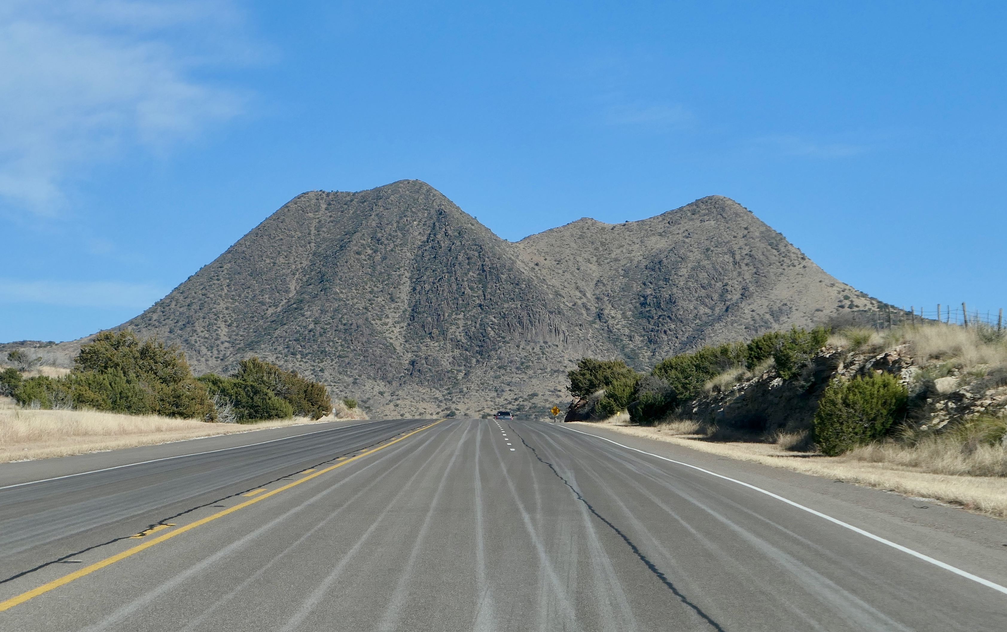
Eventually, the danger inherent in parking on the side of a highway (the speed limit is seventy) and the traffic congestion spurred the building of a roadside park, complete with restrooms and a viewing stand.
In 2004, students from the University of Texas in Dallas studied the lights for four days and concluded they are automobile headlights on US Route 67 between Presidio and Marfa. Regardless, visitors come to the viewing area nightly to see for themselves.
My own encounter with the Marfa lights occurred in broad daylight. On the exact same stretch of road, blue flashing lights followed me closely for nearly half of a mile before I pulled onto the berm and collected a ticket for speeding.
Largest of the largest
I left touristy Hill Country and headed south by southwest. The barista at Java Ranch said, “Once you get west of Fredericksburg, you won’t find much in your way.”
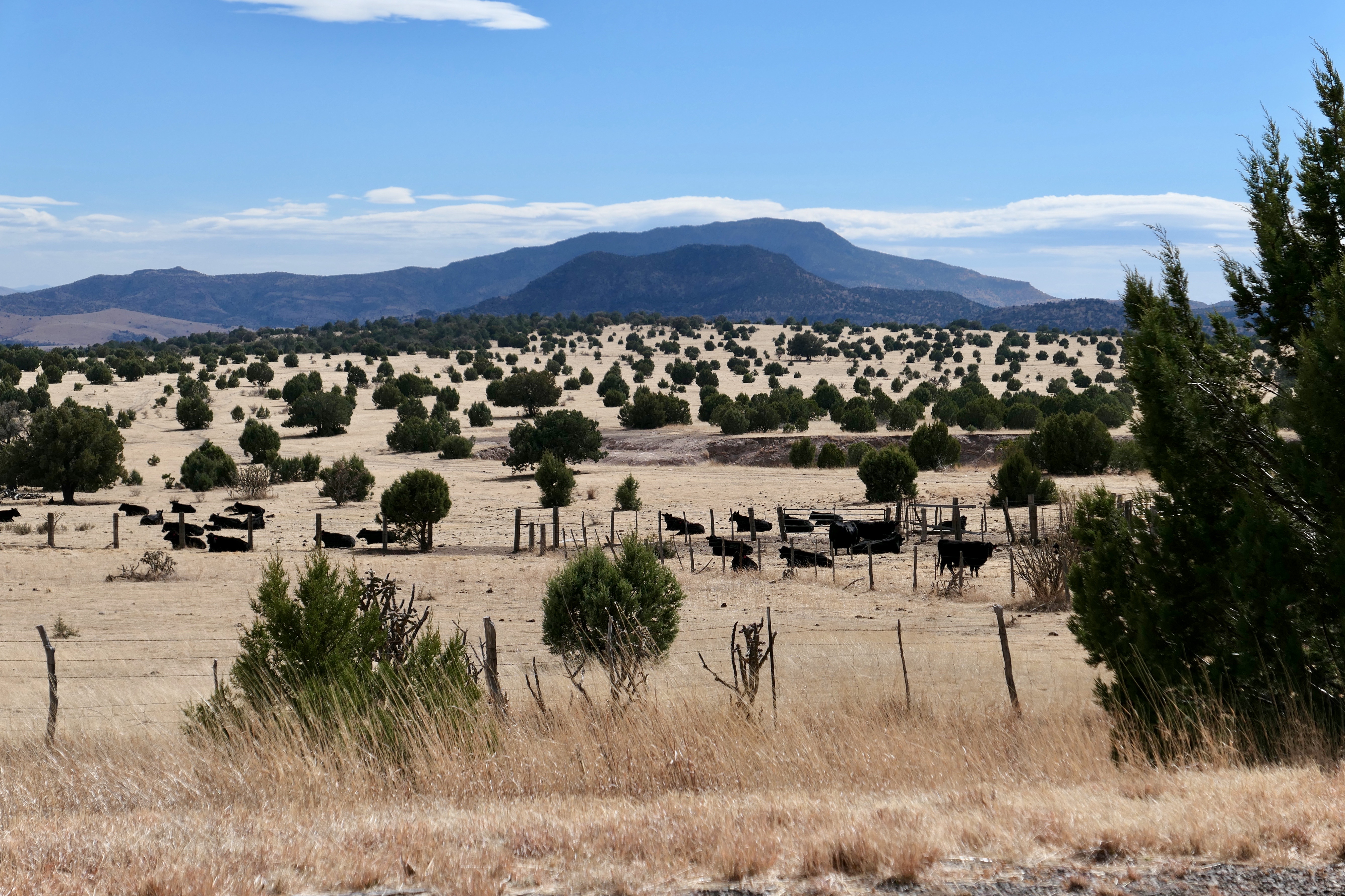
Southwest Texas is vast beyond description. Even its counties are huge. Seven of them are individually bigger than the states of Delaware and Rhode Island combined.
On I-10 the speed limit is eighty miles an hour. The country is wide-open yellow grassland, scattered with limestone.
A radio announcer near Sonora reported that Whitey Ford, the local prairie dog, saw his shadow. Six more weeks of sunny, sixty-degree winter. After a while, the radio’s scan button was unable to detect a signal anywhere on the dial.

Farther west, the grass gave way to desert, then to scrubby basin and range.
An hour east of Fort Stockton, scores of wind turbines sprouted on the mesas. In the valleys, oil rigs churned.
Finally, I turned south toward Alpine. I could see for hundreds of miles, it seemed, in every direction. The horizon is ringed with blue mountain ranges. Dirt roads lead, apparently, to distant ranches.
Alpine, Fort Davis, and Marfa are the county seats of three of the biggest counties in Texas, and yet the three towns are within twenty-five miles of each other. They are the last-chance undercard before the main event, Big Bend National Park.
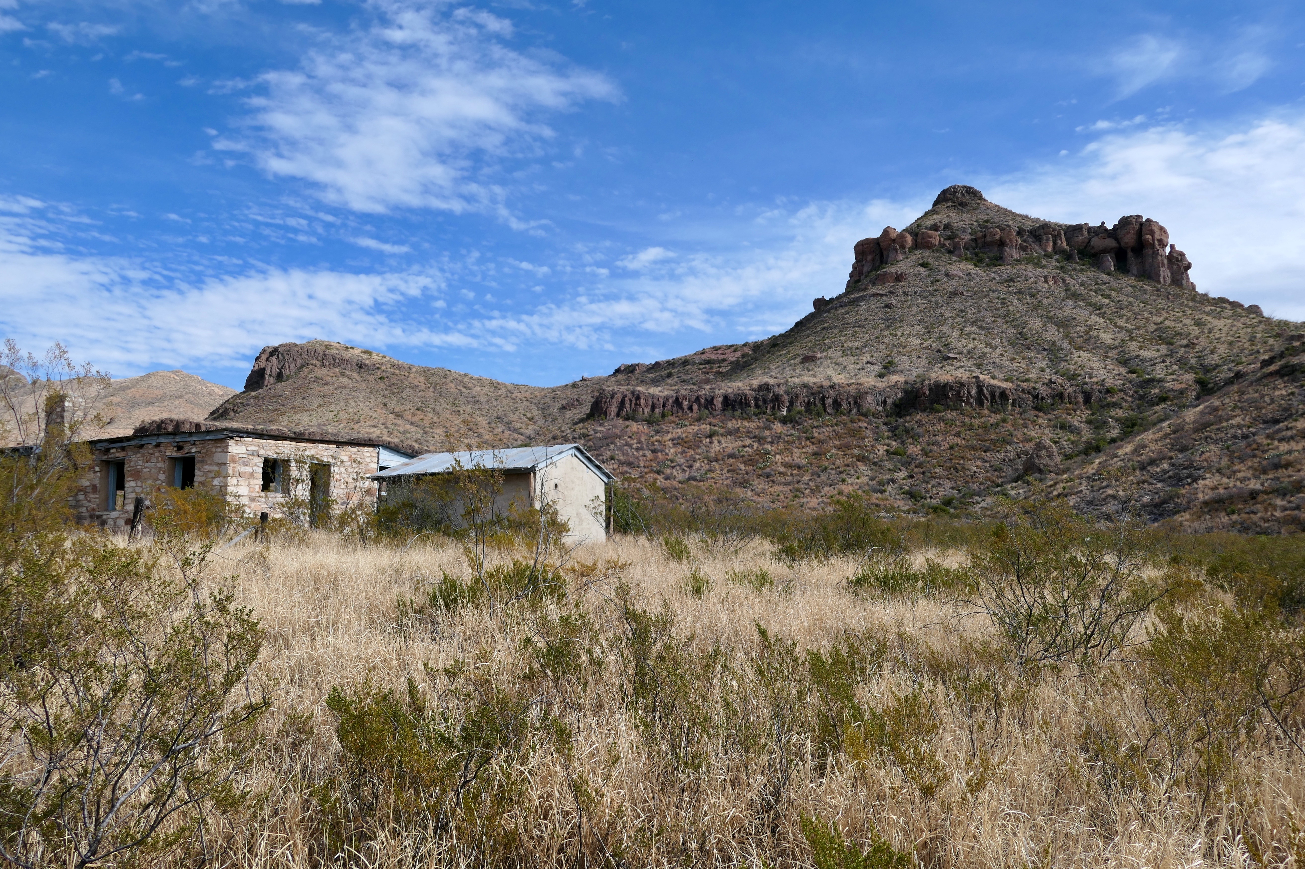
Alpine sits nearly a mile high on a plateau in the Chihuahuan Desert. It once served as a campsite for cowboys and railroad workers.
The development of Big Bend National Park in the 1930s and 1940s spurred growth, attracting a population of over six thousand. Today, colorful murals and taco trucks attempt to cover up the empty downtown storefronts.
I checked into the Holland Hotel, a grand old lodge built in 1928. It bills itself as “the largest hotel in the largest city in the largest county in the largest state.” Bison, elk, and wild boar are on the menu.
On the way into town, I spotted a herd of javelinas, about ten of them around a water tank. Big Bend National Park’s film says the javelina “looks like a pig and smells like a skunk.”
Hard cache
Jeff Davis County, the Davis Mountains, and Fort Davis are all named after Jefferson Davis, who once served as Secretary of War for the United States.
The town of Fort Davis has a thousand residents and, at a little over five thousand feet, brags that it is the highest place in Texas.
The tallest of the Davis Mountains, Mount Livermore, kept a secret until 1895. While hiking, two young men found a cache of thousands of arrowheads beneath a cairn on the summit.
The mother of one of the men, Susan Janes, an amateur archaeologist, excavated the site. She also implored other collectors to consolidate their pickings. The hoard has been dated between 700 and 1300 CE. The Livermore Cache now resides at the Museum of the Big Bend in Alpine.
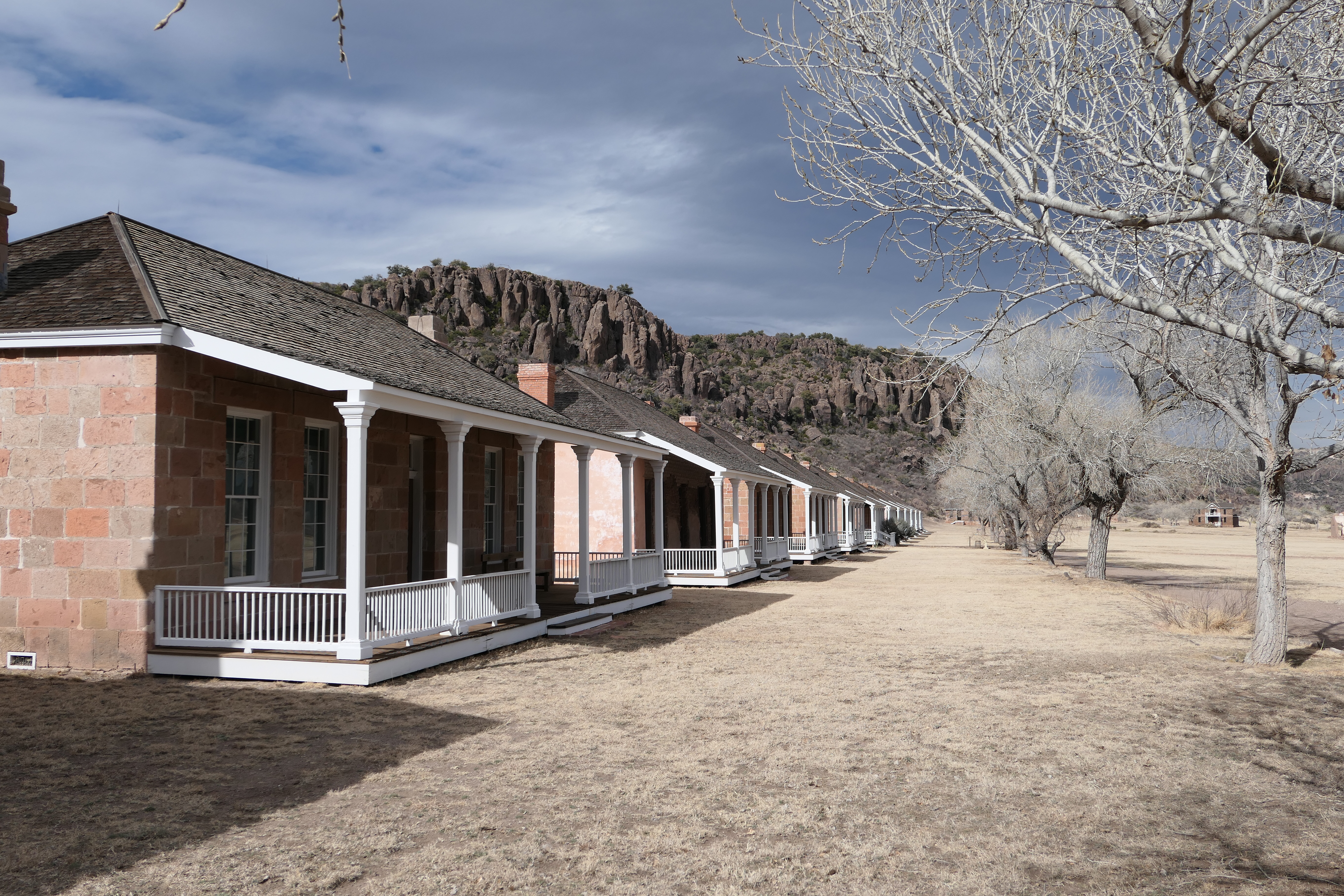
Fort Davis National Historic Site sits to the east of the mountains, tucked into a box canyon. It is one of the best remaining examples of a western military fort.
Troops were stationed at the post from 1854 to 1891 to protect settlers from the Comanche and Apache.
“Fighting on arrival, fighting for survival”
Fort Davis is unique in history in that it served as the headquarters of all four regiments of enlisted African Americans, the famous Buffalo Soldiers.
In 1866, Congress established the regiments to help protect the remote western frontier after the Civil War. Many African Americans enlisted because they could earn more in the military than elsewhere, and the military offered more dignity than might be available to them as civilians.
According to legend, Native Americans nicknamed the African American troops “buffalo soldiers” because of their dark curly hair and their fierceness as fighters.
Buffalo Soldiers reoccupied and rebuilt Fort Davis after the war, protected travelers on wagon trains and stagecoaches, built and repaired telegraph lines, guarded water holes, and carried out numerous incursions against the Apache.
By the end of the Indian Wars, eighteen Medals of Honor were awarded to Buffalo Soldiers for their courage.
After completing their enlistment, some of the Buffalo Soldiers pursued civilian work. Because they knew the terrain and were expert horsemen, many got jobs as cowboys on local ranches. During the 1880s and 1890s, an estimated twenty-five percent of all of the cowboys in the Big Bend region were African American.
Bob Marley, in his song “Buffalo Soldier,” compares all African Americans to Buffalo Soldiers, “fighting for survival” in the heart of America.
Desert luxe
The small town of Marfa looks a bit more upscale than the I Love Dick TV series indicates. The town has served as a setting for several movies, including Giant, the 1956 western starring Elizabeth Taylor, Rock Hudson, and James Dean. More recent films shot nearby include No Country for Old Men and There Will Be Blood.
Today, Marfa is a major center for minimalist art with nationally known museums, installments, and galleries.

The landscape north of Marfa is some of the most remote country I’ve seen on this trip. For hundreds of miles in every direction, nothing breaks the monotony of yellow grassland and desert.
The only signs of humanity are the highway, the barbed-wire fencing, and the US Border Patrol balloon.
The fifty-five-feet balloons, part of the Tethered Aerostat Radar System, can rise as high as fifteen thousand feet. Their surveillance cameras read license plates from miles away.
And, then, in the middle of nowhere is a Prada store.
On the facade of the tiny shop is the Prada logo. In the windows are real Prada shoes and handbags. The front door, however, does not open.
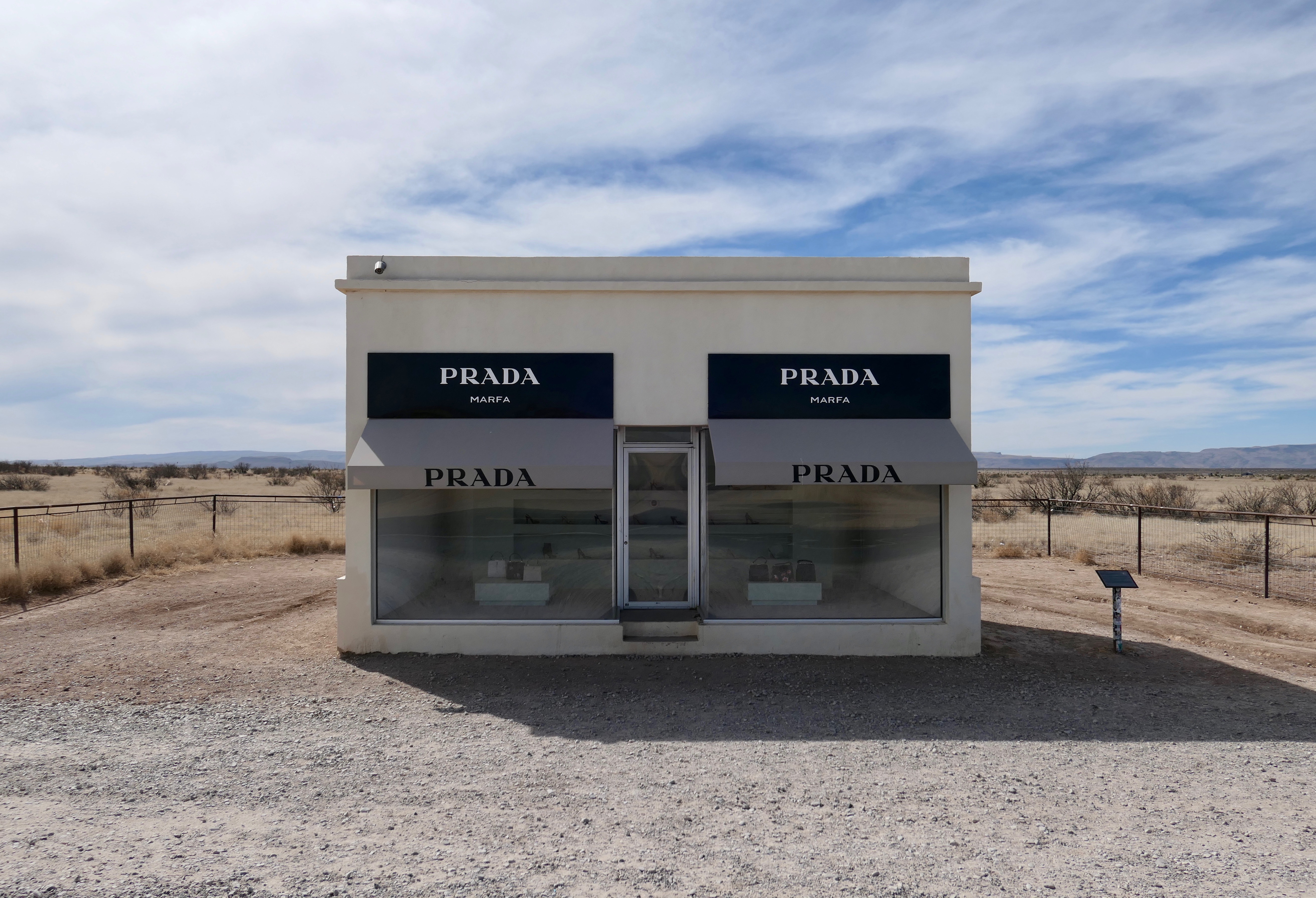
“Prada Marfa” is an art installation, a permanently installed sculpture along a desolate stretch of US Route 90. The sculpture is made of bricks and mortar. The merchandise was personally selected by Miuccia Prada.
The installation is intended as a comment on consumerism and branding. It has been broken into twice since 2005.
Road Runner and Coyote
To me, the Chihuahuan Desert, which covers parts of Mexico, Texas, New Mexico, and Arizona, looks like the landscape through which Wile E. Coyote chased the Road Runner.
The pair cavorted through fantastically shaped, brightly colored mesas, buttes, and pinnacles. Big Bend National Park lies within the Chihuahuan Desert and is home to numerous coyotes and road runners.
The park’s name is an understatement. Big Bend is huge. It is a state park bigger than the state of Rhode Island.
Big Bend encompasses deep canyons, sweeping deserts, forested mountains, and over one hundred miles of the Rio Grande, separating the United States from Mexico.
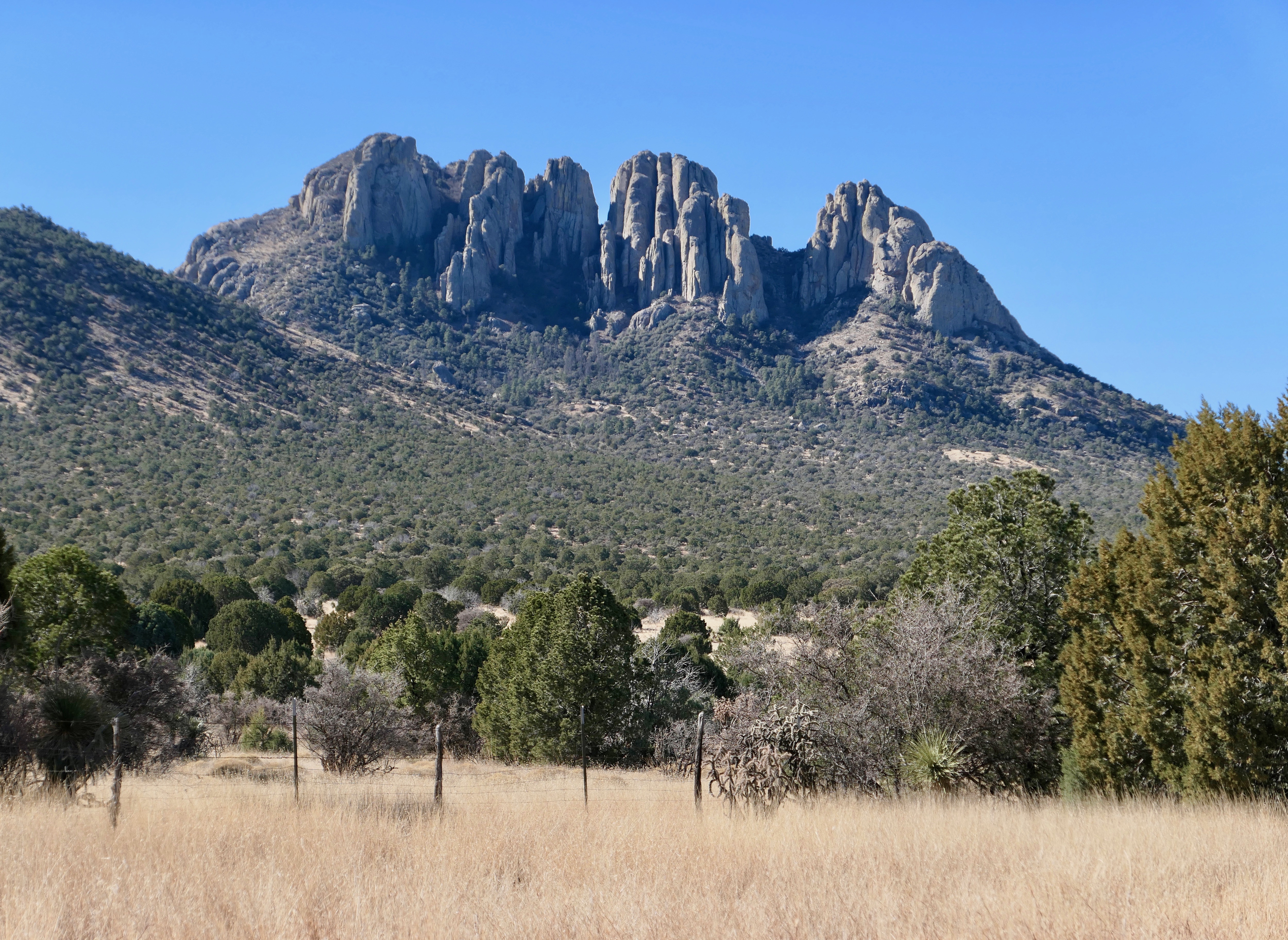
The craggy Chisos Mountains in the middle of the park are sky islands, where Mexican black bears and mountain lions prowl. Twenty-five lions are known to be in the park.
Numerous dinosaur fossils have been found at Big Bend, including those of ancient crocodiles fifty feet long. Some of the fossils belong to the largest flying reptile that ever lived, Quetzalcoatlus northropi, also known as the Texas Pterosaur. Its wingspan was almost forty feet.
Big Bend is a certified Dark Sky Park, “a land possessing an exceptional or distinguished quality of starry nights . . . ” Its skies are some of the darkest in the continental United States, a benefit to the astronomers at the MacDonald Observatory one hundred miles to the north.
Woodstock West
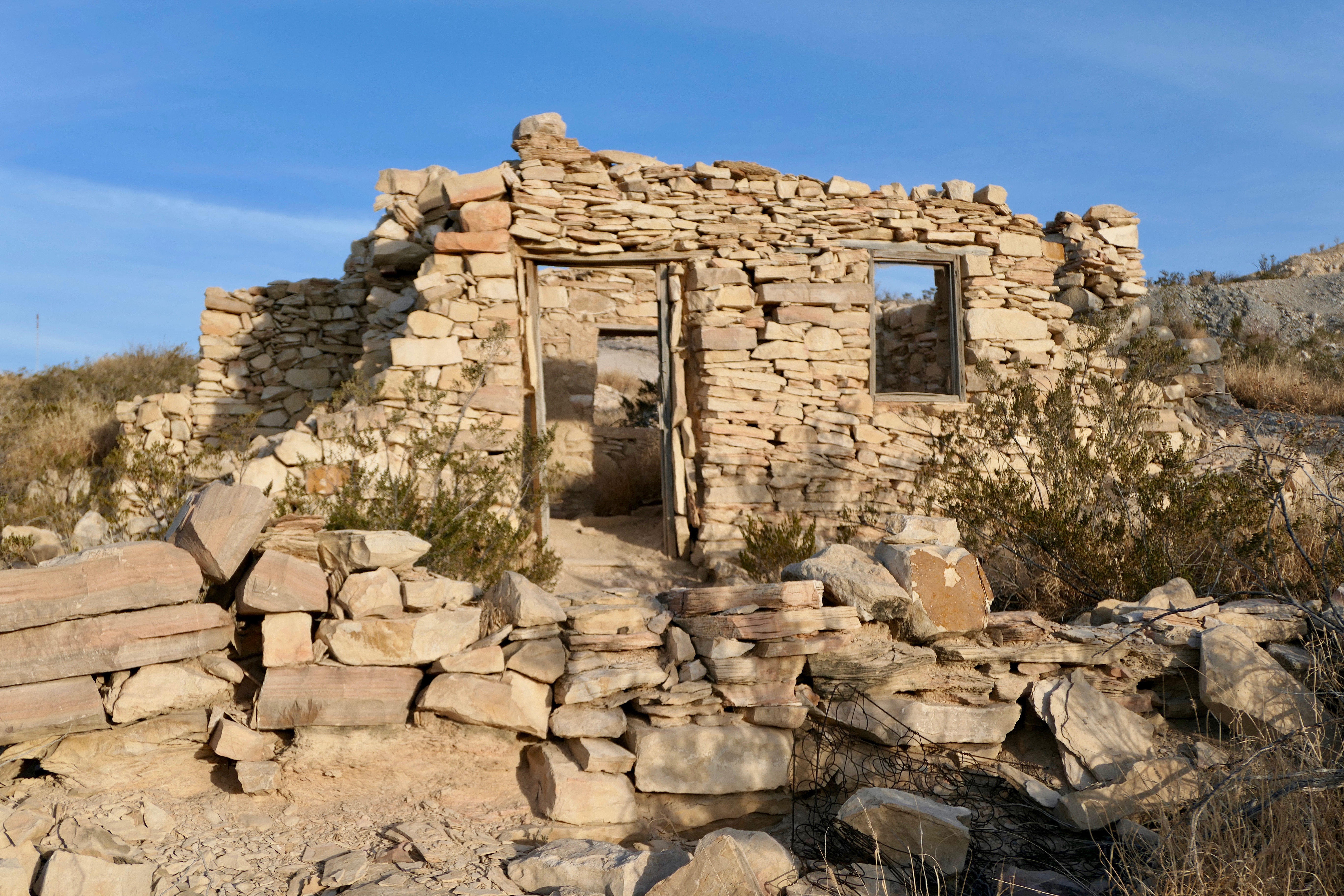
I stayed on the western edge of the park in the ghost town of Terlingua. The town is a loose-knit community of adobe ruins, mobile homes, sheds, shacks, shops, churches, schools, bars, and tepees, widely flung over several acres of mountainous desert.
The discovery of cinnabar, from which mercury is extracted, brought thousands of miners to the area in the 1880s. When the mines closed in the 1940s, Terlingua went bust. However, the ghost town’s proximity to the national park has given it a more recent boost. Its adobe ruins have been incorporated into the architecture of several of its newer buildings.
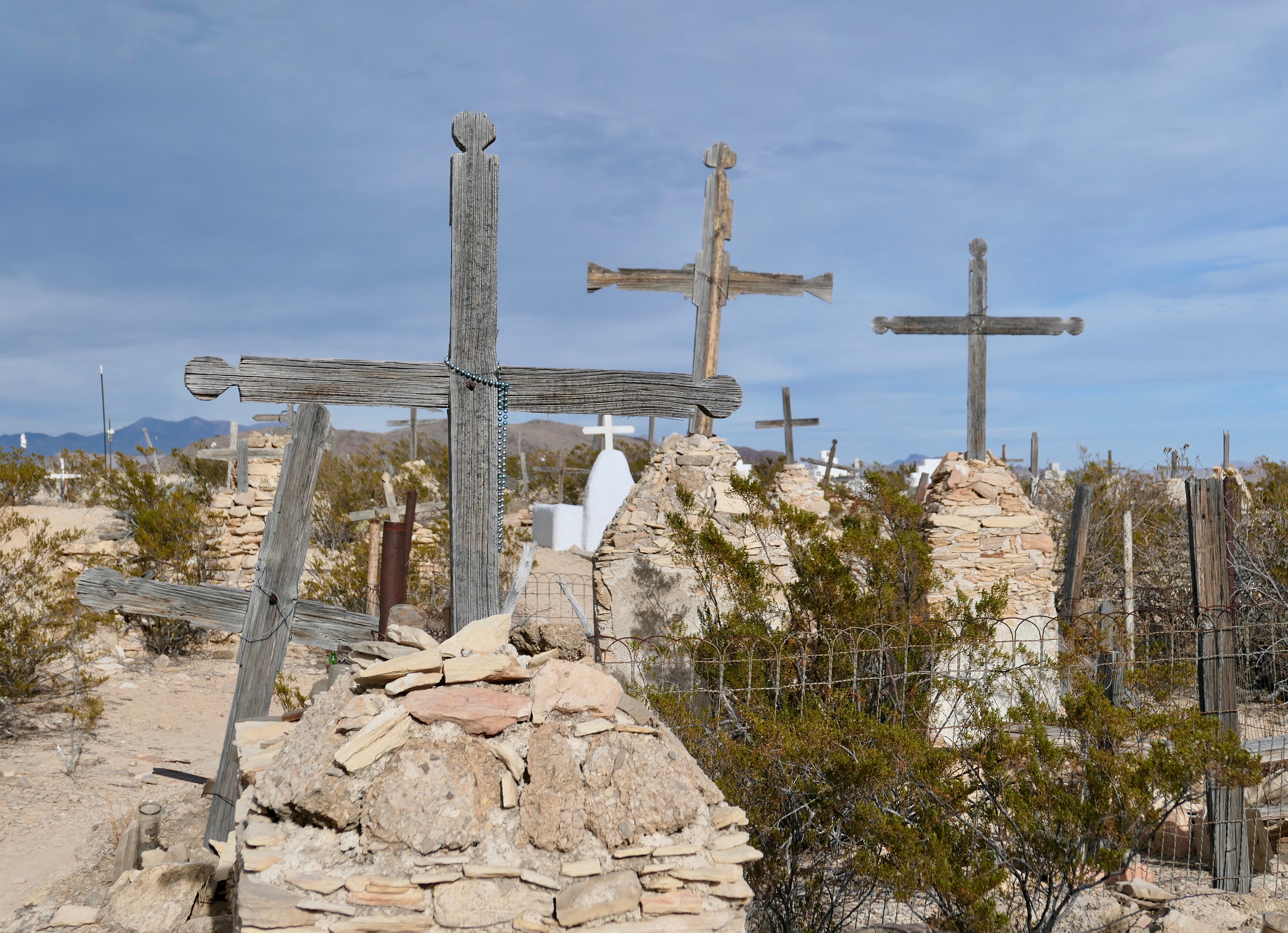
Some of the ghosts likely reside at the dusty, stony cemetery on the edge of town. Many miners died at an early age, due to the danger of the work and the exposure to mercury.
They are buried above ground under piles of rocks because the earth is too hard to dig. The sites are marked with simple wood crosses, most of which have fallen over.
The gravel parking lot in front of my hotel was cratered with potholes. Not a problem for the locals—they drive Silverados, Raptors, and Ram 3500s.
The long porch in front of the trading post and restaurant serves as an impromptu community center. Every afternoon cowboys, hippies, bikers, and river guides lounge on the porch and sip beer. (The trading post sells cans and bottles individually.)
Both men and women wear cowboy hats over gray ponytails. They clip knives to their belts. Some wear sandals. A few pick guitars and sing. (Community guitars stand at the ready.) The porch is crowded with Willie Nelson look-alikes.
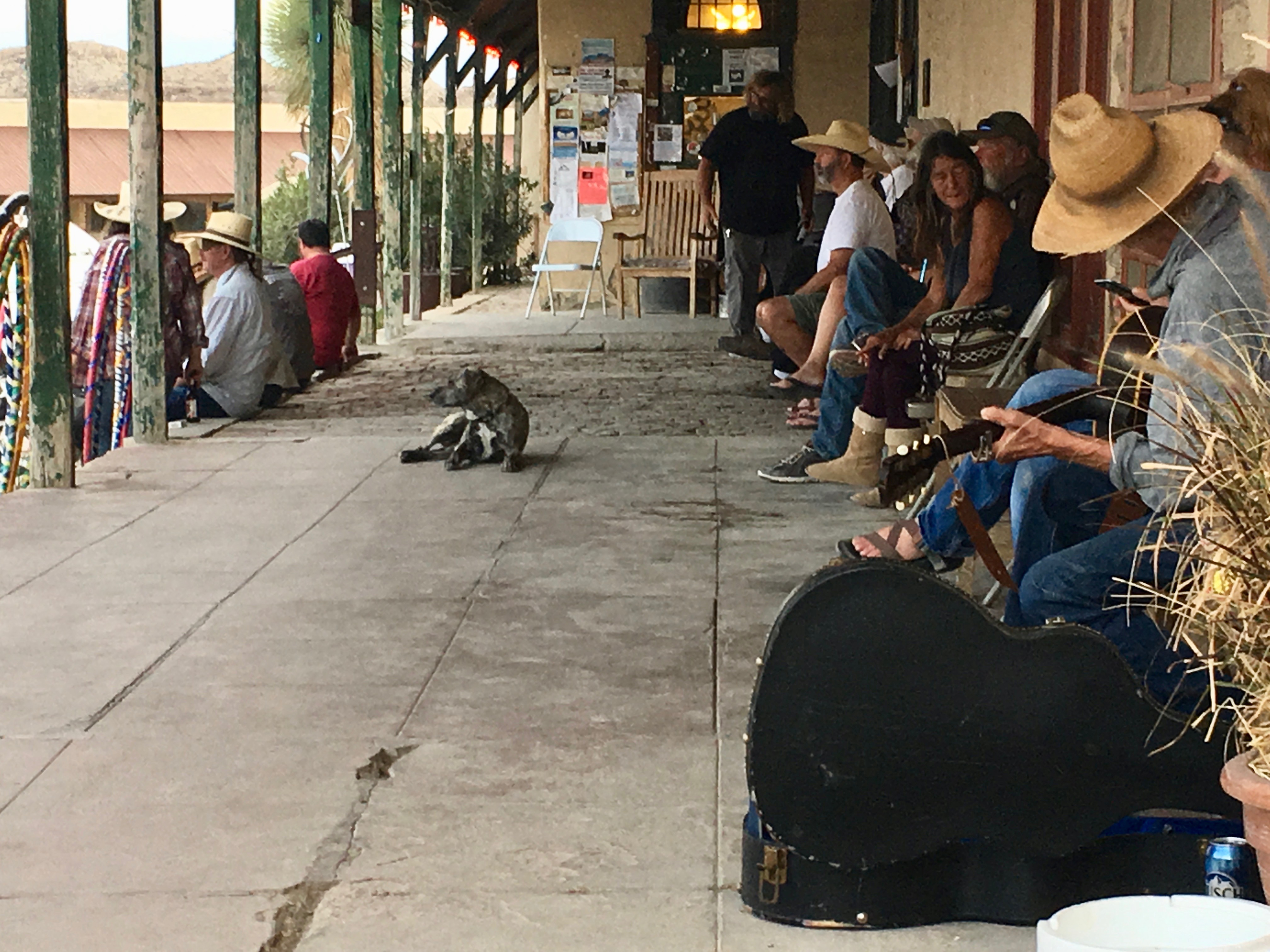
They watch as the sun transforms the Chisos Mountains from dusty brown to glowing orange and pink. An old cowboy in a straw hat strums and sings “El Paso.” Dogs wander up and down.
At 5 p.m. the doors to the Starlight Theatre Restaurant open. Built in the 1930s, the Starlight was originally a movie theater.
When the town fell on hard times, the building was abandoned and the roof collapsed. (Thus, the name.) In the 1990s the theater, now on the National Register of Historic Places, reopened as a restaurant.
Inside, the walls are still crumbling. A jam band of three old-timers plays Grateful Dead songs. The front door swings open for a moment and reveals a western landscape, the distant mountains purple in the setting sun.
Hot springs and contraband
I began most days at Big Bend watching the sun rise over the mountains from the patio at Espresso y Poco Mas. The diner is built within a ruin. The mornings were chilly, but the temperature rose quickly, hitting ninety degrees one afternoon in February.
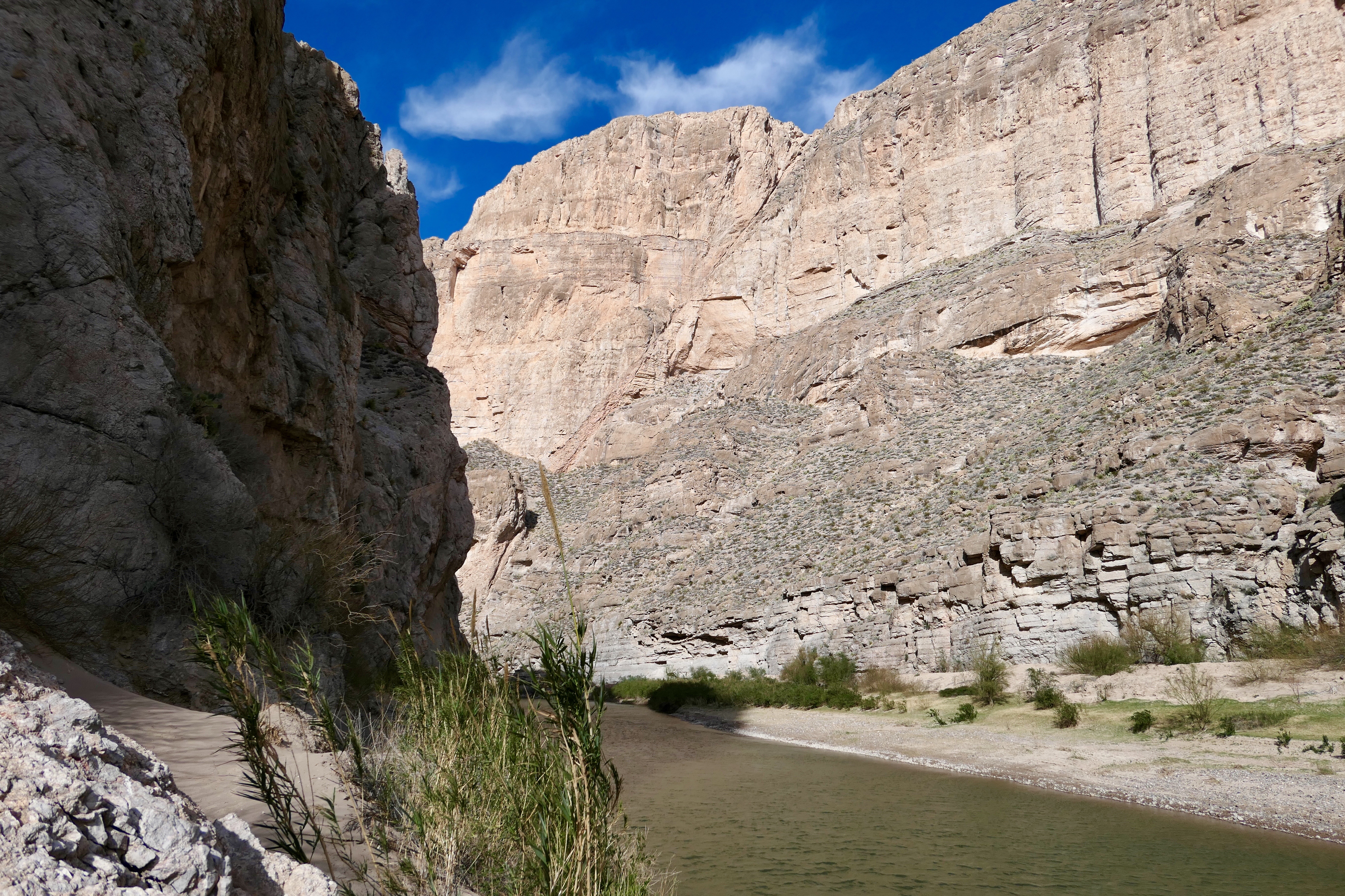
The hiking trails were diverse. One passed through the Santa Elena Canyon with the United States on one side and Mexico on the other. The cliffs on both sides of the Rio Grande are almost a quarter of a mile high, a natural “wall” between the countries.
On another hike I reached a spring just past the Mule Ears rock formation. I sat down to rest, listened to the water trickle over the rocks, and watched tadpoles swim in the middle of the desert.
Next day, I drove the bone-jarring Old Maverick Road, bouncing over washboards and crossing gravel stream beds.

I stopped to visit Luna’s Jacal (ha CALL), the former residence of Gilberto Luna, a Mexican farmer. He built the lean-to of rocks, wood, and earth around 1890. Luna raised a large family in the hut despite the presence of Comanche in the area. He died in 1947 at the age of 108.
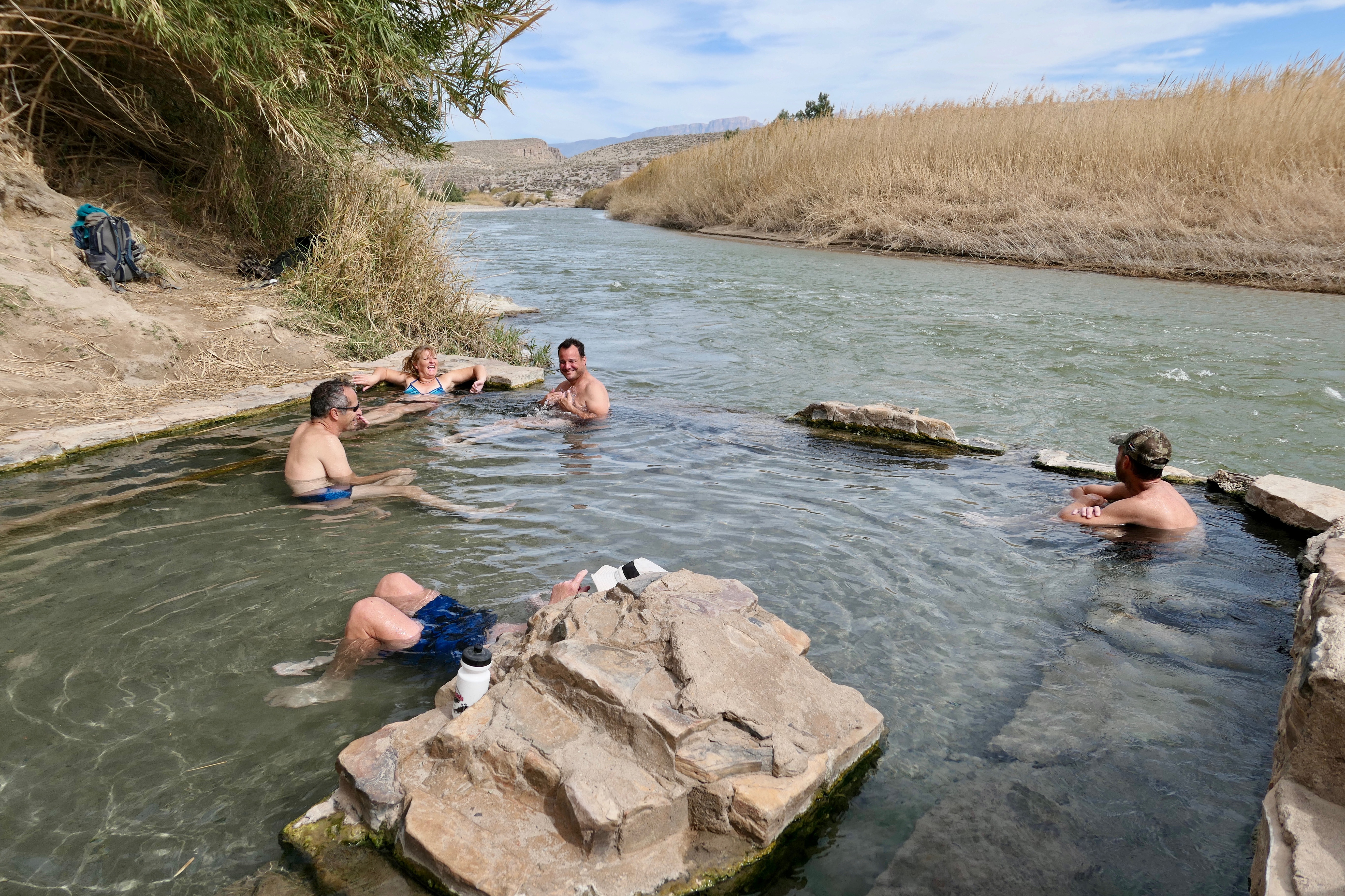
One afternoon I walked to Hot Springs for a soak. At the edge of the Rio Grande is a natural spring-fed pool, lined with limestone blocks.
There is room for only a few people to bathe at a time. The 105-degree water runs over the edge of the pool and into the river, infinity-style. There, the narrow Rio Grande rushes through thick bamboo groves.
The area around the spring was once a resort, developed in 1909 before Big Bend was a national park. Nearby are the remains of several buildings, including an adobe house, a bathhouse, a store, and seven attached cabins. The cliffs along the path to the spring display petroglyphs and pictographs.

The Grapevine Hills Trail is short and easy—until the end. The path enters a box canyon and winds around boulders the size of trucks, jumbled on top of each other in unusual formations.
At the closed end, scrambling over rocks is required to reach Balanced Rock. The rock is about the size of two full-size cars and seems to be suspended in the air. I walked beneath it, wondering if today would be the day it would fall.
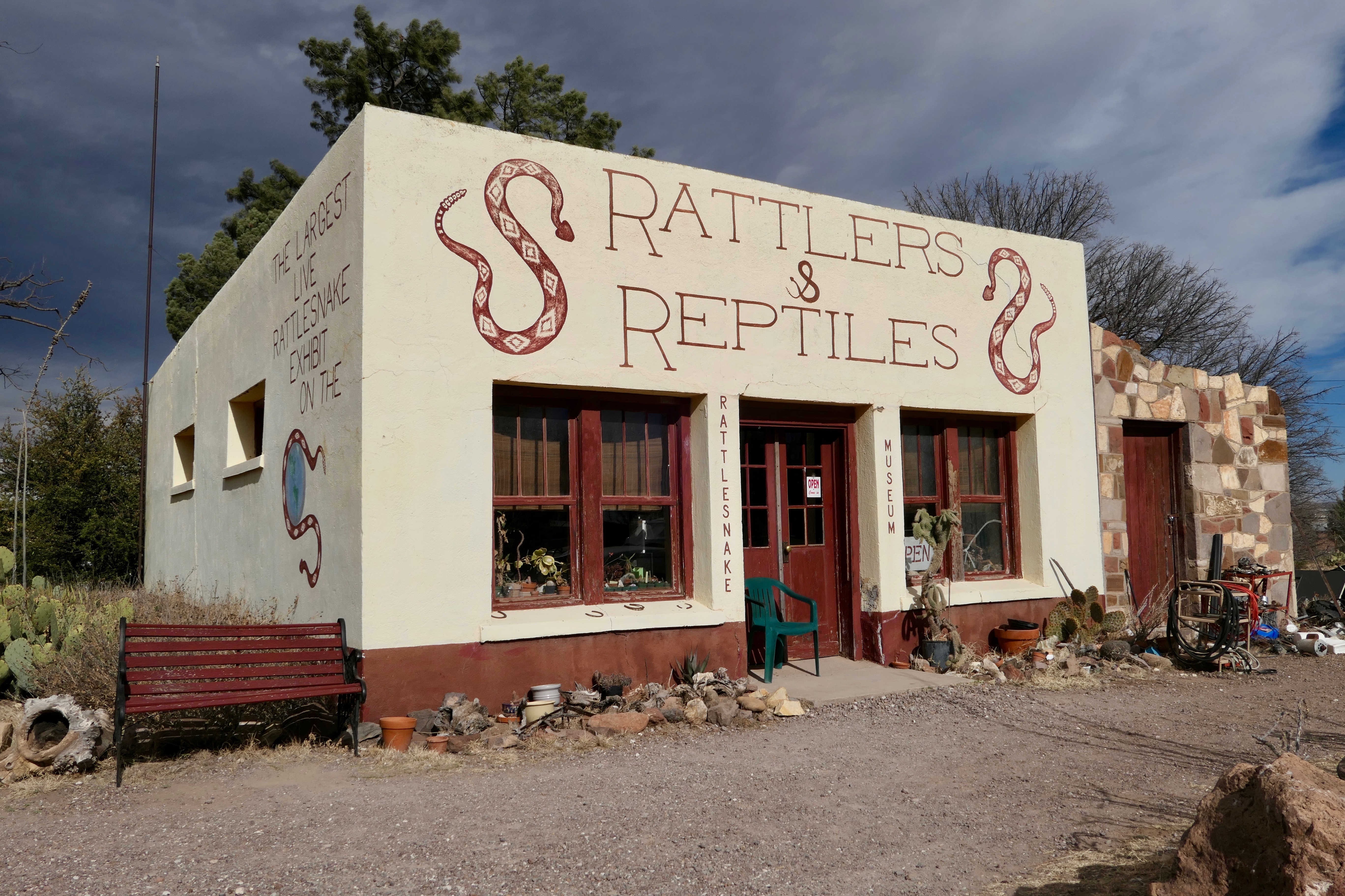
Along the trail into Boquillas (bo KEY yes) Canyon, illegal handicrafts are displayed.
Merchants ferry walking sticks, bracelets, and wire sculptures over from Mexico in row boats and leave them in piles for hikers to browse. Payment is on the honor system. The items are considered contraband by the Port of Entry staff.
The park next door
Next door to Big Bend National Park is Big Bend Ranch State Park. The area is unspoiled wilderness, best known for its only paved road, a sixty-mile rollercoaster of a ride along the winding Rio Grande.
The highway climbs and falls, while providing breathtaking views of the yellow-green river, bounded by tall, thick grass on both sides. I drove around rocks which had fallen into the road from the cliffs. A herd of mule deer crossed in front of my car.
The area suffers extreme temperatures most of the year. The average along the Rio Grande (day and night) is 102 degrees every summer. Presidio and Lajitas, the two small towns at either side of the park, often compete to be the hottest place in Texas.
North of the park is Shafter, another ghost town with a population of maybe half of a dozen. In the early 1900s, Shafter was a mining town. Scenes from The Andromeda Strain were shot there in 1971. The Ten Commandments are posted in Spanish on the side of its church.
“Minimum government. Maximum freedom.”
Drive times in Texas are long. It’s fourteen hours from border to border. In southwest Texas hours in the car seem longer.
While there, I spoke with residents about living in such extreme remoteness. To a one, they love it.
They prefer the natural setting, the solitude, the peace and quiet. They take pride in their separateness and independence.
They don’t like cities. One new resident of Terlingua, a school teacher, said she occasionally makes the 7½-hour drive to Austin to visit friends, but the city quickly makes her “itchy” to get back to the isolation of the desert.
I was expecting to meet staunch conservatives in this secluded part of Texas, but most of the people I encountered describe themselves as libertarians.
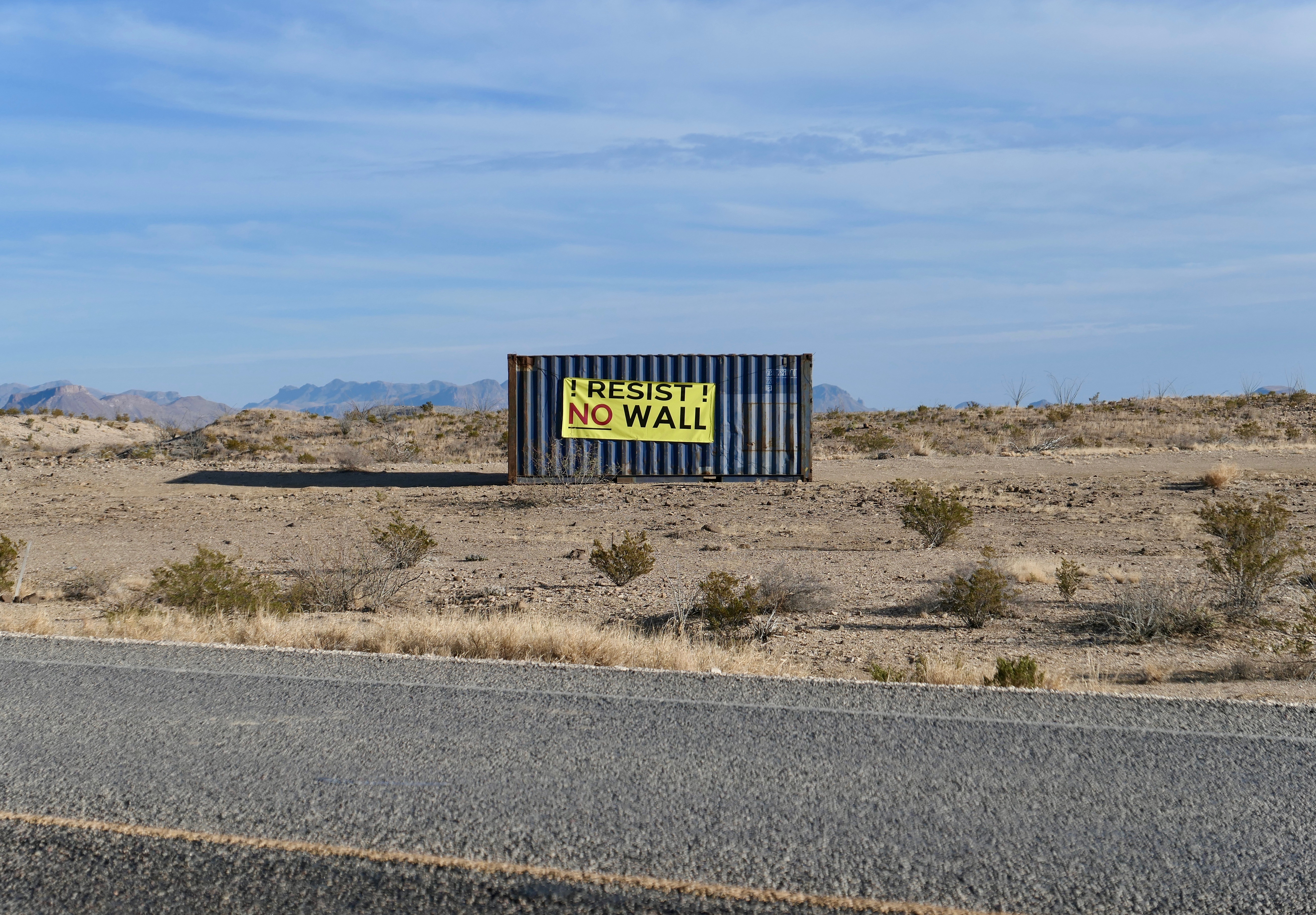
They value personal freedom.
They don’t want the government to take their guns. They don’t want the government to take their marijuana either. They don’t want to be required to wear motorcycle helmets or buy health insurance. They don’t want the “wall.”
They want to be left alone to live life as they see fit.
Dark energy
“If it were possible to drive your car nonstop toward the sun at one hundred miles an hour,” posed the observatory’s tour guide, “it would take you 106 years to arrive at its surface.”
This scenario is easier to contemplate in southwest Texas where the speeds are faster and the distances are greater.
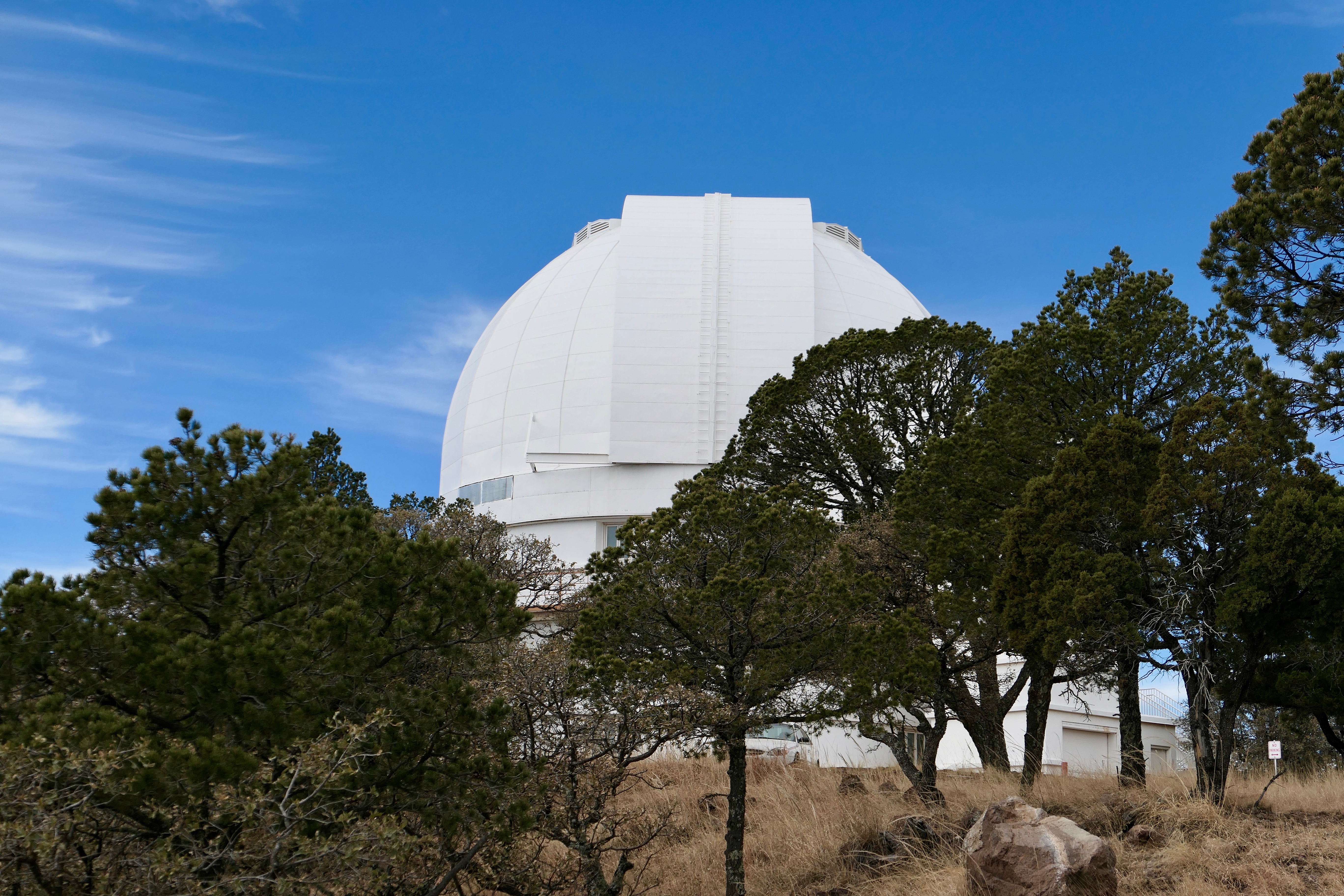
Southwest Texas also has some of the darkest and clearest night skies in the United States, an advantage when observing outer space. I visited the MacDonald Observatory, a research unit of the University of Texas at Austin, located in the high and dry Davis Mountains.
My tour group of three was allowed close-up looks at two of the observatory’s eight telescopes. At the 107-inch Harlan J. Smith Telescope, we entered the dome, took an elevator to the observing floor, and, incredibly, played with the remote controls.
Slowly, we swiveled the eighty-ton telescope in circles with a joystick. Then we opened and closed the dome’s roof hatch with a device much like a garage-door opener.

Over on Mount Fowlkes, we visited the 360-inch Hobby-Eberly Telescope, constructed of ninety-one hexagonal mirrors that fit together like a child’s toy. It is the third largest reflecting telescope in the world.
The Hobby-Eberly is being used to figure out dark energy, the name given to the unknown force behind the expansion of the universe.
Scientists say that, not only is the universe spreading out, but it is doing so increasingly faster.
The plan is to collect data on a million galaxies that are nine to eleven billion light-years distant in order to study just how fast the universe has been expanding at different times throughout its history.
Driving a car to the sun is easier to comprehend.

You made me snort my drink out my nose, “Jefferson Davis, who once served as Secretary of War for the United States.” Trying for a job with CNN?
Making you snort was my goal. Actually, I forgot he was SoW until reminded. Just a factoid. I like that the county’s name is the shortened version–Jeff Davis. I also like that song they sing before ball games by Frank Key.
But you are right, the fort was named for him as SoW not for his more famous or infamous role. I laughed because I had just last night finished a book on him (published in 2010) and it predicted that he would be remembered more for his “former SoW” role rather than as president of the Confederacy.
Am so happy to have had the fun of reading your fascinating blog of such a stark and detailed description of your recent trip. It must have been mostly enjoyable with some second thoughts nearly every day. Glad you’re home. Hugs.
Great blog! You nailed west Texas to a tee! I felt proud reading this. Native Texan! 😎
Especially nice to get a compliment from a Texan. Thanks, Kay!