
The rain was steady, as I strained to see the next waymark on the climb up Mount Brandon.
The black marker posts did not identify an obvious footpath, but instead indicated the general direction—uphill through a marshy field of rubble.
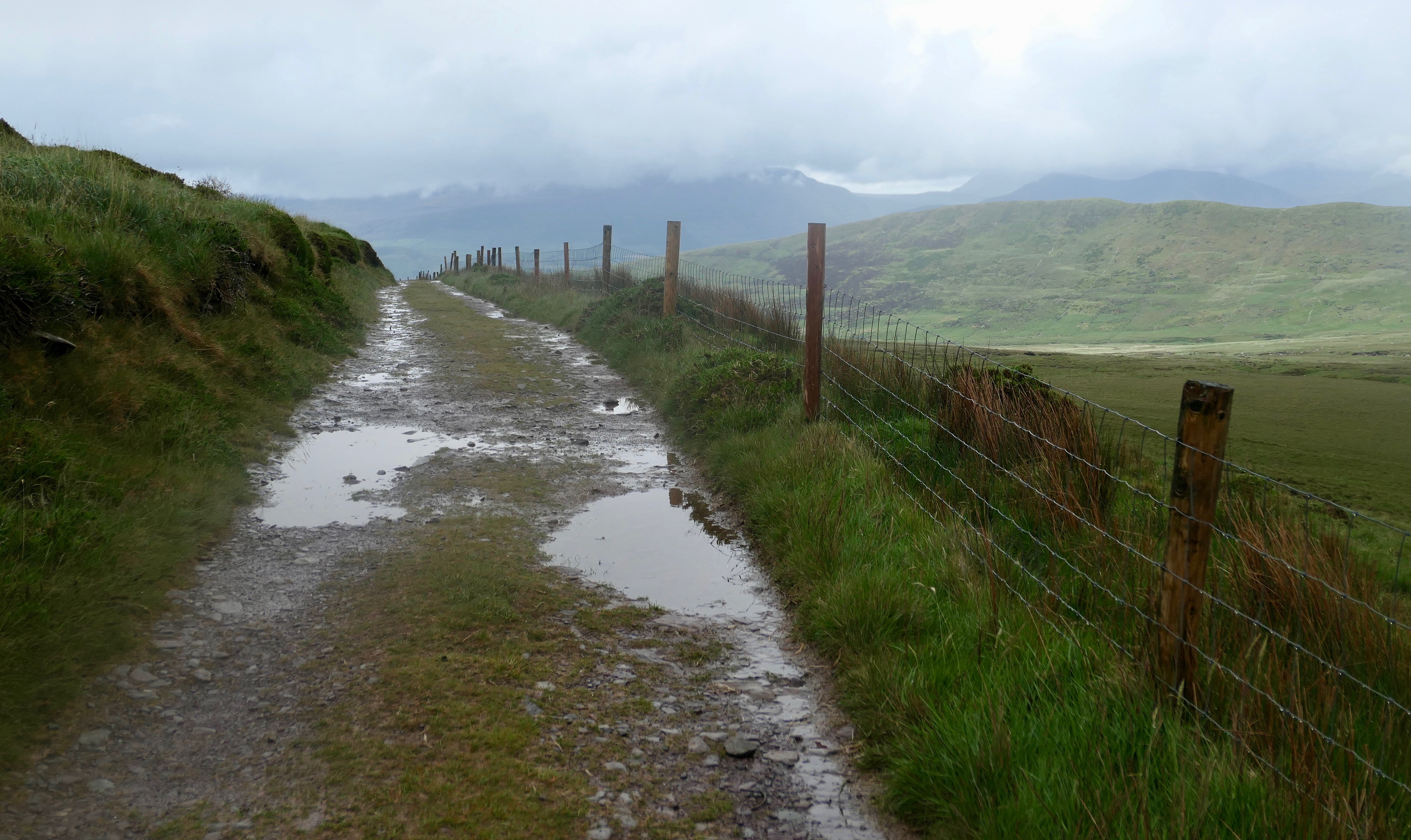
The markers stood every hundred yards or so, but were sometimes too far ahead to be seen.
I had been climbing for about two hours. The footing was difficult. Rivulets of rainwater ran down the mountainside through channels that had to be circumvented. A vertical swamp. Each step, I slipped on a rock or plunged into an ankle-deep puddle. My shoes were soaked.
Looking up, I could not measure my progress toward the shoulder of the mountain. Dark rain clouds obscured Brandon’s summit. Once inside the cloud bank, I could see only the dim shapes of boulders and scrubby trees. The markers faded from view.
I wasn’t exactly lost, but I was stranded. Somewhere ahead was a trail that would lead me down the other side of the mountain, but in the fog I couldn’t find it.

A long way
The Dingle Way is a 111-mile trail around the circumference of Ireland’s Dingle Peninsula.
The eight-day route passes through farms, beaches, and cliff tops. I averaged fifteen miles a day, enjoying spectacular scenery and the amenities of various B&Bs.
As on previous hikes in the British Isles, I used a walking-tour company to arrange my lodging and transfer my spare bag each day. The company also provided directions and an emergency phone number.
The route started in Tralee, the seat of County Kerry. The town saw a lot of violence during the Irish War of Independence from 1919 to 1921. A statue of a rebel brandishing a pike, a spear-like weapon, stands menacingly on the main street.
Ashe Memorial Hall, built in 1928, is dedicated to the memory of Thomas Ashe, a founding member of the Irish Volunteers and battalion commander during the Easter Rising of 1916. He died during a hunger strike, while demanding to be classified as a prisoner of war. Now, the hall is home to the County Kerry Museum.
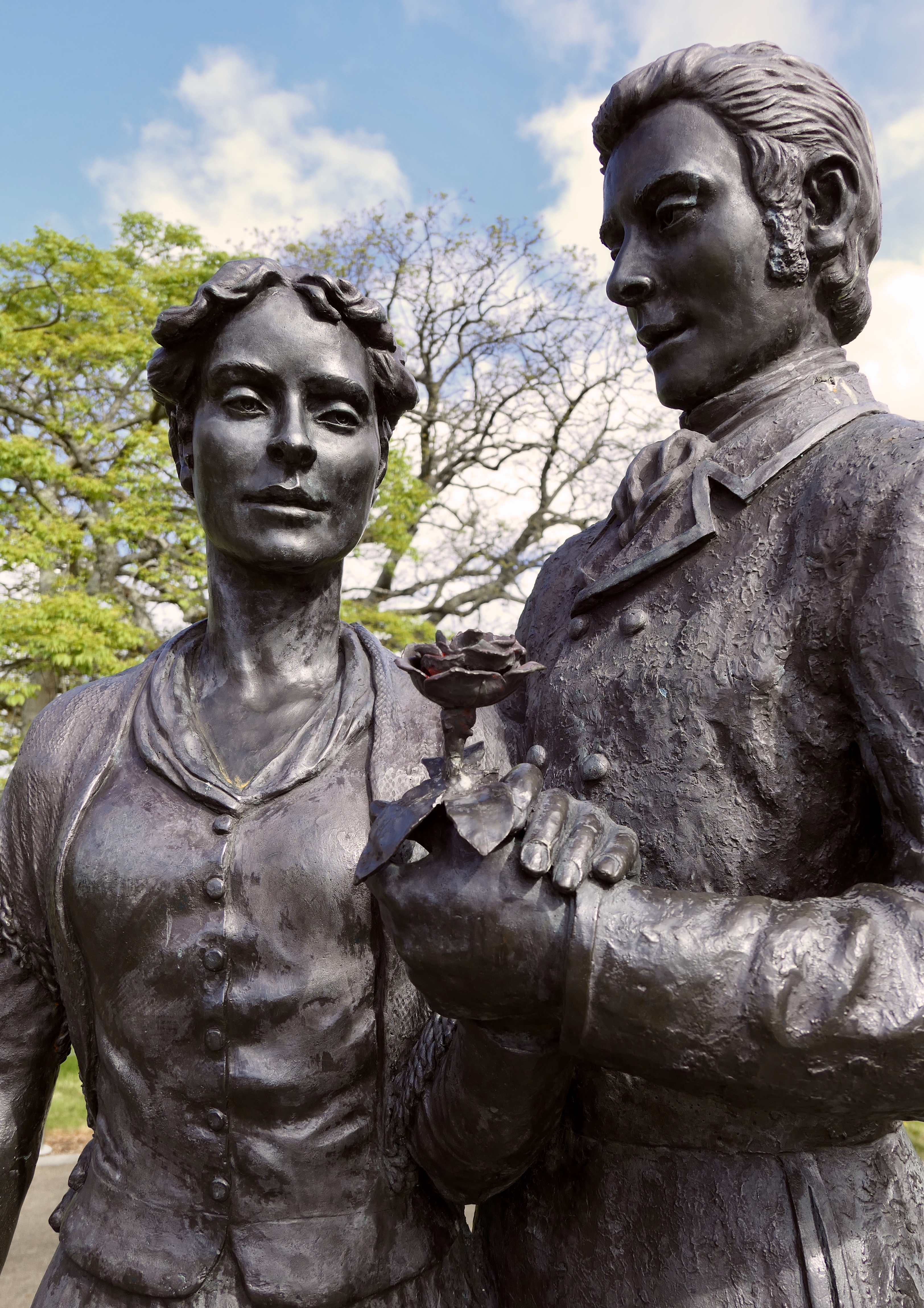
A popular ballad from the 1800s is the inspiration for the Rose of Tralee competition among Irish communities around the world. Statues depicting the original Rose, Mary O’Connor, and the supposed composer of the ballad flirt in Tralee’s rose garden.
The evening before the start, I organized my gear, collected some euros from an ATM, and bought a SIM card for my mobile phone.
At a pub I talked with some locals about the unpredictability of the weather during my hike. “No one comes to Ireland for the sunshine,” one said.
“Where are you from?’ another asked.
“Columbus, Ohio,” I said. “How about you?”
“Tipperary,” he said. “Do you know where that is?”
“I know it’s a long way,” I said.
Into the Gaeltacht
The Dingle Peninsula is roughly forty miles long and ten miles wide. It has supported various populations for over six thousand years.
The western half of Dingle is one of the regions in Ireland where the primary language is Irish, not English. Such regions are called the Gaeltacht (GWELL tukt).
Only five percent of the residents of Ireland speak Irish as a first language. However, many know it as a second language.
Within the Gaeltacht, Irish is spoken at home and taught in schools. Place names and road signs are in Irish only. The news is broadcast in Irish.
There are six Celtic nations, each with its own language. Sadly, the languages of Manx from the Isle of Man and Cornish from Cornwall, England, have died out. Gaelic Scottish and Breton from Brittany, France, are both on life support.
However, two Celtic languages are staging a comeback—Welsh and Gaelic Irish.
I am fortunate to have heard Gaelic Scottish, Welsh, and now Gaelic Irish spoken by locals in everyday conversation.
Pilgrim path
In the morning I left town on the canal path to Tralee Bay.
The former towpath from the 1800s is now a walking and cycling trail.
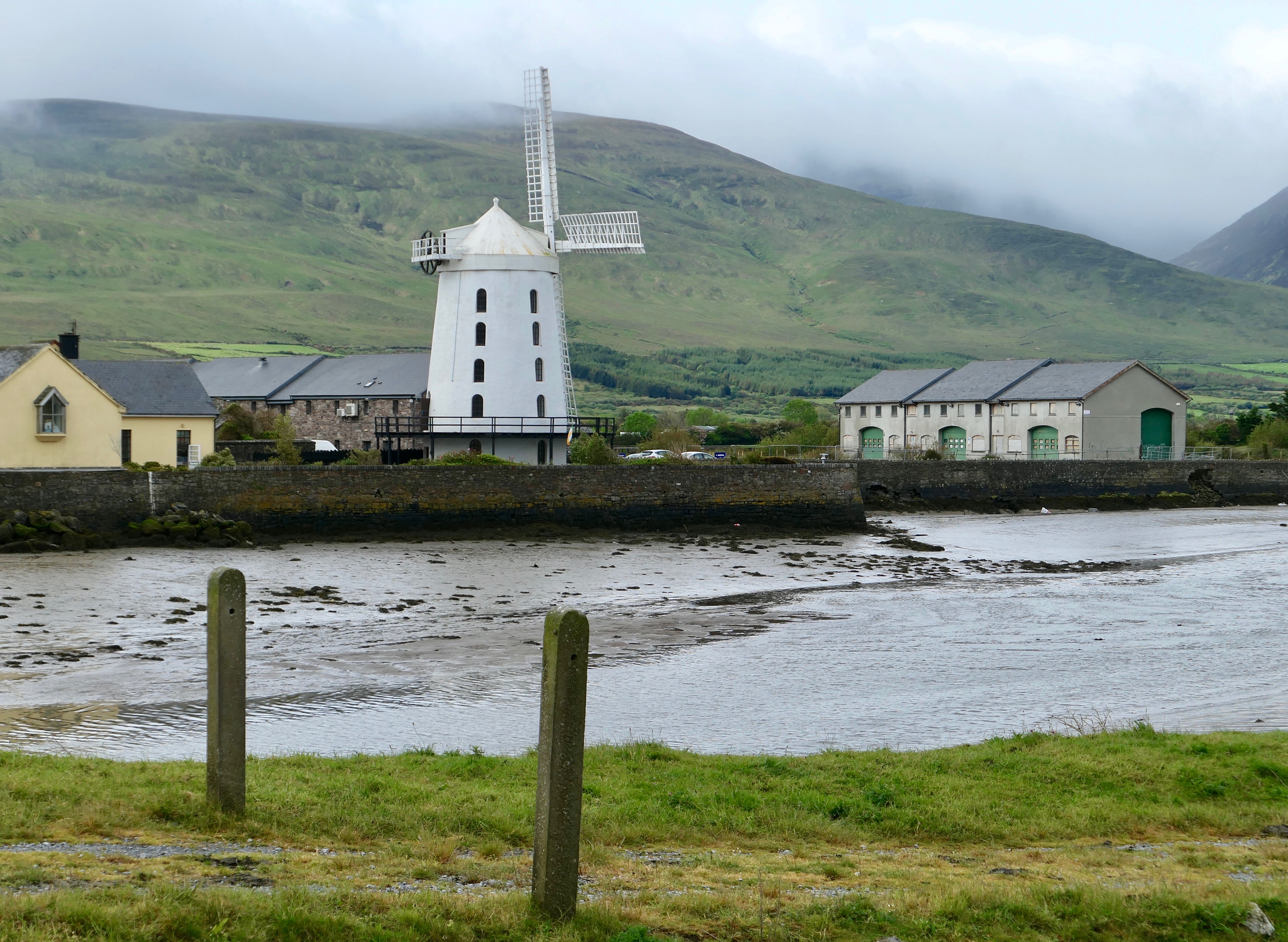
Ahead I could see the graceful Blennerville Windmill, built on the bay in 1800 to grind grain. The mill has been restored and is grinding once again.
Past Blennerville, the trail was rocky and muddy with strong headwinds and short periods of rain. I traversed the slanting sides of the Slieve Mish Mountains, where horses and sheep grazed. On my right was a sweeping view of Tralee Bay.

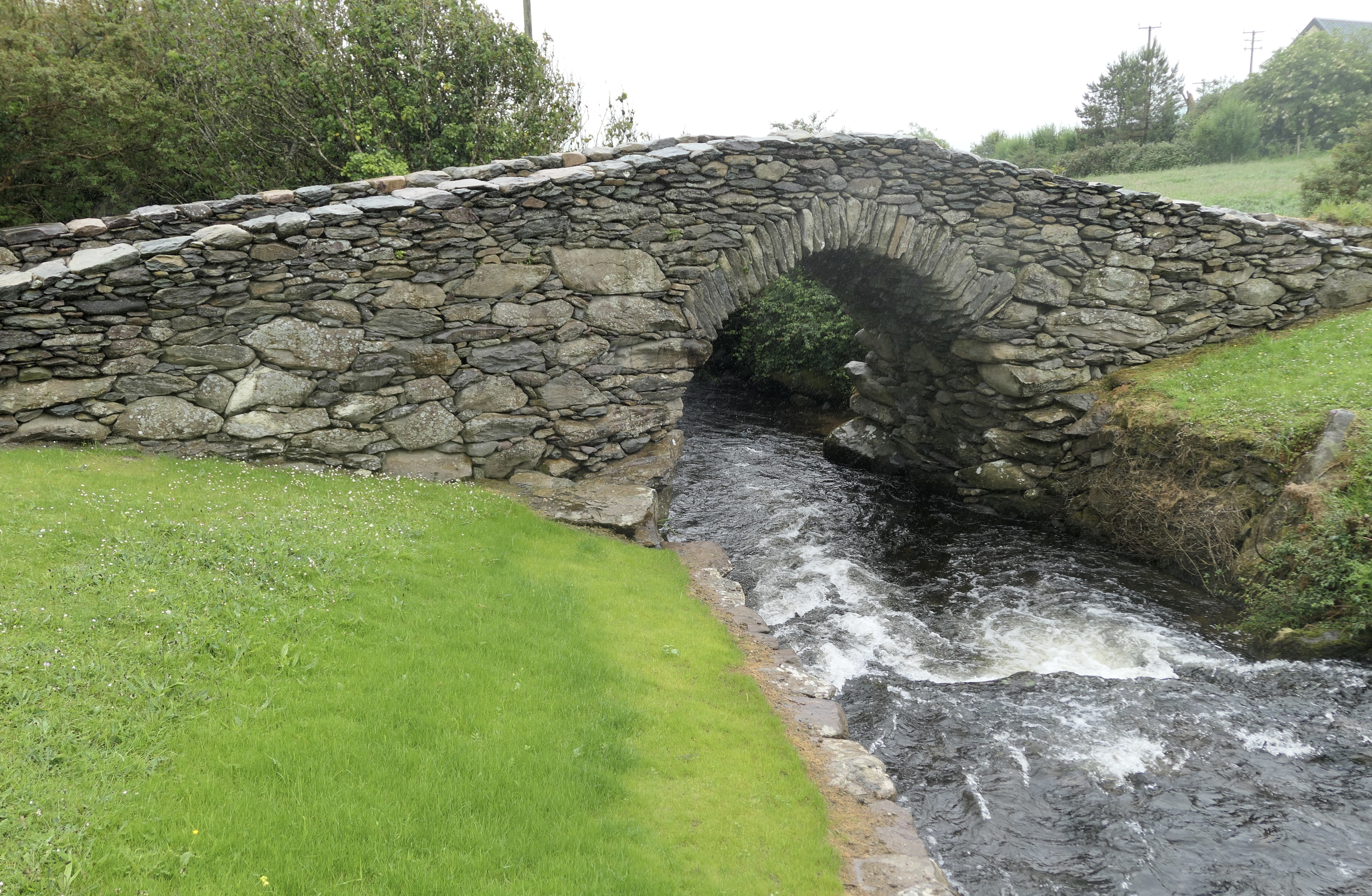
I crossed several streams on plank bridges. Near one stood a metal cross marking the Kerry Camino.
At first I suspected the “camino” was a tourism strategy. I learned, however, that the trail between Tralee and Dingle was once a pilgrimage route to the cathedral in Santiago de Compostela, Spain.
There were many traditional routes leading to Santiago. The Irish version involved walking to the closest port, booking passage on a merchant ship, sailing to northern Spain, and continuing the journey.
In the 1300s and 1400s, ships sailed to Spain from several Irish ports, including Dingle.
Today, the Kerry Camino overlaps the Dingle Way between Saint John’s Church in Tralee and Saint James Church in Dingle.

Near the village of Camp, I visited the stone remains of a medieval village, including Killelton Church, built in the 800s.
Soon, I crossed the Finglas River on large stepping stones using a rope handrail. After sixteen miles, I arrived at Seaview B&B. Joanna handed me a glass of water and asked me to leave my muddy shoes at the door.
South Pole
The next morning I set out to cross the peninsula from the north side to the south.
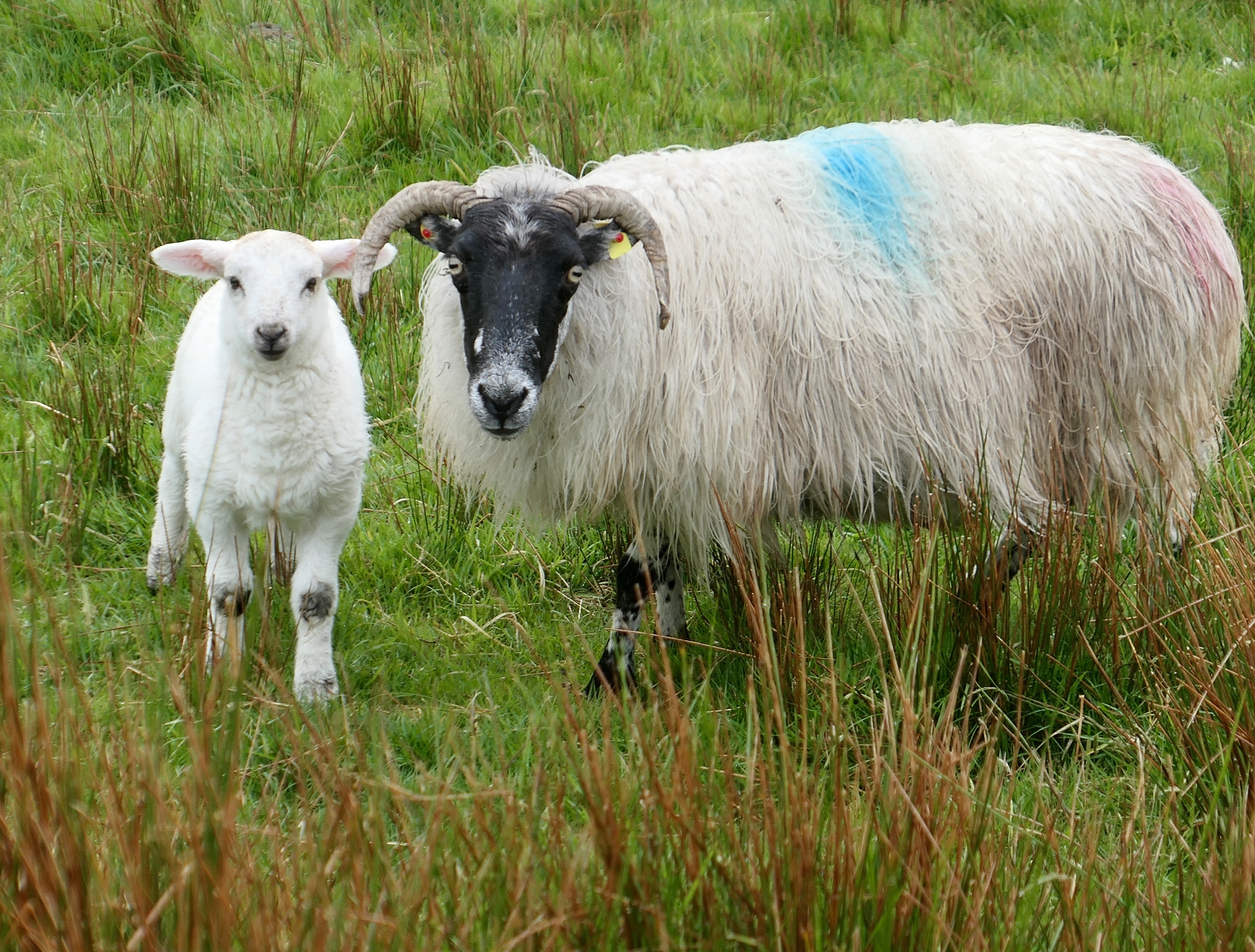
Much of the route was through farmland. The pastures were full of spring lambs, prodding their moms’ udders.
In the foggy Emlagh River Valley, the last of the Slieve Mish Mountains were on my left. Trenches had been dug in the boggy areas to extract peat for winter fires. The wind was in my face all day.
Then, on the far side of a low mountain pass, I glimpsed the sea. It was Dingle Bay, the south side of the peninsula.

Another climb to a long view over the beach called Inch Strand.
I left the trail and hiked down to the beach for lunch at the touristy Sammy’s Restaurant. Billboards promoted surfing.
Along the way I met Erik and Brigitte, a couple from Amsterdam. Together, we climbed to Maum and walked the long straight downhill road into Annascaul. To our right, a standing stone, Ballintermon, watched over the scene.
Annascaul has a population of around three hundred. The village is the birthplace of explorer Tom Crean.
Crean was a member of three major expeditions to Antarctica, during the so-called Heroic Age. He participated in Robert Scott’s 1901–04 Discovery Expedition and 1911–13 Terra Nova Expedition.

During this second expedition, Scott lost the race to the South Pole to Norwegian Roald Amundsen.
Crean demonstrated his stamina by walking thirty-five miles in eighteen hours without survival gear in order to fetch help for an injured crew member.
His third polar adventure was on Ernest Shackleton’s 1914–1917 Imperial Trans-Antarctic Expedition. After the ship Endurance was crushed in pack ice, the crew spent over a year drifting on ice floes before arranging their own rescue.
Again, Crean proved heroic. He and a few others made a seventeen-day, eight-hundred-mile journey in a small boat through gale-force winds and towering waves to seek help. The voyage is considered one of the greatest feats of seamanship in history.
When Crean retired and returned to Annascaul, he stowed his medals and opened a pub, the South Pole Inn. The walls are covered with photos and memorabilia from the expeditions.
Across the street from the pub is a statue of Crean cradling two sled pups. Crean never made it to the true South Pole, although both a glacier and a mountain in Antarctica are named for him.
Miley and Minard
As I walked west from Annascaul, the peninsula became more Irish. The Kerry Gaeltacht (the Irish-speaking region of the Dingle Peninsula) has around six thousand Irish speakers.
Soon, the directional signs were in Irish only.
In 2005, English place names disappeared from the Gaeltecht. Annascaul’s name became Abhainn an Scáil.
The town of Dingle’s name was changed to Daingean Uí Chúis. This rankled some locals in the tourism industry who were concerned the change would confuse visitors. In 2011, an exception to the law was made—Dingle would go by both names.
Three miles southwest of Annascaul is the largest fortification on the peninsula. Built by the Knights of Kerry in 1551, Minard Castle was destroyed by Cromwell’s troops in 1650.
The shell of the castle looked ominous under dark clouds. Its beach is piled with sandstone boulders.
The rain came. I was soaked before I was able to put on my gear.
Erik, Brigitte, and I stopped at Keane’s, a convenience store in Lispole, for sandwiches and coffee, then continued walking in the rain.
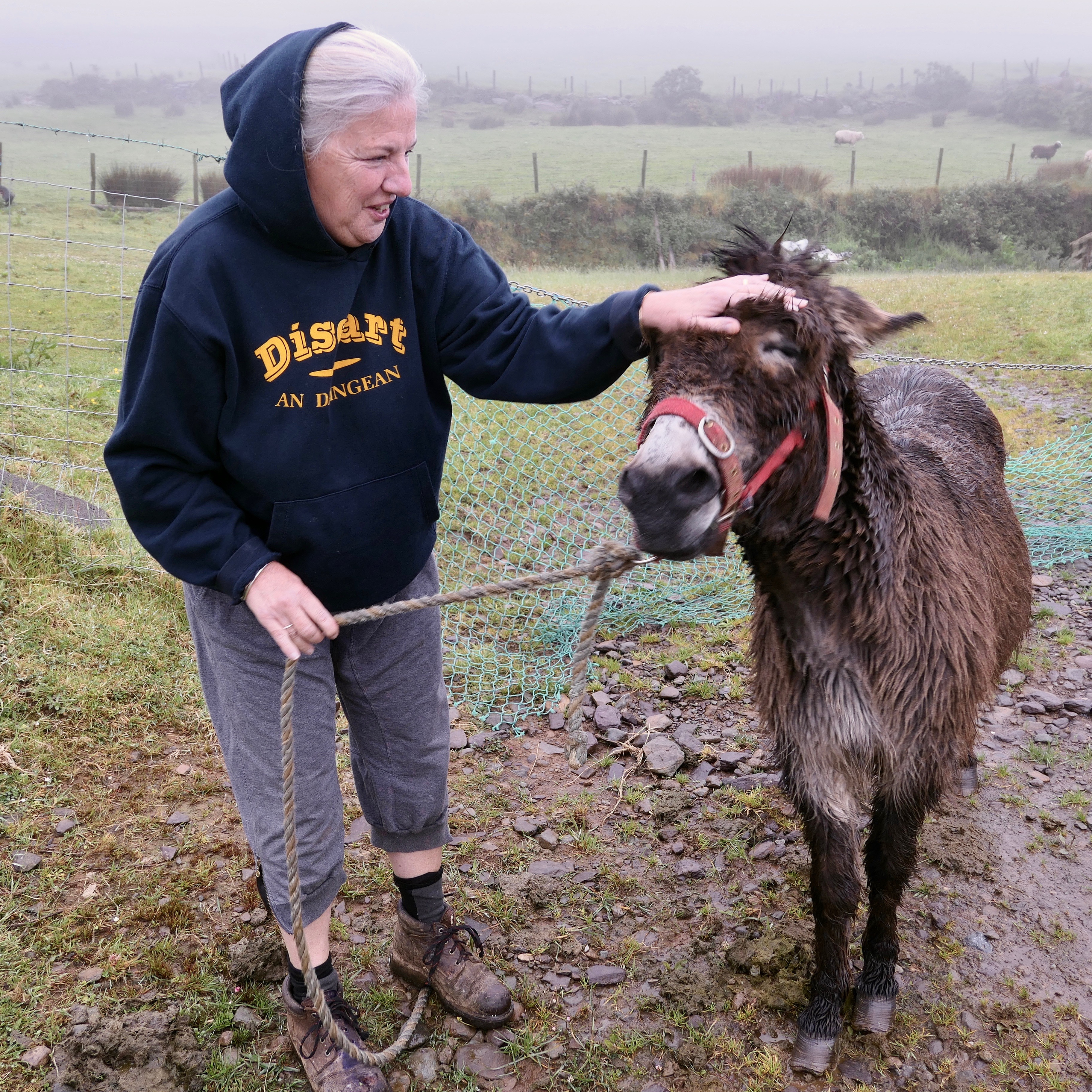
On several farm roads the mud was ankle-deep. The views to the ocean and the mountains would have been spectacular if not for the mist. We visited with a farmer and her pet donkey, Miley, somewhere in the clouds near Lisdargan.
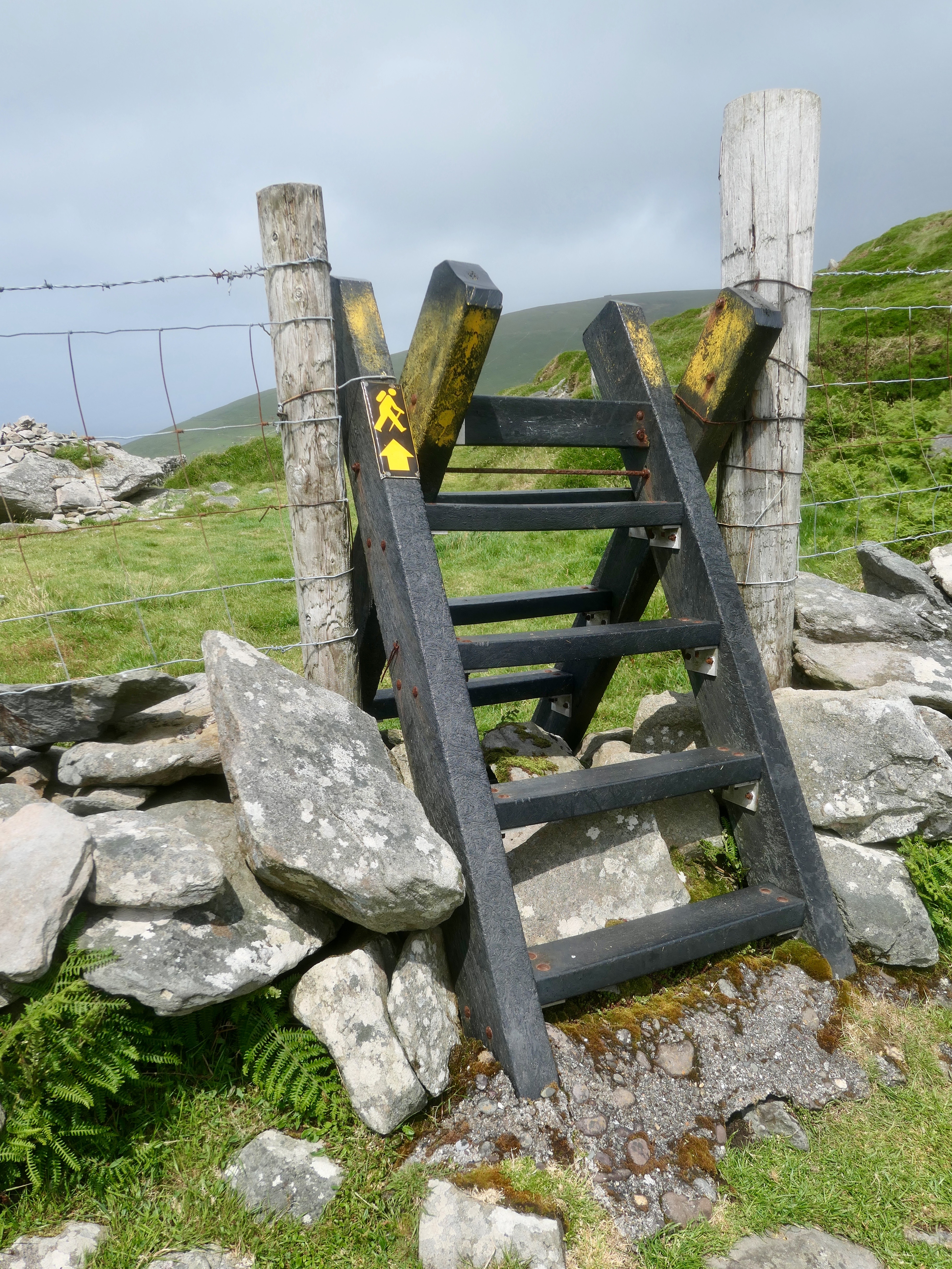
Over the next couple of miles, we climbed numerous stiles. Somewhere in the hedgerows, we missed a turn and had to walk into Dingle on a main road. The mistake probably added a mile.
Three miles outside of town the sun came out, brightening the landscape and our spirits. Eoin checked me into Murphy’s B&B and showed me where to scrub the mud from my shoes. I placed them in the furnace room to dry.
The Dutch and I celebrated our nineteen-mile day over pints at Paudie’s Bar. When we said goodbye, Brigitte kissed me European-style, three kisses on alternating cheeks.
“I’ve never been kissed like that before,” I exclaimed. “You are my first!”
She found this funny.

Pub session
With a population of two thousand, Dingle is the only town on the peninsula. (The rest are villages.)
In the 1500s, it was one of Ireland’s biggest ports, trading fish and cowhides for European wine. French and Spanish fishing fleets used the town as a base. Dingle’s major industry in the 1700s was linen weaving; in the 1800s, fishing.
Today, the harbor is full of sailboats and the streets full of tourists. Dingle’s draw is its live-music scene. Every night, its numerous pubs offer rollicking traditional music for free.
Foxy John’s is a hardware store. It is also a pub. You can buy both a socket wrench and a pint there. When I visited, Foxy John’s was crowded with fans excited about the upcoming Liverpool vs. Tottenham Champions League final match. One showed me his betting slip.

Across the street is Curran’s, a men’s clothing store. It is also a pub. You can buy both a dress shirt and a pint there. Robert Mitchum frequented Curran’s during the filming of Ryan’s Daughter.
A scene from a real-life movie unfolded before me. A groom and his groomsmen, dashing in black suits, swaggered across the cobbles from Saint Mary’s Church to Dick Mack’s Pub for a last-minute shot of courage. Due to its proximity to the church, Dick Mack’s is called by some “the last pew.”
Later in the evening, I listened to traditional music at Siopa Ceoil (Music Shop). A duo played button accordion and guitar.
“Irish is my first language,” the singer said. “In school, I studied in Irish. I learned math in Irish. I even learned French in Irish.”
Subs and huts
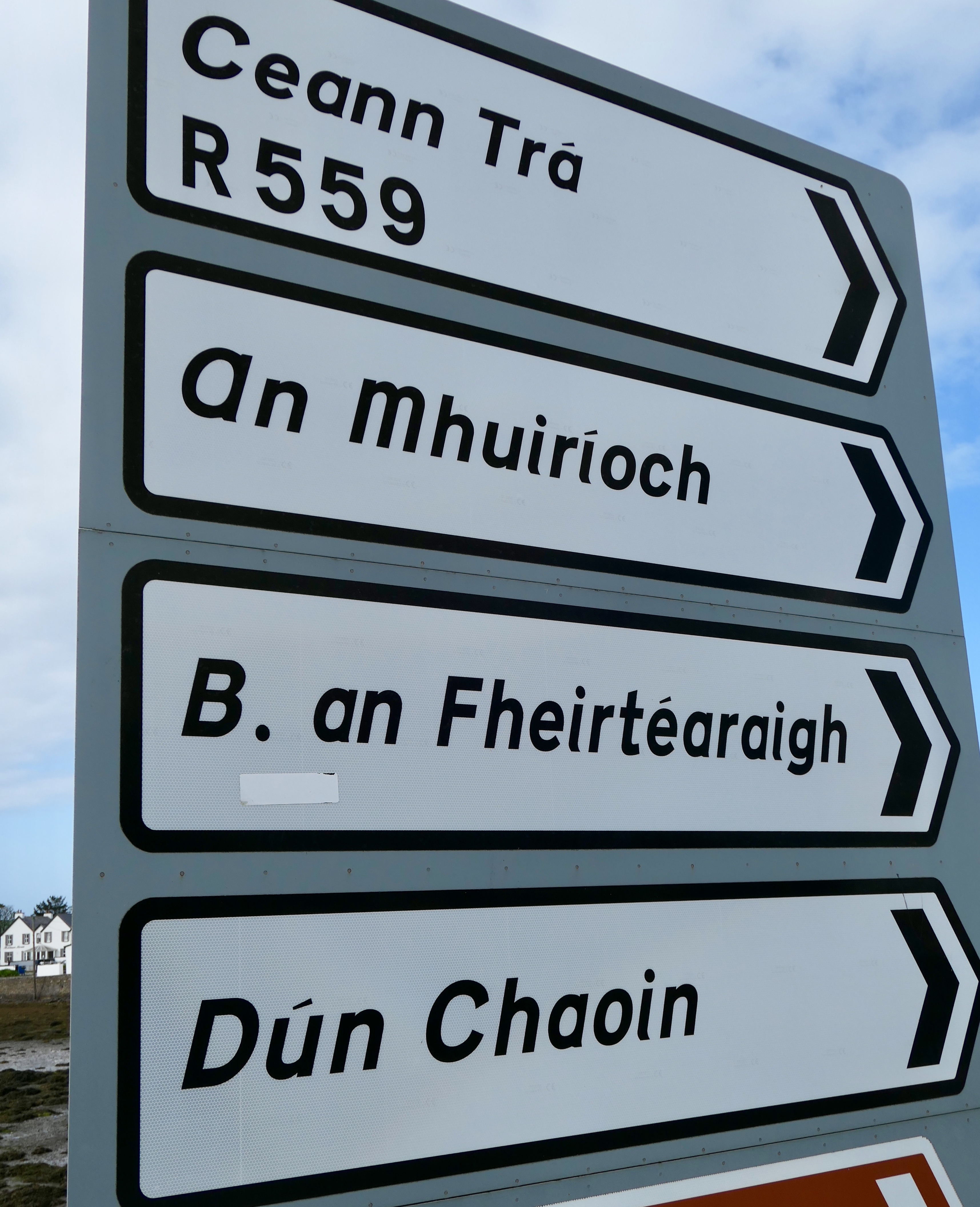
After breakfast, Eoin told me he would be transporting my bag to Dún Chaoin (Dunquin). “I’ll beat you there,” he said.
The skies were sunny until I got to Ceann Trá (Ventry). Purple bell-shaped foxglove bloomed along the trail. I drank a coffee and then headed to the beach for the stroll to Raheen. High winds kicked up the sand.
In 1939, a German submarine torpedoed a Greek ore boat, Diamantis. Greece was neutral during the war, but the cargo was strategic and headed to Britain. The twenty-eight Greek sailors abandoned Diamantis and the German sub commander chose to rescue them.
The sub deposited the Greeks safely on the beach in Ventry. This unusual humanitarian gesture was commemorated with a plaque in 2009.

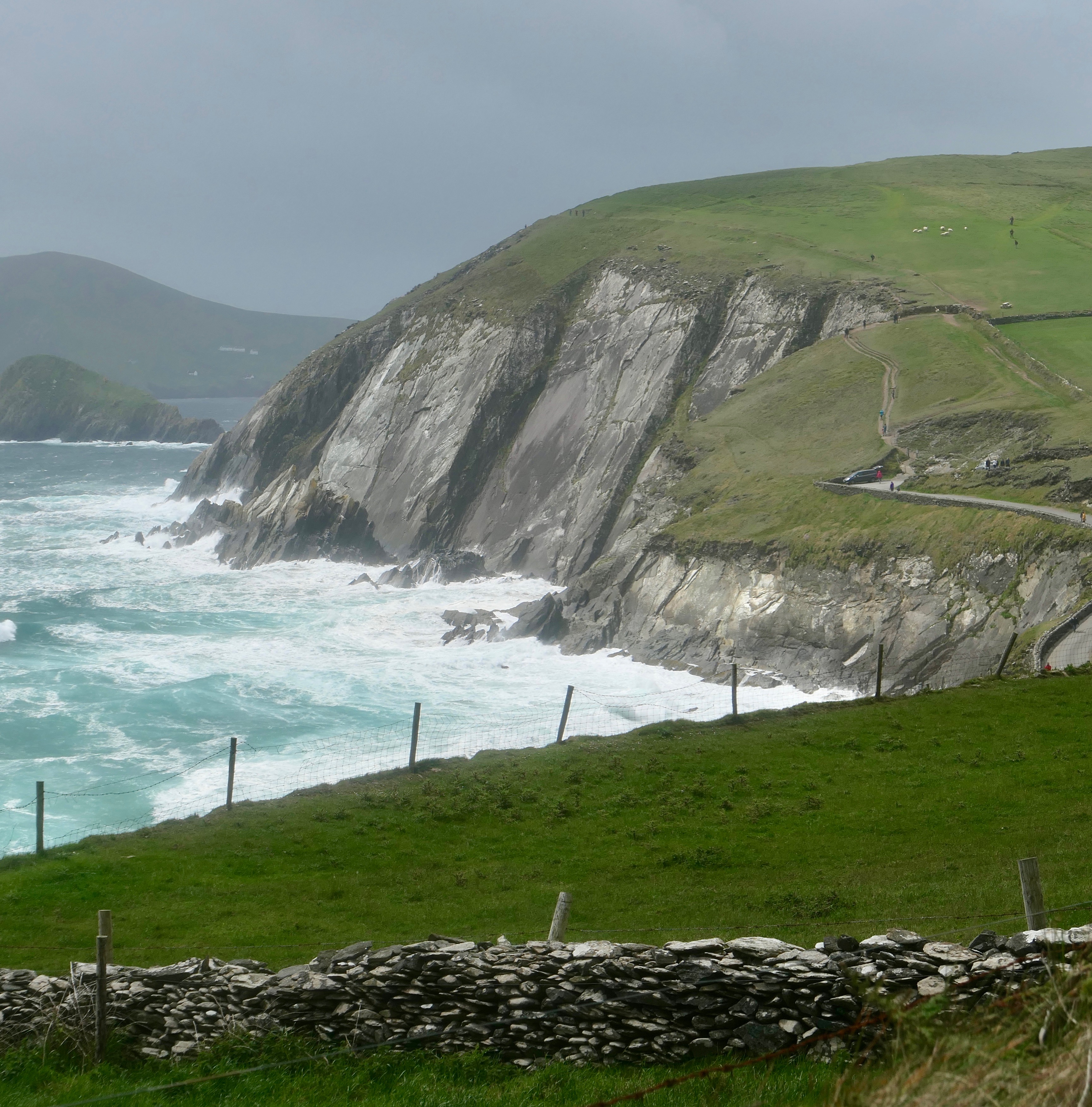
The wind brought rain. After climbing from the beach up to the shoulder of Mount Eagle, I entered an archaeological wonderland. The landscape was littered with hundreds of stone ruins—over five hundred according to the guidebooks.
I walked through a patchwork of sheep pastures, which slanted steeply down to the sea. The mountainside was interlaced with drystone walls and gorse hedgerows.
I passed a couple of Belted Galloway cows, black fronts and backs with broad white stripes around their middles. They are called “Oreo cows.”
Ahead of me, the Blasket Islands appeared through the mist. The islands have been uninhabited since the 1950s.

Thirty mile-per-hour winds continued the rest of the day. Sometimes the gusts brought me to a standstill.
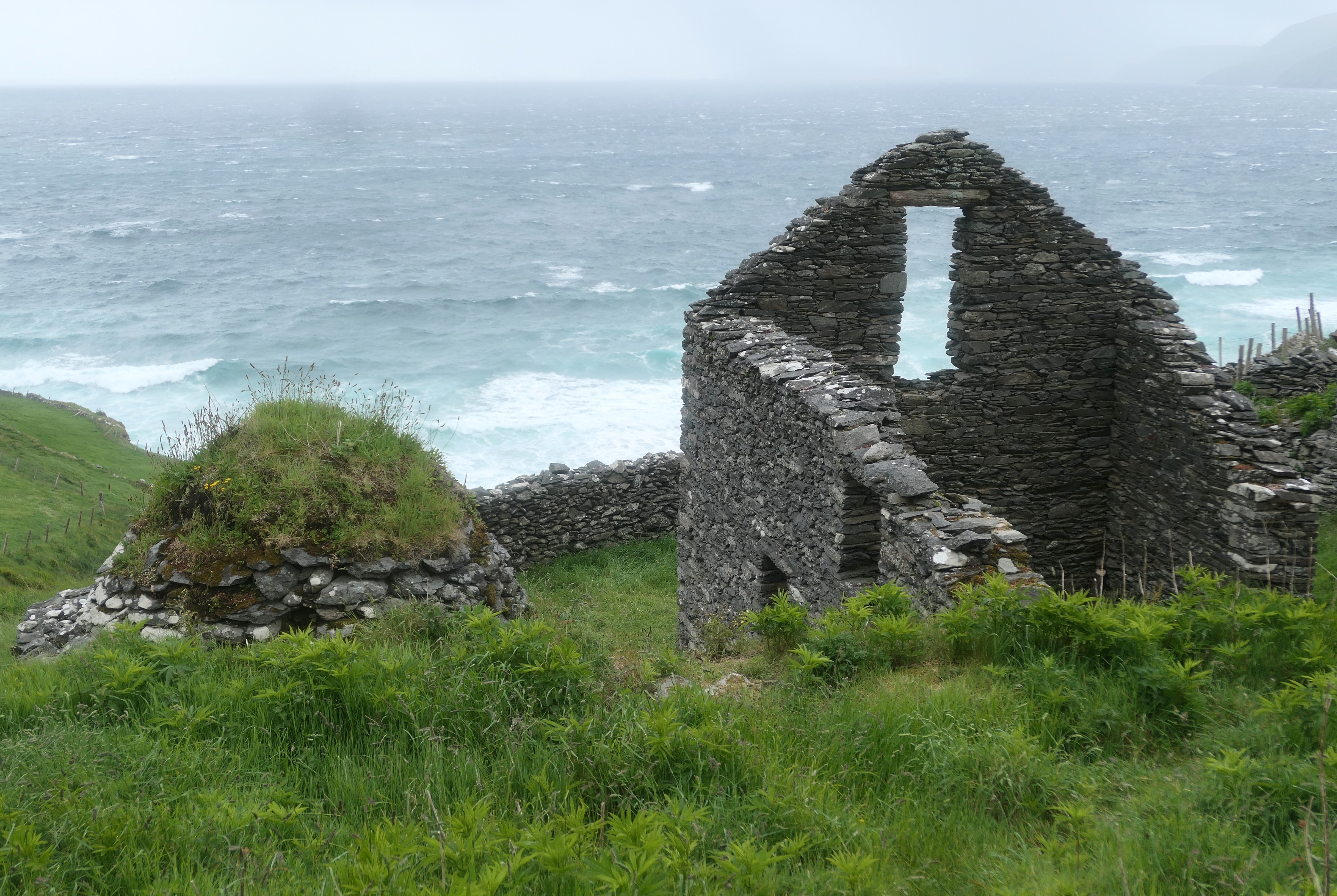
The rain fogged my camera lens and pelted my face. Despite the weather, I spotted several clocháns.
A clochán or “beehive hut” is a circular drystone building with a domed roof. They look like stone igloos.
The surviving ones date from the 700s to the 1100s and may have been used by monks following Saint Patrick. Most of them are missing their domes.
Nearby stood the ruins of An Dún Beag (Dunbeg), an Iron Age fort on the edge of a cliff.
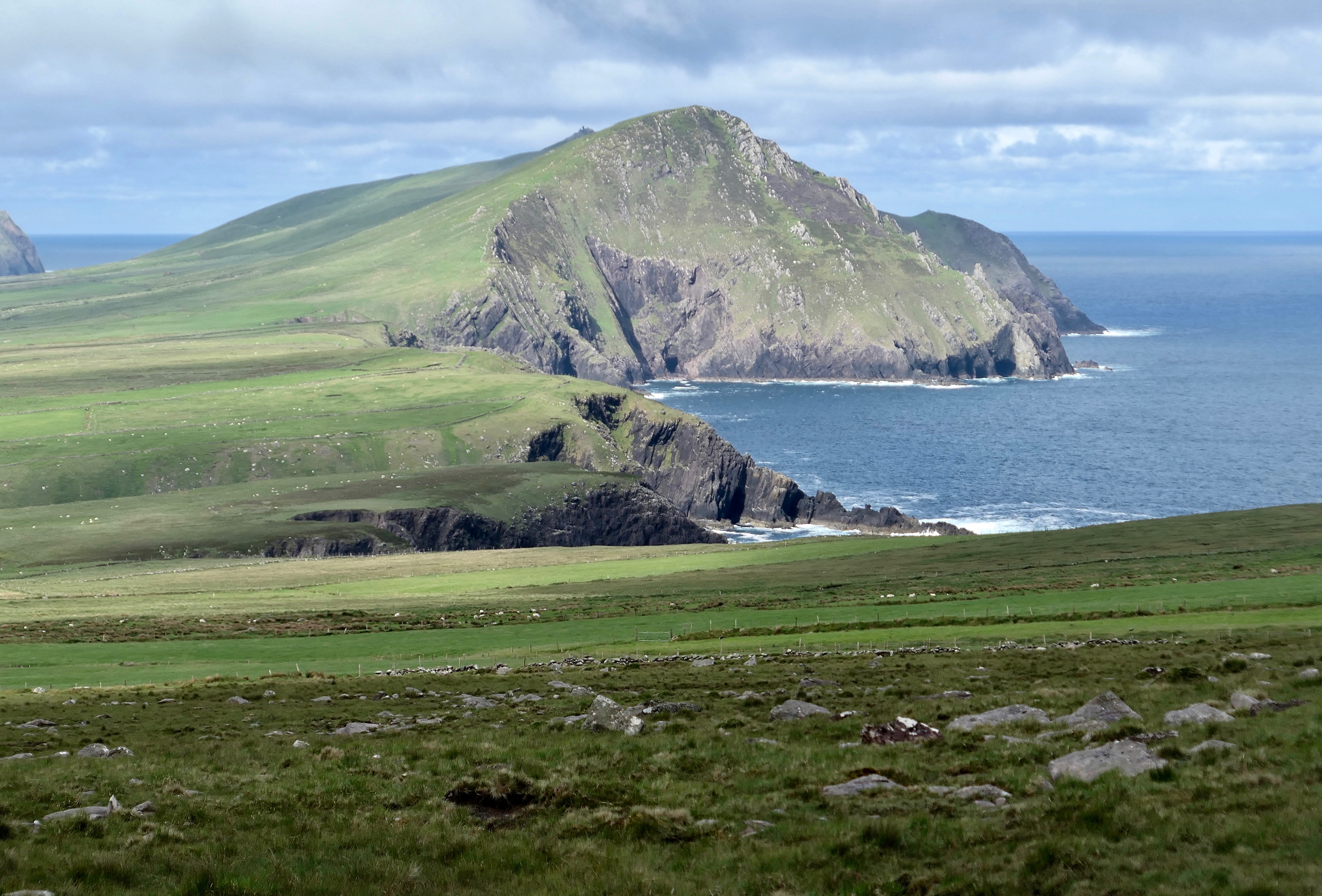
I circled Mount Eagle to Slea Head, Coumeenole Bay and Dunmore Head, the most western point of mainland Ireland.
Once in Dunquin, the sun, of course, finally emerged. Dunquin’s population is around two hundred. Scenes from 1970’s Ryan’s Daughter were shot in the area, which helped revive its economy.
Jedi hideout
I left Dunquin after blueberry pancakes. At last, a sunny day! Today’s route rounds the end of the peninsula and heads me back in an easterly direction toward where I started.
The views were spectacular all day—Dunmore Head, the Blasket Islands, Clogher’s Beach, Clogher Head, Sybil Head, and the Three Sisters.
The mountains put on a good face, sloping gently upward, broad, green, and inviting. They hid their rocky backsides, which drop straight to the sea.
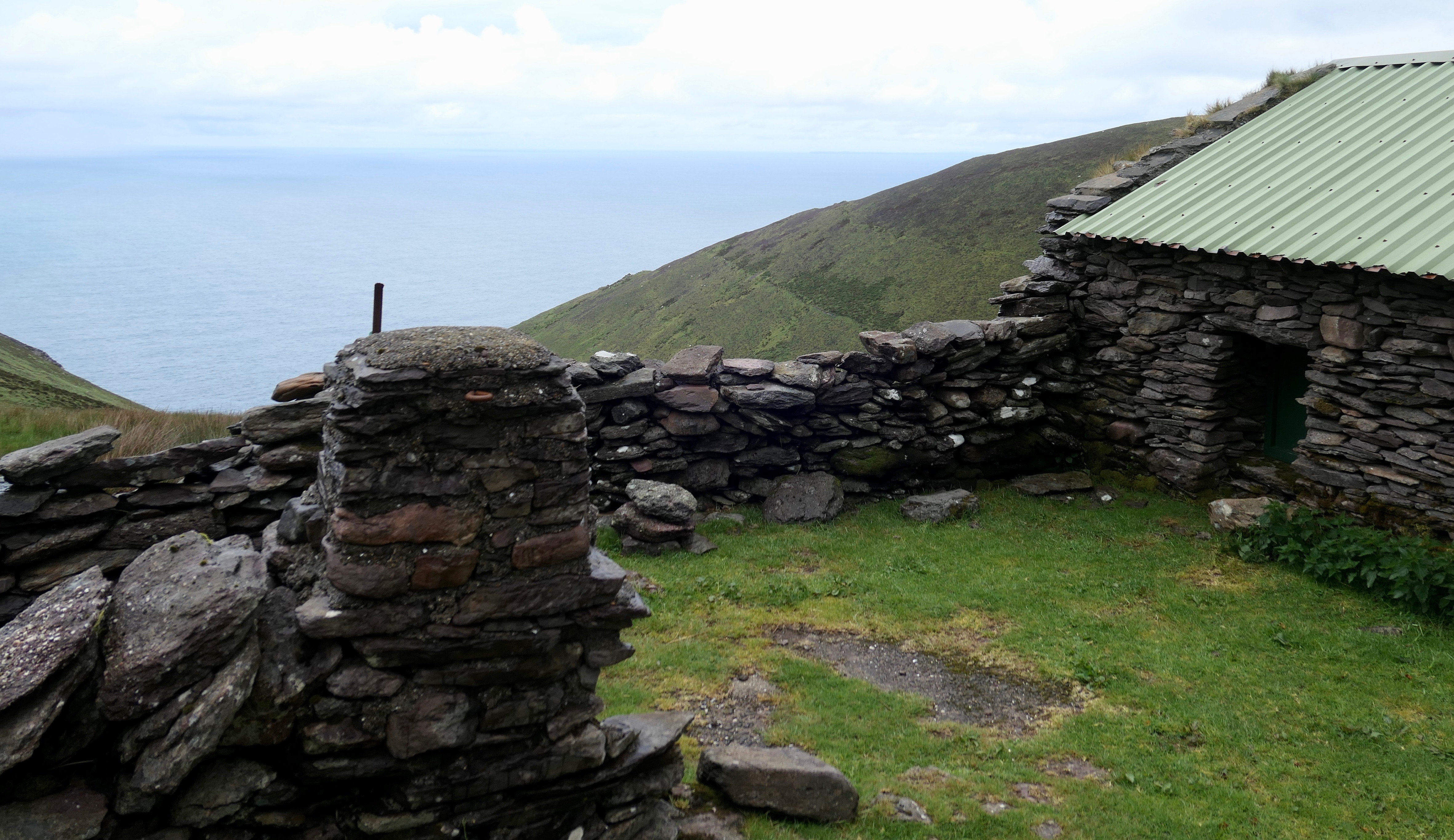
On Skellig Michael, a craggy island a few miles to the southwest, are six more beehive huts. They were built by an order of monks, perhaps in the 500s. Due to the remoteness of the island, they are in especially good condition. All but one retain their domes. The uninhabited island is a UNESCO World Heritage Site.

Scenes in the 2015 and 2017 films, Star Wars: The Force Awakens and Star Wars: The Last Jedi, were filmed on Skellig Michael. However, due to restrictions intended to protect the ruins, a set of replica huts were built on the mountainside of Ceann Sibéal (Sybil Head).
Kicking and screaming
Further on, I visited Dún an Óir, an Iron Age fort on a promontory jutting into Smerwick Harbour. Only earthworks remain.
The siege of Ard na Caithne (Smerwick) took place in 1580. A force of six hundred Spanish and Italian mercenaries, sent by Pope Gregory XIII, held the fort in support of Irish rebels. They were attacked by an army of four thousand, sent by Elizabeth I of England.
There is disagreement as to whether or not the fort’s defenders were promised their lives if they surrendered. There is no disagreement about what happened to them when they did.
All six hundred, including women and children, were beheaded. Their bodies were thrown into the ocean; their heads buried in a field. One of those carrying out the brutal executions was Walter Raleigh, who was later knighted (and also beheaded).
I walked the Wine Strand into An Mhuiríoch (Murreagh). Surfers played in the waves. Toward the end of the beach, a local named Tony joined me.
He told me Murreagh was hosting a championship Gaelic football match that evening. We passed the stadium along the beach. A TV crew was setting up.
Upon arrival at the B&B, Ard na Carraige, Mary interrupted her phone conversation to say, “My walker’s here.” She brought me a pot of hot tea and cookies.

I walked a mile to dinner in Baile na nGall (Ballydavid). On the way, I could hear the roar of the football fans every time the home team scored. The TV in the pub was tuned to the match as well.
I ordered fish and chips and tried to understand how Gaelic football is played.
It appears to be half soccer and half rugby. Points are scored by kicking over the goalpost from anywhere on the field. Advancing the ball by dribbling is allowed.
The final play was exciting. The home team, An Gaeltacht, beat Cill Chartha in overtime on a one-point goal kicked on the run from the middle of the field.
I walked back to the B&B immersed in the Irish experience—green mountains, stone walls, horses, sheep, Brandon Bay, and, in the distance, trad music at the victory celebration.
Navigating Brandon
In the morning, Mary would not allow me to leave without a packed lunch and a bottle of water. She knew what lay ahead.
Today was the steepest climb of the walk—the hike over Mount Brandon, named for Saint Brendan.
Brendan the Navigator was born in Tralee in 484. He evangelized widely, visiting Scotland, Wales, and France. He founded several monasteries, including one at the foot of his namesake mountain.
Sometime in the 500s, he and other monks set sail in the Atlantic Ocean in search of the Garden of Eden. His seafaring adventures are legendary. If they are true, Brendan may have been the first European to reach North America.

My climb over Mount Brandon was beginning to feel like an odyssey as well. From the south side, I hiked marker to marker through a downpour, until I found myself in a near whiteout.
I stopped to think about my options. Moving forward meant possibly going off-course or falling over a cliff in the fog. I was near the halfway point, so returning offered no benefit.
Then, I heard disembodied voices behind me and waited for the accompanying bodies to arrive. A couple from Switzerland, Etienne and Ursula, appeared as silhouettes.
They were also having difficulty finding the waymarks. We agreed to work together, so as not to get lost on the mountainside. I was glad for their company.
We continued step by step through pools of water. Each discovery of a marker delivered some small relief, as it meant we were headed in the right direction.
Finally, we crested. A standing stone marked the saddle. Going down the north side was worse. Steep, muddy, rocky. As the guidebook says, “during wet weather this section is treacherous.”
For an hour, we picked our way through ruts and hillocks. There was no solid footing.
Below the cloud bank, we found a hut. The timing was good, as it began to rain hard. Quickly, we took refuge under the tin roof and ate our packed lunches.
During World War II, four planes crashed into Brandon in the fog. Remains of the wrecks can still be found on the mountain.
One of the planes was German and three were British. In all, twenty-four people died and twenty-four survived. Six of the survivors were German and were, by all accounts, happy to be POWs in a neutral country for the remainder of the war. So happy that a couple of them married Irish women.
The rain slowed. Below the hut, the markers led us to a gravel road, steep and rocky, but more solid than the bog. We descended to the bottom of Brandon and into An Clochán (Cloghane). The village has a population of 250.

I was relieved to find the Benach B&B, where my bag of dry clothes was waiting. David stuffed my wet shoes with newspapers and gave me a lift to O’Conners, the only pub in the area.
Inside, a group of young Gaelic footballers massed around one end of the bar, singing loudly and enjoying their camaraderie.
I assumed they were celebrating, but I learned they were mourning their season-ending loss. Hard to tell the difference.
The end
After breakfast at the B&B, Etienne, Ursula, and I said goodbye. On the way out of Cloghane, I bought scones at the bakery.

After a few miles on the main road, I turned onto Brandon Bay Beach, the longest beach in Ireland. For seven miles, it stretches in an arc toward the village of An Fhaiche Mhór (Fahamore) on the Maharees Peninsula.
For over two hours I strolled the strand. Waves rolled in the sun. Fahamore was always in view, but seemingly out of reach.
On the horizon are the uninhabited Magharee Islands, also known as the Seven Hogs. In the summers, farmers used to swim sheep and cattle to the islands during low tide for grazing. A few beehive huts are located on one of the islands.
I left the beach and walked through a gap in the sand dunes to Fahamore, a village of about fifty homes.

Nearby are the ruins of Kilshannig Church, containing a graveyard slab from the 600s.
Scraggane Bay was quiet. The lobstermen will check their pots at 4 a.m.
At the pier, I found a few naomhóg (NAY vogue) boats. Naomhógs are handmade wood-frame vessels, clad in tightly stretched, waterproofed leather.
Fahamore is the only place naomhógs are still built and one of only a few places where they are still employed.
During his seven-year voyage, Saint Brendan sailed a naomhóg.
I relaxed in the front yard of Harbour House B&B. Waves washed against the Magharees. Magpies scavenged on the rocky beach. Sheep grazed in a field near the ruins of a medieval church. The B&B’s dog slept in the sun.
“I’m sorry about the Wi-Fi,” Sandra said when I checked in. “We’re at the end of the world.”
It seemed that way.

Thanks so very much for sharing. This was a wonderful journey.