

At every summit, I hoped we were done with the uphill climbs, but, with each one, the top of another mountain loomed ahead in the mist.
The wind was now gusting to forty miles per hour and driving the rain sideways. I was soaked, even inside of the rain gear. The only way out of the storm was to keep climbing.
Picking my way carefully through mud and rocks, I lagged behind and lost sight of the others. Then, on a downhill section, I slipped sideways and fell.
As I tumbled, I grabbed at a wire fence to catch myself, spun around, and landed backwards against the pale.
Leaning against the wires, I paused to consider my situation. I was off-balance on a steep decline. I was ankle-deep in a mud puddle. Wind was howling at my back. And I was surprised to find myself ensnared by the fence.
As I struggled to get free, I realized the top wire to which I was clinging was barbed. The palm of my right hand was dripping blood from a couple of punctures. Another barb had impaled the shoulder of my rain jacket and held it tight. And one more had pierced both the pack cover and the pack.
I was caught like a fly in a spider’s web.
Ring around Kerry
After a few days of exploring Dublin, I joined Leslie for a hike on Ireland’s west coast. For a week, we walked the Kerry Way, a circular path around the Iveragh Peninsula.
The total trail, Killarney to Killarney, is 133 miles.
We hiked sections of it, averaging eleven miles a day on the trail and fifteen a day in total. The route passes through forests, farms, beaches, and mountains.
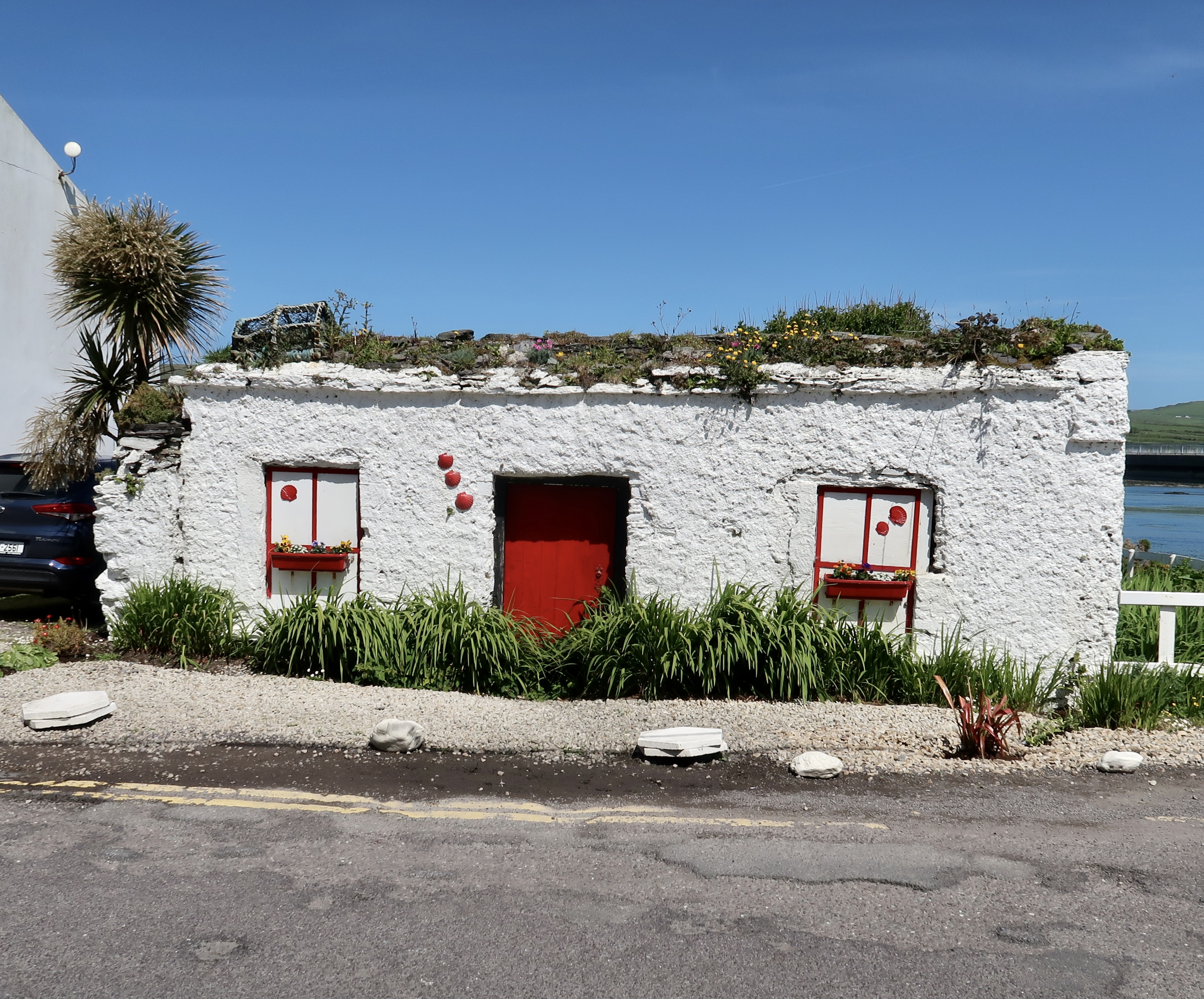
Each day’s hike ended at a B&B in a small town or village: Kenmare, Sneem, Caherdaniel, Waterville, Caherciveen, and Glenbeigh. The prefix caher- is an Anglicized version of the Irish word cathair, meaning stone ring fort.
I used a walking tour company to arrange the lodgings and transfer spare bags each day.
At the start, we met two Scots, Paul and Ruth, and, after a couple of chance encounters on the trail, fell in with them for most of the week.
By the end of the walk, I could almost understand Paul’s broad Scottish accent.
Into the muck
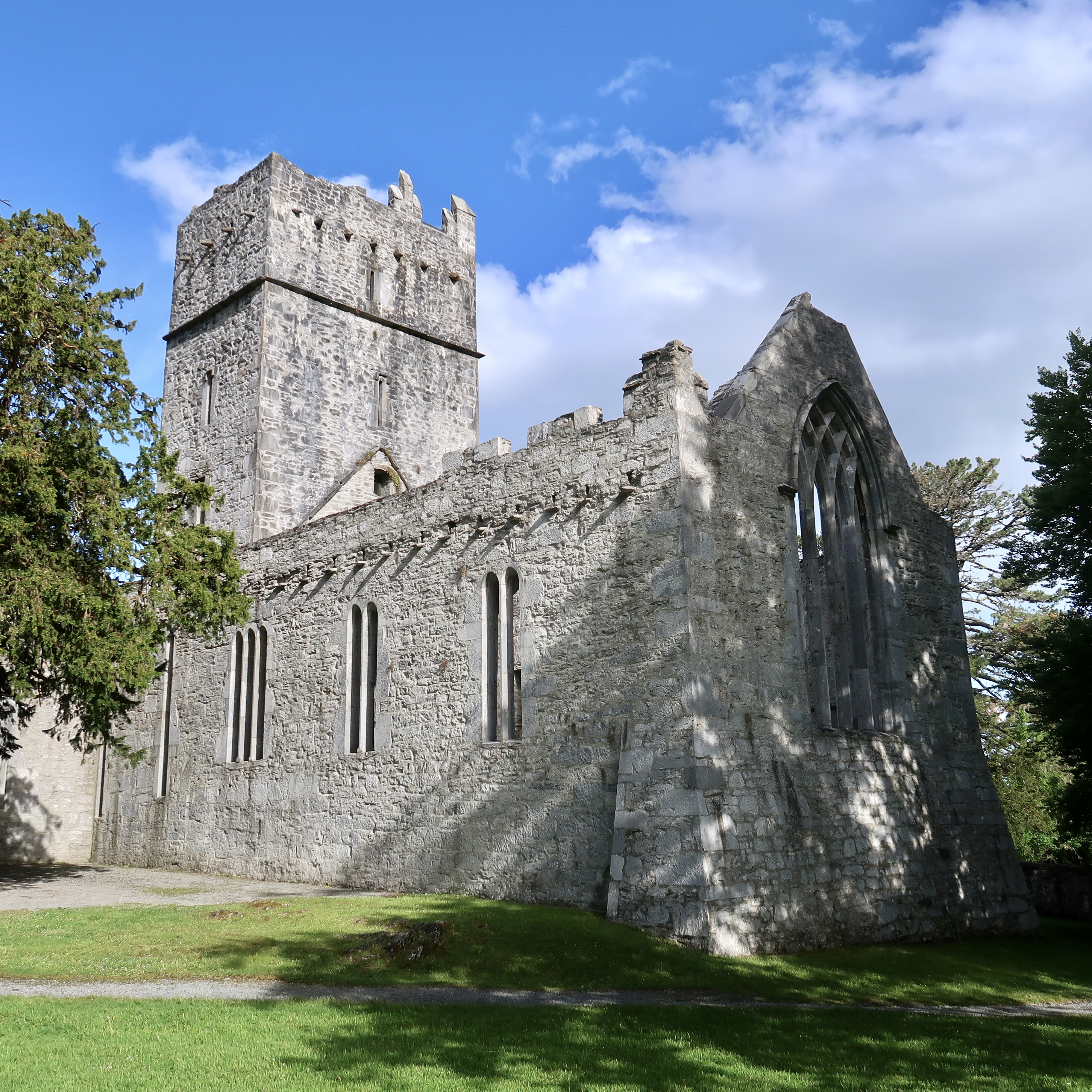
The hike started in Killarney National Park at the ruins of Muckross Abbey. Founded in 1448, the friary has been damaged and rebuilt many times. The friars were often raided by bandits.
Leaving the ruins, we walked through the woods to Muckross House. Muckross is a Tudor-style mansion with sixty-five rooms, built in 1843. Queen Victoria visited in 1861.
In 1932 the house and surrounding eleven thousand acres were donated to Ireland and became the genesis for the country’s first national park.
The park has since been expanded to twenty-five thousand acres. The only red deer in Ireland live in Killarney, a couple of which we spotted.
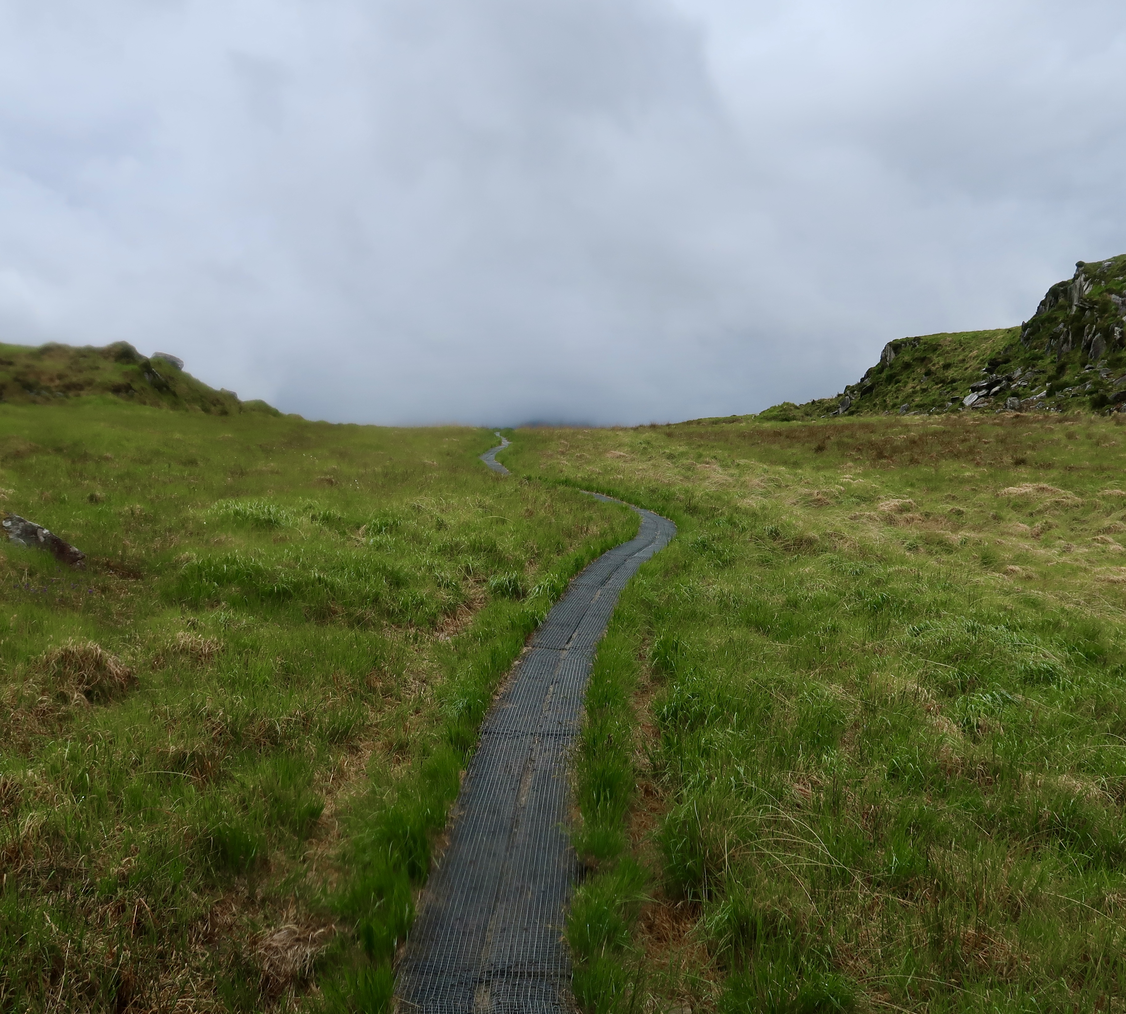
We stopped to admire Torc Waterfall. The rest of the day was spent climbing through the long, open, and appropriately named Esknamucky Glen. The side of the mountain was boggy, as is one-sixth of Ireland.
Bog is wet, spongy ground covered with vegetation. It makes for challenging footing. Planks were laid on sections of the mountainside to help with walking. We crossed several streams on stepping stones.
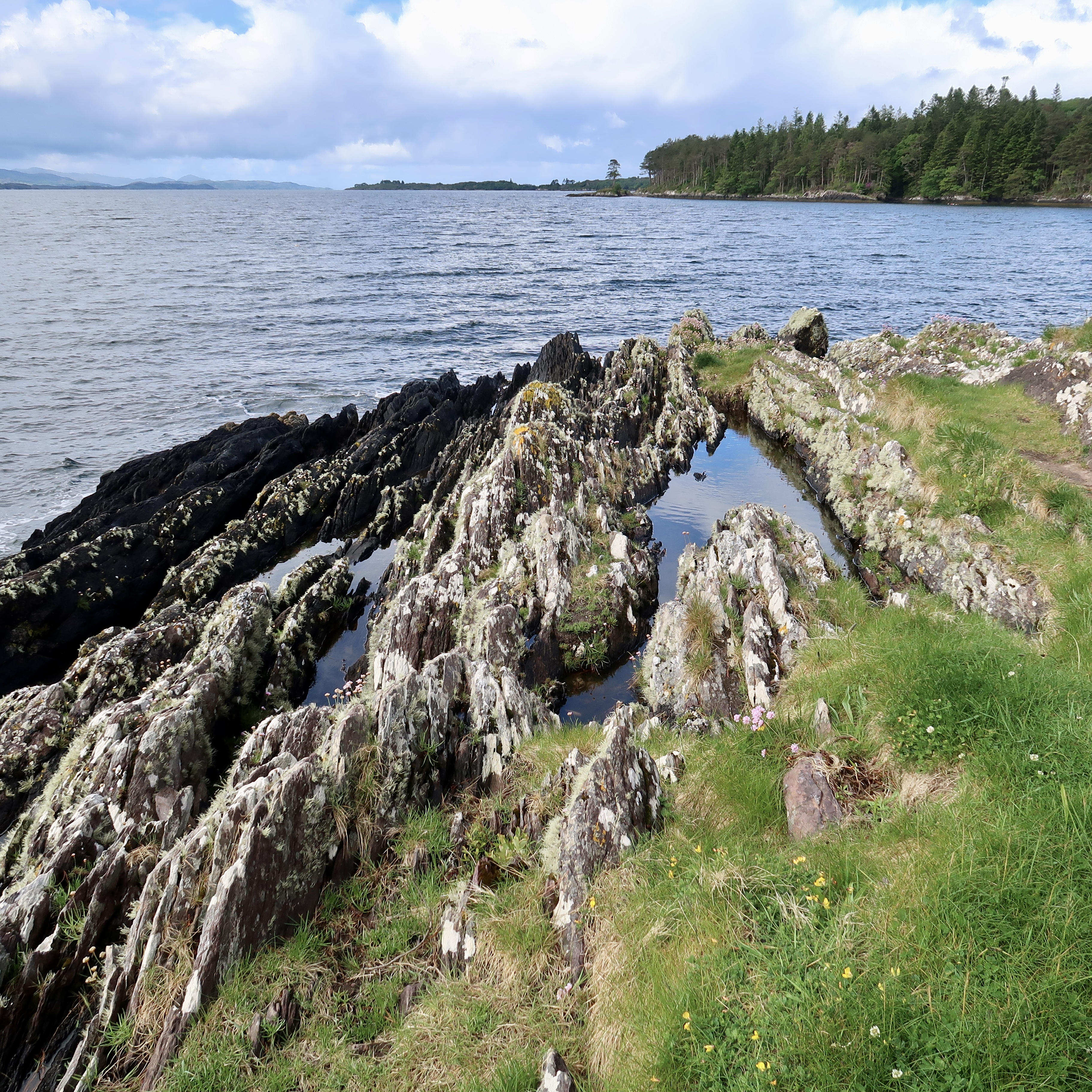
With wind and rain in our faces, we reached Windy Gap on the high ridge, and saw Kenmare Bay on the south shore of the peninsula for the first time.
Finally, we arrived in the town of Kenmare. I revisited a stone circle, a mini-Stonehenge, which my kids and I explored in 1998. Constructed between 2500 and 500 BCE, Kenmare’s stone circle is one of the largest in southwest Ireland. The circle has fifteen stones around the circumference.
Tomb with a view
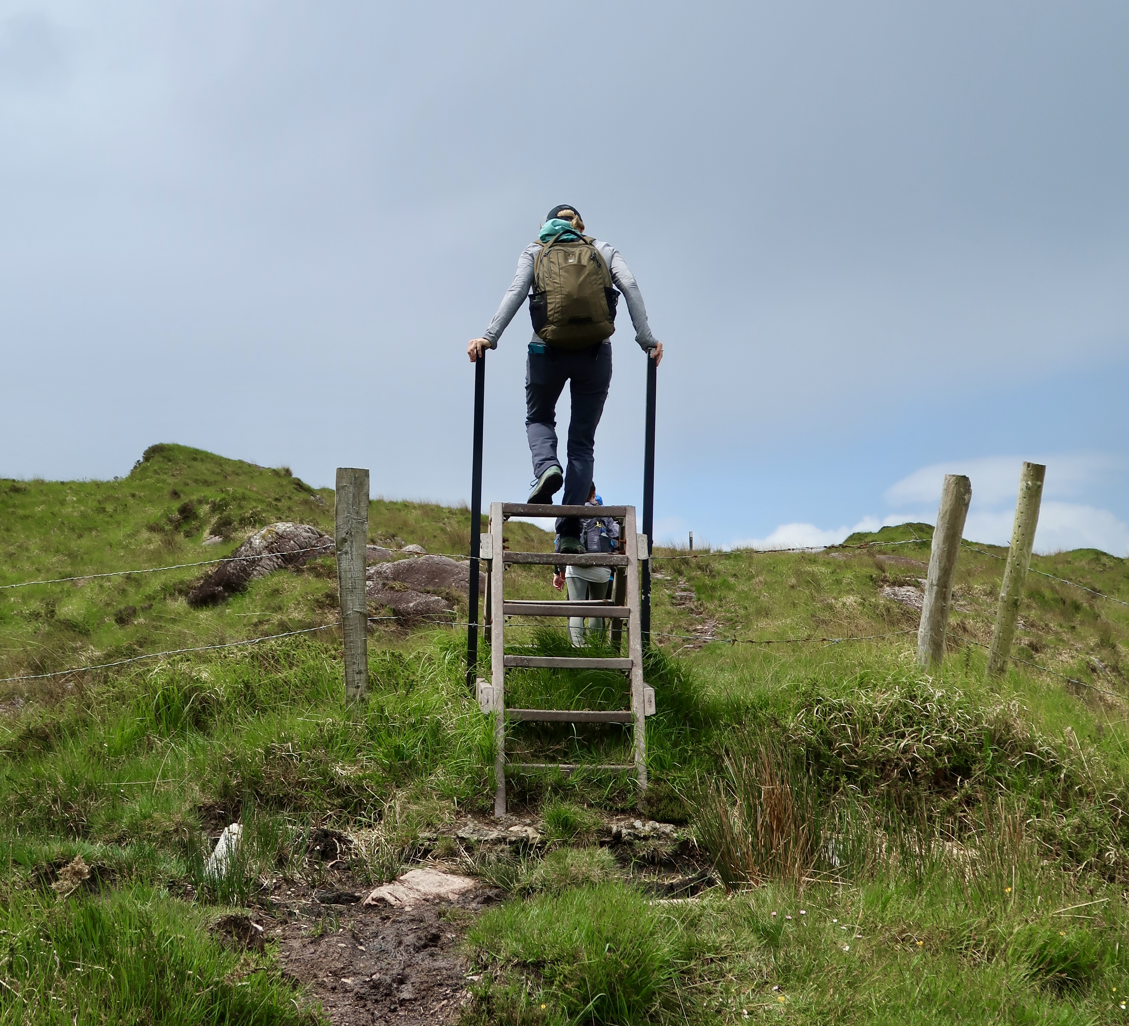
On the second day, between Kenmare and Sneem, we strolled through forests and pastures along the bay. Across the water to the south we could see the next peninsula, Beara. Leslie climbed her first-ever stile, and then many more.
When we walked into the village of Sneem, a light rain welcomed us. At the B&B, owner Joe said, “If it didn’t rain, the grass wouldn’t be green, and then you wouldn’t come.”
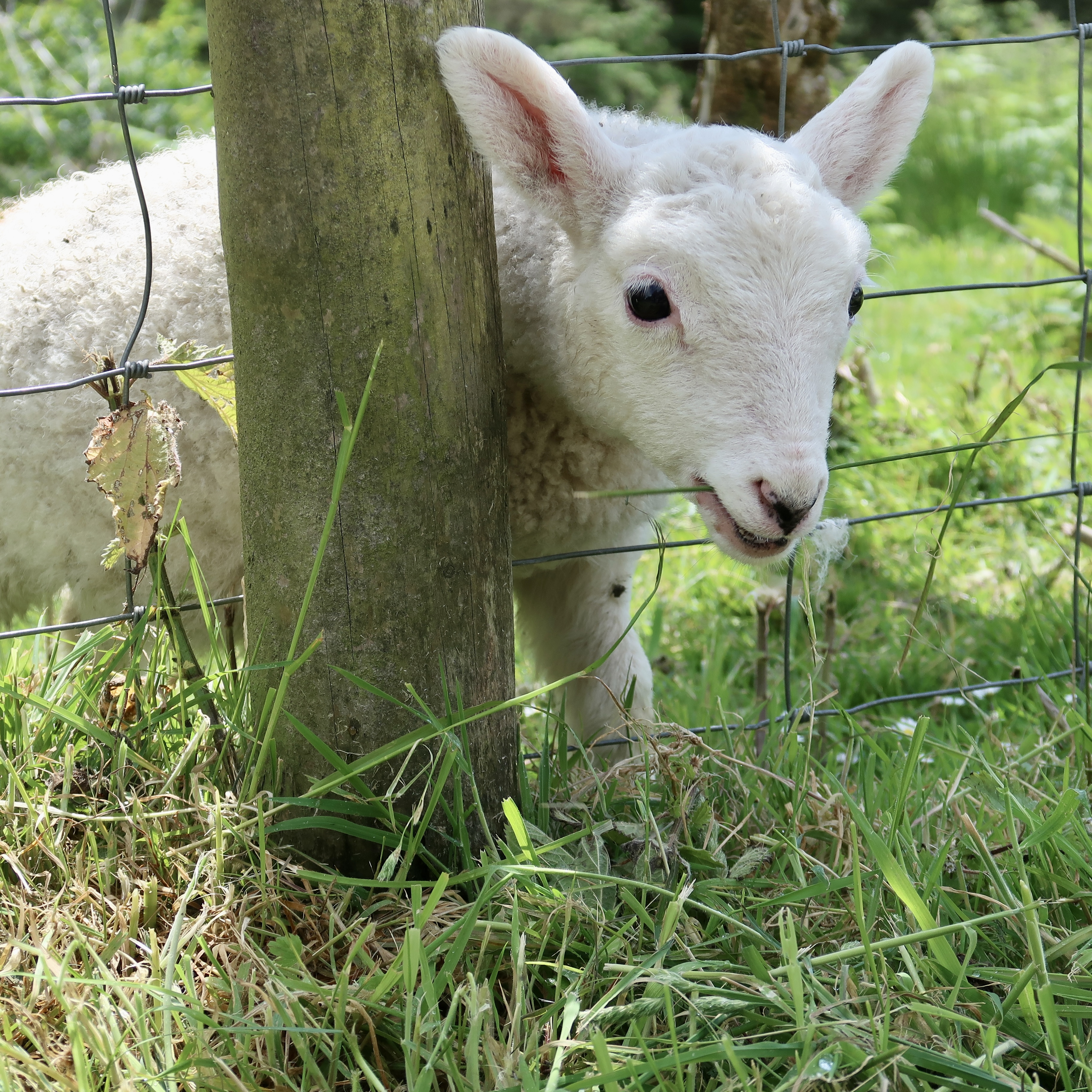
On day three, between the villages of Sneem and Caherdaniel, spring lambs frolicked in the pastures and posed for photos with their moms. Our Scottish friends didn’t understand why we took pictures of sheep, which are as common in Scotland as mosquitoes in Ohio.
Signs on the trail indicated that we had entered the Kerry International Dark-Sky Reserve. Dark-sky preserves restrict artificial-light pollution and promote astronomy.
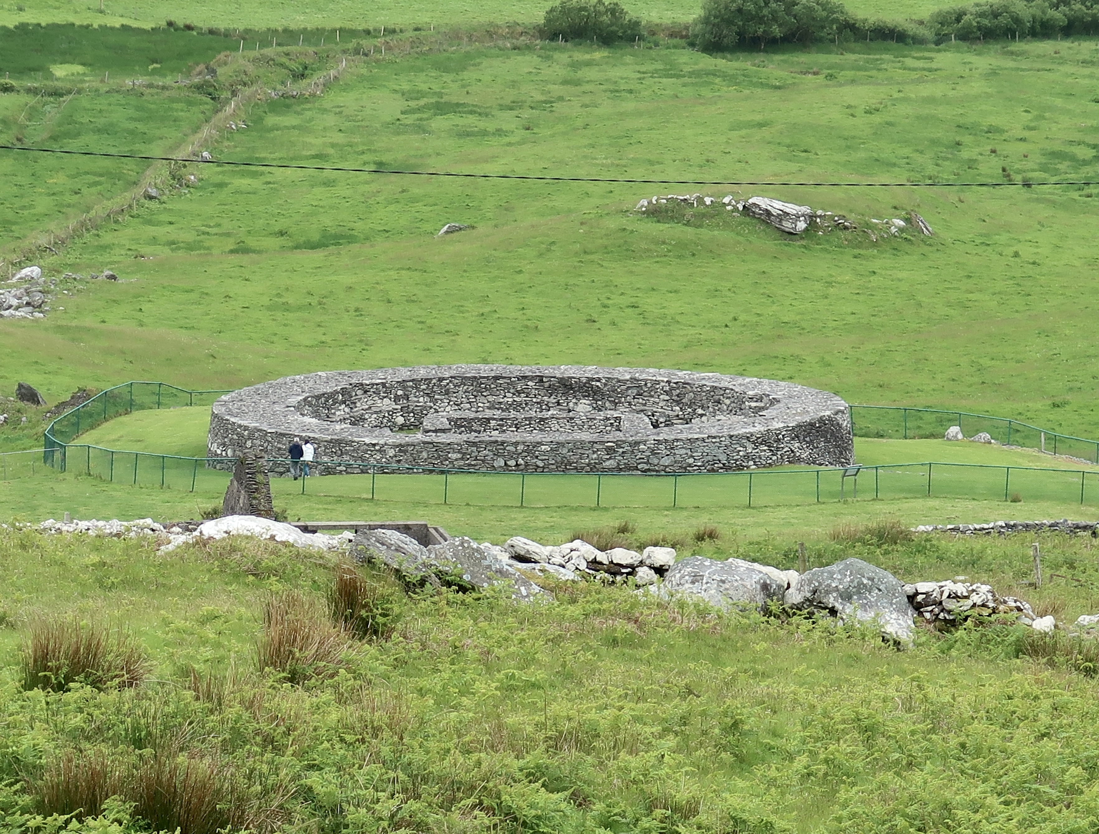
The fourth day was cloudy with sporadic, light rain. We passed beneath Cathair Dónall Ring Fort, which was overgrown with weeds.
Ring forts are enclosed farming settlements, built of stone without mortar between 500 BCE and 400 CE.
Over forty thousand ring forts have been identified in Ireland. We visited a few of them.
Near Derrynane Beach, we stopped to examine a standing stone with ogham marks. Celtic Ogham is a writing system composed of notches or lines carved into stone or wood. The arrangement of the marks represents individual letters in the alphabet.
Ogham stones may have served to indicate the locations of graves, claim ownership of property, or record family histories. (Paul tried to convince us the scratches were made by a victim who was staked to the stone.) The Derrynane Beg Ogham Stone was notched sometime between 50 BCE and 400 CE.
At the end of the beach we visited the ruins of Derrynane Abbey and its graveyard, a forlorn site although some of the graves are recent.
Further on, we viewed Loher Ring Fort, an ancient farmstead now surrounded by a modern one. The outer walls are nearly seven feet tall and ten feet thick.
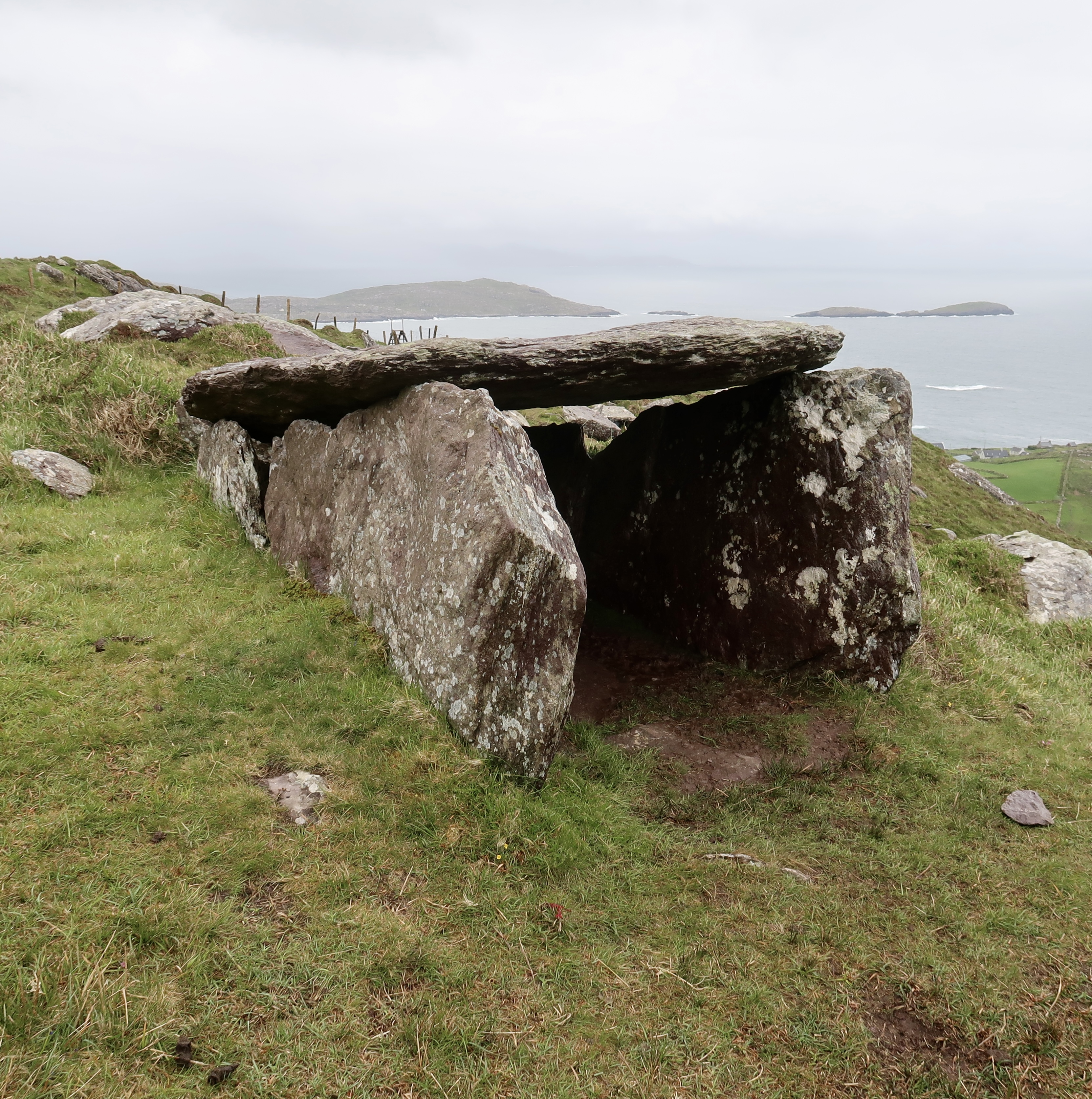
We climbed a hill to Coomakista Pass. Near the top was a wedge tomb, consisting of a few massive standing stones, bearing an even more massive slab roof. Its single chamber is shaped like a wedge.
The deceased would have had an expansive view of the bay. There are nearly four hundred wedge tombs in Ireland.
Back at sea level, we walked along Ballinskelligs Bay into the village of Waterville, where we found a statue of Charlie Chaplin. Chaplin and his family vacationed in Waterville annually for over ten years.
Bogged down
“You’re going to brave it?” Círean, the B&B owner, asked. She’d seen the ominous weather report.
We met Paul and Ruth near the hamlet of Málstir Gaoithe (Mastergeehy) and walked for a while on some rolling farm roads. A quiet morning. Fog lingered in the fields.
Eventually the route headed uphill and the asphalt gave way to rocks. We huffed for some time on a long rough track that became increasingly steep. The wind picked up and rain visited occasionally.
We passed through a gate and entered a boulder-strewn pasture. Another climb.
The wind increased considerably, blowing from the left (west) and gusting. The rain attacked us from the side.
We donned all of our rain gear and fastened waterproof covers on our packs. The footing was difficult—a choice of deep mud, puddles of water, or slippery rocks. Boggy, as they say. Every step had to be considered, particularly by me on the downhills.
The wind began gusting to forty miles per hour—a moderate gale. Occasionally, the broadside blasts combined with the uneven footing pushed me off of my feet.
The rain and the wind prevented us from stopping to rest or eat. Nothing to do but persevere.
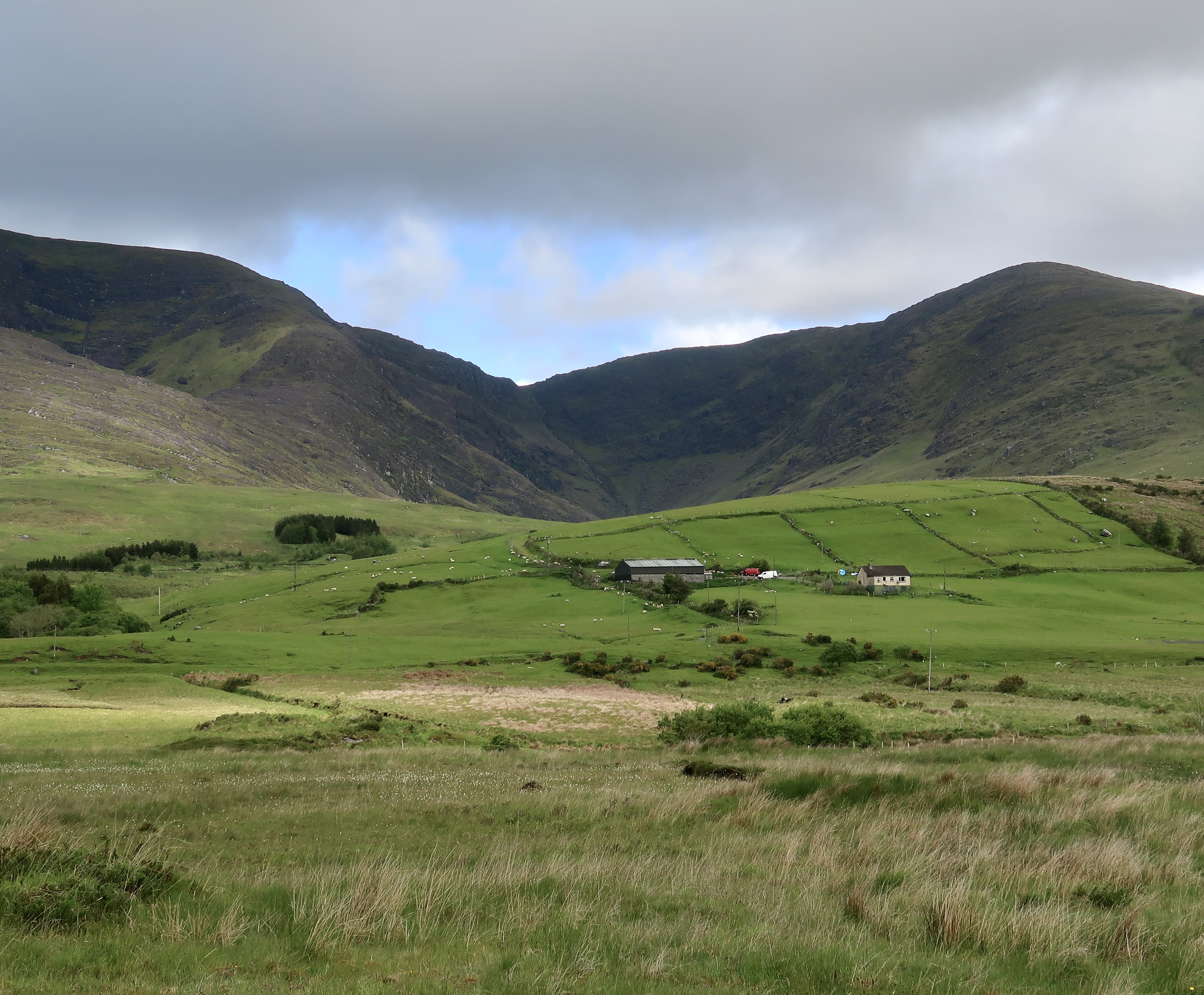
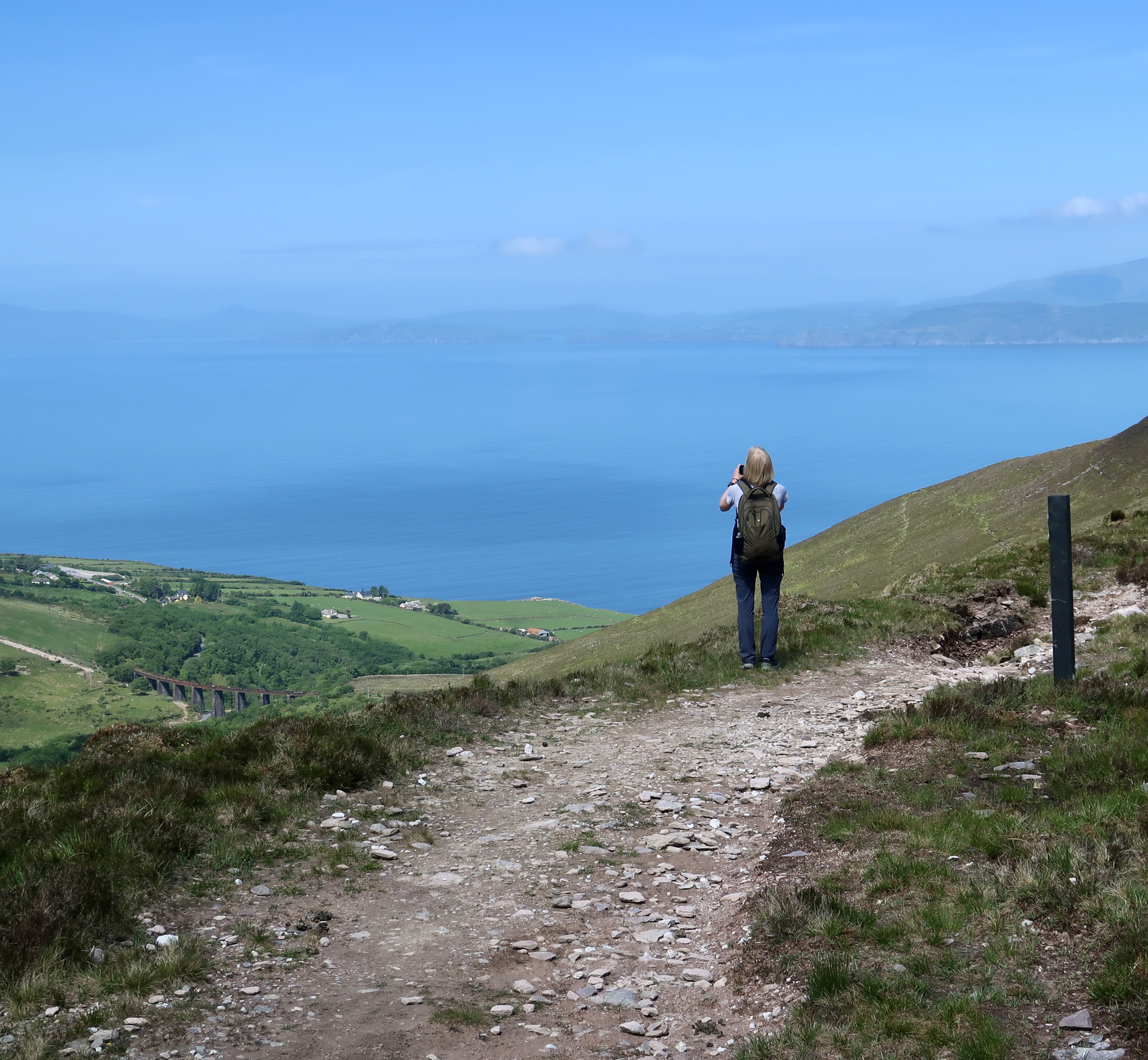
We trudged onward, heads down, step by step, up and over four peaks—Ceannúigh (856 feet), Knockavahaun (1,217 feet), Keelnagore (1,079 feet), and Coomdeween (751 feet).
All are part of the MacGillycuddy’s Reeks, a range that stretches across the peninsula. The Reeks is Ireland’s highest mountain range.
Surreally, when we passed walkers from the other direction, we paused briefly to exchange pleasantries, as if we each hoped the other had good news to share about the path ahead. “Lovely day for a walk.” Many of them were cheery Germans, who seemed oblivious to the storm.
It was on the downhill side of Coomdeween that I fell into the barbed-wire fence, punctured my hand, and found myself pinned like a wet towel on a clothes line.
Wired
I attempted to lift myself from the fence, but the barbs were too deeply hooked into my clothing. First, I wrapped a bandana around my hand to control the bleeding. Then, twisting slightly, I was able to rip my jacket from its barb.
Still, the pack was held fast. I slipped my shoulders out of the straps and was able to turn and work the pack free from the wire. Downhill, the others were waiting for me. I waved to let them know I was okay. After refitting the cover on the pack, I hoisted it, and continued.
At the bottom, we found a road and followed it to a school. There, we stopped to consider our condition. All of us were soaked through, including the contents of our packs, and we were still six hilly miles from Caherciveen.
Most alarming, two of our party were shivering and showing early symptoms of hypothermia.
I called Alan, the owner of our next B&B, and asked if he could arrange a taxi. Twenty minutes later, we were on our way into town, much relieved to be out of the weather.
Upon arrival, Alan collected our hiking boots for cleaning and drying.
We delivered our muddy clothes to a laundry that also sells fishing tackle. If you’re ever in Caherciveen and need both clean clothes and crank bait, you can’t go wrong at Bubbles Laundry & Fishing Tackle.
Later, we joined Paul and Ruth for dinner and reflected on the hike. “We were no longer on holiday,” Paul said. “We were in survival mode.”
The pirate and the pimpernel
We had planned a rest day from the walk in order to visit Skellig Michael, the craggy island with the beehive-shaped stone huts on top. We were up early, Dramamine-d, and ready to go. Unfortunately, the rangers on the island decided the swells were too high to land safely.
At Alan’s suggestion, we rented bikes, rode to the ferry at Renard Point, and crossed to Valentia Island. There, we biked across the bridge into Portmagee.
The village is named for Theobald Magee, a smuggler in the 1700s. Taking advantage of the many hard-to-patrol inlets in western Ireland, Magee illegally traded alcohol, tea, and tobacco with Portugal and France.
According to local legend, his father-in-law, a minister in Ireland’s parliament, exiled Magee to Portugal. Magee’s wife and sons, however, maintained the family smuggling operation.
A different sort of smuggler also hailed from the area. Hugh O’Flaherty of Caherciveen was a priest and senior official at the Vatican.
During World War II, while the Nazis occupied Rome, he organized the hiding and escape of more than sixty-five hundred people, including Jews and Allied soldiers. His superiors at the Vatican never knew.
His ability to evade the Gestapo earned him the nickname the Scarlet Pimpernel of the Vatican.
Local legends
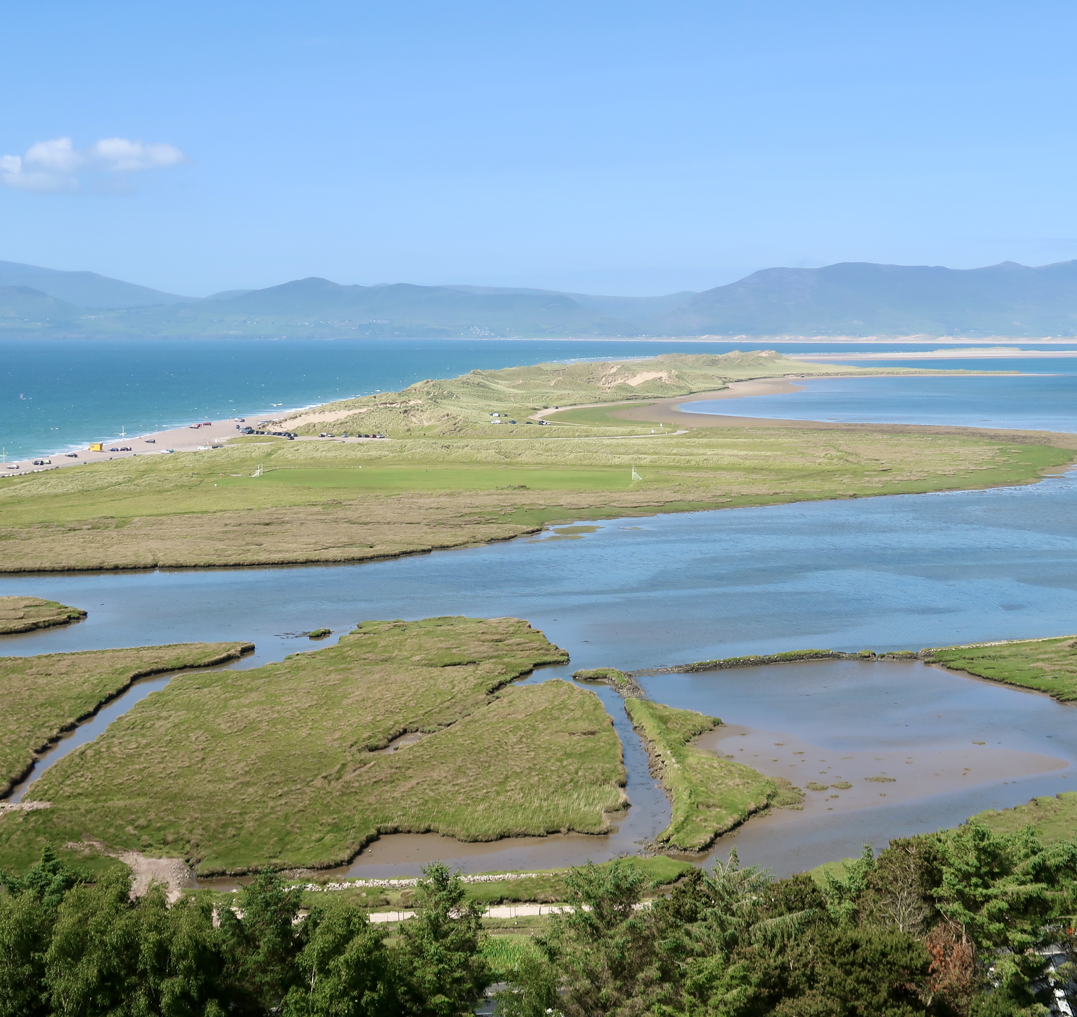
Our last day of walking was sunny and warm. We passed a ruined village, several sheep farms, and a forest before Dingle Bay came into view. After climbing down to Rossbeigh Beach, we continued into Glenbeigh, our last stop.
The next day, on the way to the Kerry Airport to pick up a rental car, the taxi driver told this story about musician Dave Grohl:
When his bandmate Kurt Cobain died, Grohl became so despondent he stopped playing music.
“I wasn’t sure what to do with my life,” he said. “So, I thought, I’m going to go to . . . one of the most remote areas that I can find.” He went to the Ring of Kerry.
“I was driving down this country road,” Grohl continued, “and I’m trying to figure out my life and trying to move on, and I see this hitchhiker. He’s in a parka, and it’s kind of maybe raining a little, and as I’m pulling up to him, I think, ‘I’m going to pick this kid up.’
“I got closer and closer and I saw that he had a Kurt Cobain T-shirt on and I thought . . . I can’t outrun this thing. So, I said, ‘Okay, I’m going to start over,’ and so I started the Foo Fighters.”
In the rental car we headed up the west coast.
At the Tarbert ferry terminal, a local man told us another story—this one about Scotland-born John Paul Jones, who served as a naval commander during the American War of Independence.
In 1777, Jones captained the USS Ranger, one of the first ships to fly the new American flag. In British waters, he succeeded in capturing several ships. The British were in hot pursuit.
One evening, Jones sailed the Ranger into the mouth of the River Shannon and anchored near Tarbert Island, exactly the spot where we were waiting for the ferry.
Two British warships blocked the entry, confident they had Jones trapped.
After dark, Jones directed his crew to hang lanterns in tree branches on the opposite riverbank. The lanterns swayed in the breeze and gave the appearance of a ship bobbing on the waves.
Then, with the onboard lights extinguished, Jones slipped past the British warships under cover of darkness. At dawn the British awoke to find the Ranger long gone.
Time portal
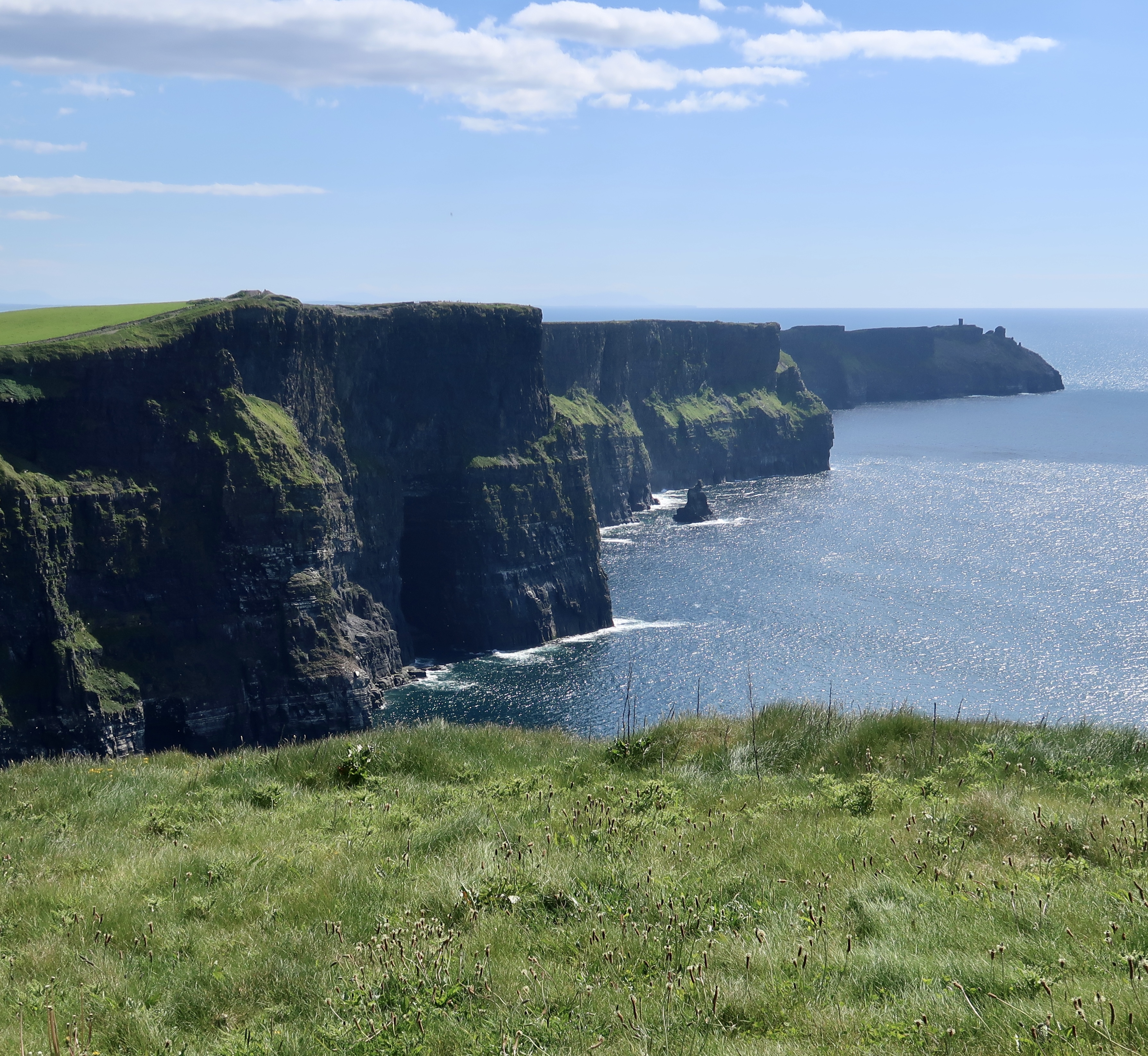
In 1988 I visited the Cliffs of Moher and worried my kids might fall over the edge. Now, fences have been installed to prevent people from plunging six hundred and fifty feet into the crashing waves.
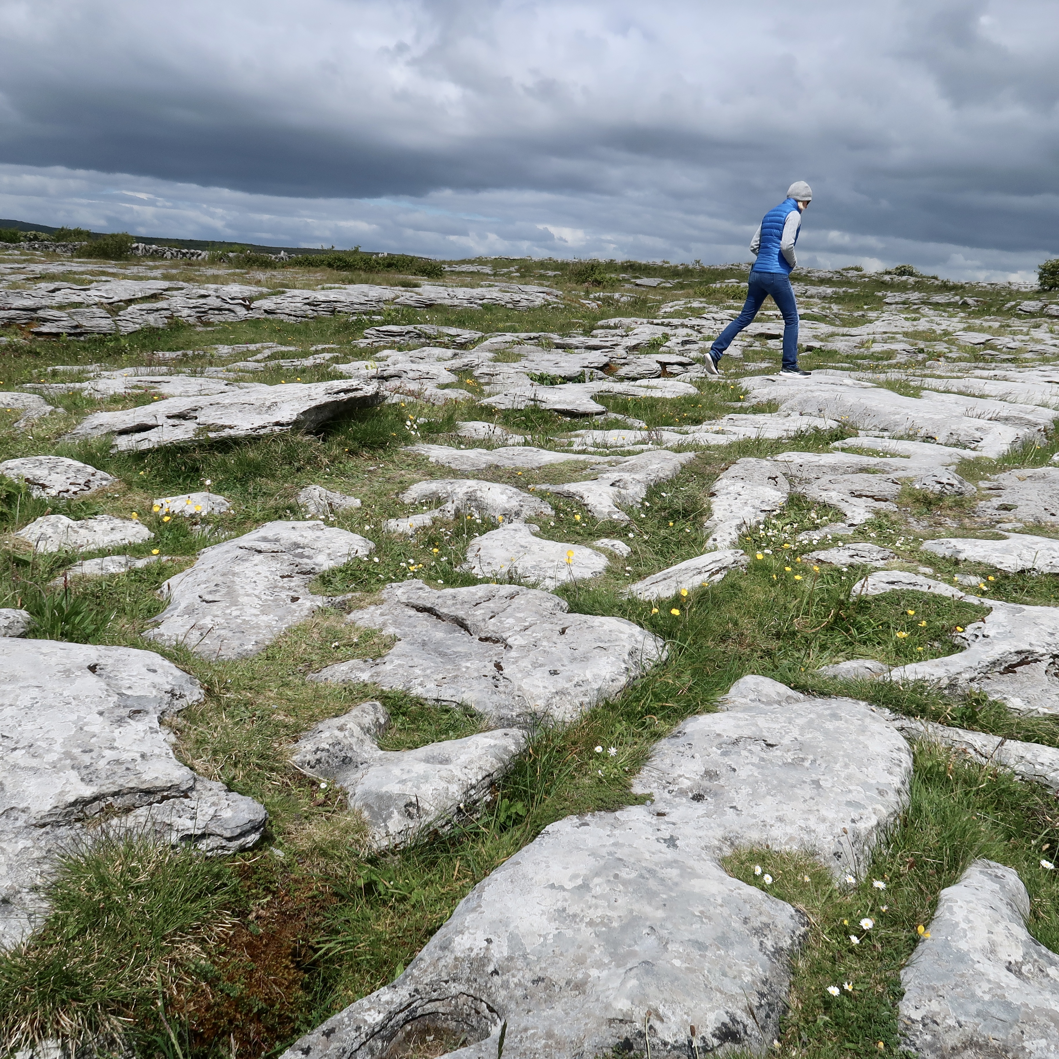
After strolling the cliffs, we continued into the Burren, a two-hundred-square-mile landscape that looks as if it has been paved. Limestone covers the Burren like fieldstone on a patio.
In 1651 an English army officer described the Burren as “a country where there is not water enough to drown a man, wood enough to hang one, nor earth enough to bury them.”
In the Burren, we visited Cahercommaun (Caherconnell) Ring Fort, but missed the sheepherding demonstration. The dog and the sheep were apparently taking a break between sets.
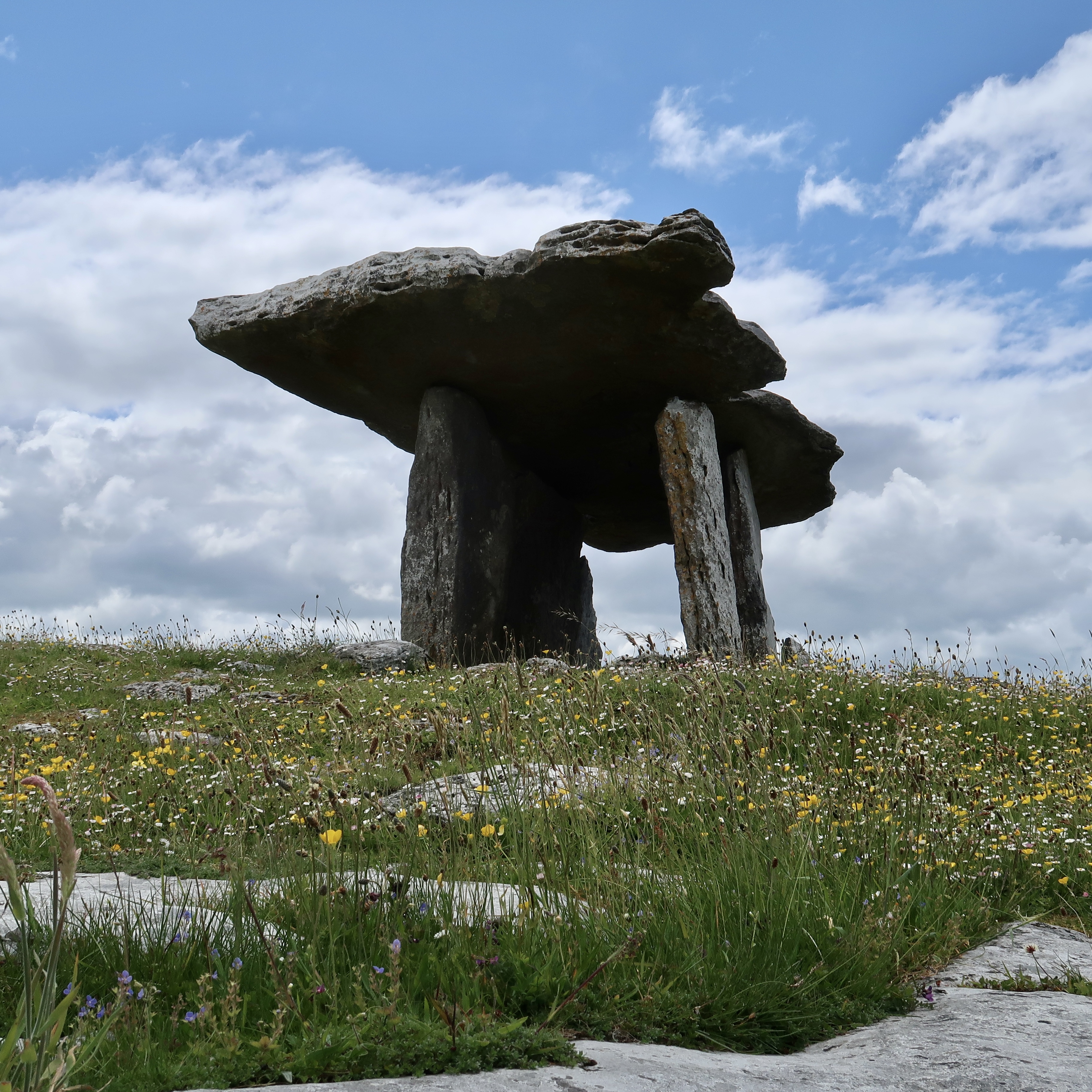
Four designs of megalithic (large stone) tombs are found in Ireland—passage tombs (see post on Newgrange and Knowth here), wedge tombs (such as the one we saw on the Kerry Way near Waterville), court tombs, and portal tombs.
Poll na Brón (Poulnabrone) in the Burren is a portal tomb. It rises above the Burren’s stony ground on the highest point in the area.
Hunter-gatherers arrived in the Burren before 4000 BCE. Around 3800 BCE they built Poll na Brón to bury their dead. When the site was excavated, thirty-three human remains were found, along with some stone tools and jewelry.
Poll na Brón is the oldest human structure in Ireland.
Island forts
Near Galway, we boarded a ferry for Inis Mór, the largest of the three islands at the mouth of Galway Bay. The population of the three islands is twelve hundred. The residents speak both Irish and English.
The islands, like the Burren, are paved with limestone. Early settlers created their own soil by mixing seaweed and sand.
In the village of Cill Rónáin (Kilronan), we checked into a hotel, which, like several other places we stayed, does not lock its front door at night. Leslie and I went looking for Dún Dúchathair, the Black Fort.
Guessing at the location of the trail, we chose an unmarked grassy farm lane lined with stone fences. It seemed to be heading in the right direction. After zigging and zagging, the trail narrowed and we found ourselves wading through weeds and brambles. The path dead-ended.
We spent a couple of frustrating hours working our way through the maze-puzzle of rock walls and enclosed pastures on the side of the hill. Sometimes, after passing through a few promising gates and wall gaps, we found our way forward blocked and had to retrace our steps.
Finally, Leslie found a gate that provided access to a rocky path leading uphill to the fort.
The Black Fort is situated on the edge of a remote promontory with cliffs on three sides. Its back wall has fallen into the sea, due to erosion. The remaining stone walls are massive, twenty feet high and sixteen feet wide. Inside are the ruins of stone huts.
The next day, we rented bikes to continue our exploration. We cycled up a stony farm track and asked two inquisitive cows and a goat to watch our bikes. After a short hike, we found another ring fort, Dún Eoghanachta.
The fort is a complete circle with a single wall over sixteen feet high and twelve feet thick. The ruins of several stone huts are inside. Dún Eoghanachta was built between 800 BCE and 100 CE.
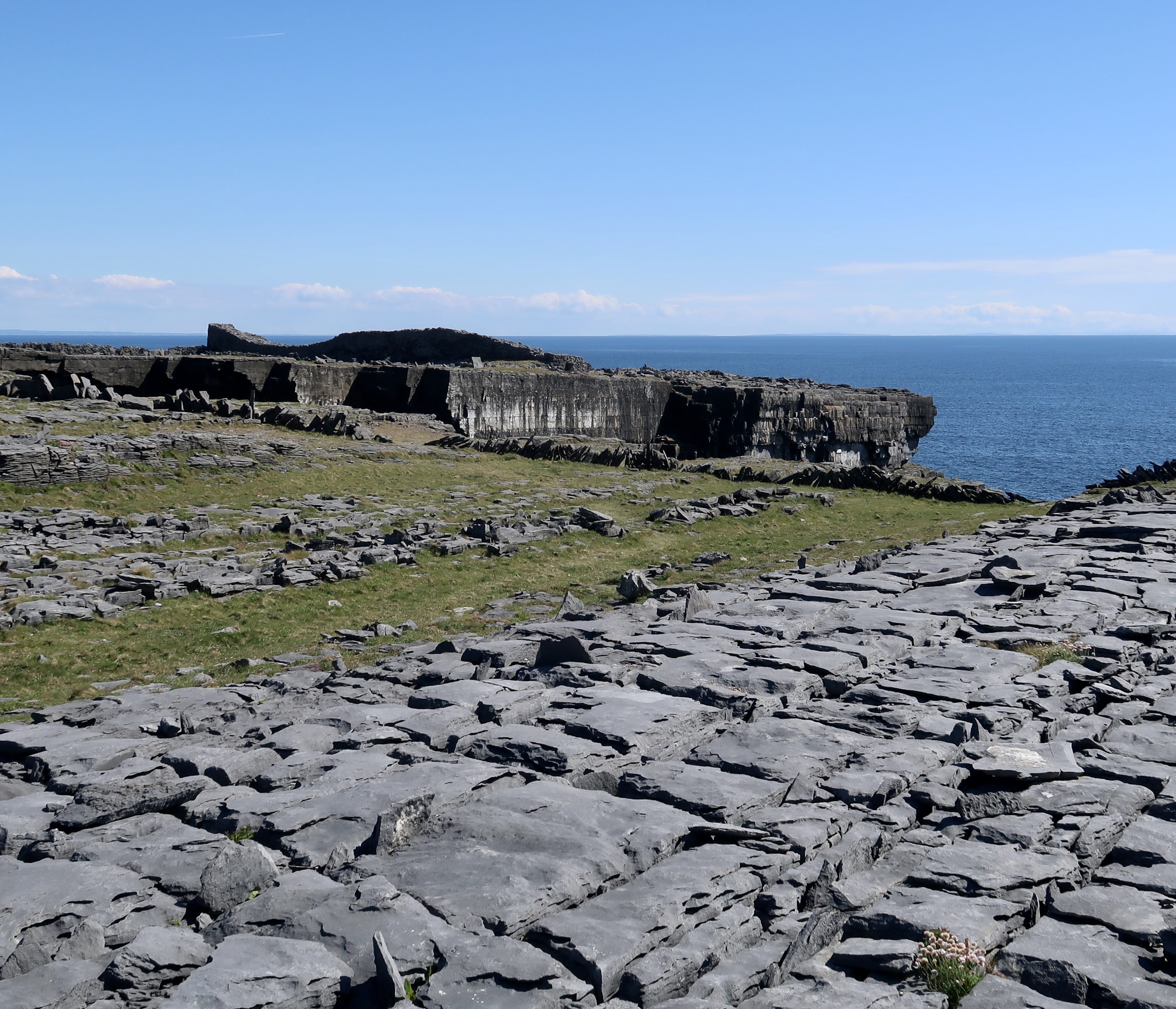
The largest and most imposing stone fort on the islands is Dún Aonghasa. The structure is perched dramatically on the edge of a three-hundred-foot cliff overlooking the ocean.
Construction started around 1100 BCE, at which time sea levels were lower and the fort may have stood further inland. Due to a rising sea and erosion, some of the structure has collapsed into the ocean. The compound is surrounded by four concentric walls. The outermost encloses fourteen acres.
The walls are thirteen feet wide in places. Between the third and fourth walls, a defensive system of sharp stone slabs, known as cheval de frise (Frisian horses), are planted upright in the ground like spears.
Faux trad
One of the attractions of western Ireland is live traditional music. One night in Tig Cóilí, a packed pub in Galway, we were listening to three lively musicians churning their way through a jig with a seven-string banjo, a button accordion, and a bodhrán.
A local man sidled up to me and asked, “Do you like Irish music?”
“Of course,” I said, nodding to the band.
One by one, he pointed at the musicians. “He’s from Scotland. He’s from Denmark. And he’s from New Zealand.” He shrugged and laughed.
“None of ‘em Irish.”

We hiked the Dingle Way in 2016, 10-day moderate hike 12-16 miles a day. But our adventures over one mountain gap weren’t as dramatic as yours! Just had mud and muck knee-deep, fog and rain clouding vision of where the trail markers were. At one point, I wasn’t sure I was actually on the trail and when I called back to the person behind me, they couldn’t even hear me for the wind. But I still loved the memories of hiking in Ireland. Gotta love adventure. All the best to you!
I had a similar experience with Dingle in 2019, trying to stay on course in the rain and the fog while going over Mount Brandon. Hiking in the rain in Ireland is part of the adventure, it seems. Thanks for reading!
I thought I did a good job learning the history of the places we travel to, but I always find out new facts from you. We did the Dingle peninsula but in a car, which was an adventure in itself. Your piece brought back all those wonderful memories! Thanks for taking us along!